
Coring Plan
We collected eight 100 meters long sediment cores along the Chilean Margin (36-46°S, 670-3055 m) to investigate links between oceanographic changes at the northern margin of the Antarctic Circumpolar Current and climate variability on the South American continent over one glacial-interglacial cycle and two terminations. The new cores will allow us to reconstruct surface and intermediate water variability at centennial-to-millennial resolution, which will extend available records from previous coring and drilling cruises to the region, thus allowing us to compare Southern Hemisphere records of the last and previous interglacial (Holocene vs. Eemian), terminations I and II, and the MIS 5e-5d glacial inception. In addition to collecting sediment, we also sampled pore waters at high-resolution to reconstruct the LGM density profile in the SE Pacific.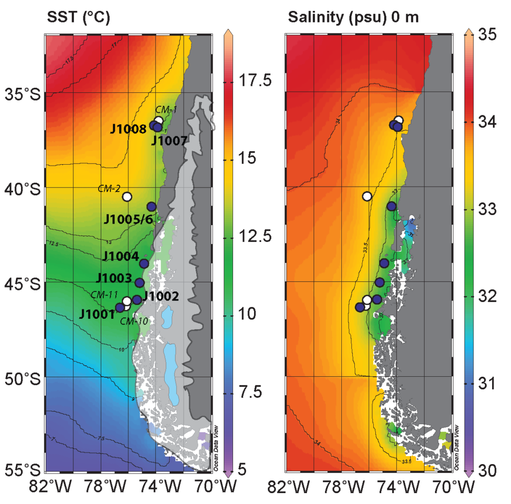 Mean annual sea surface temperature and salinity along the Chile Margin with locations of sites cored (blue circles) and sites skipped (white circles). Modern extent of the Patagonia icefields are shown in light blue and their Last Glacial Maximum extent is shown in white. Sites are ideally positioned within the low salinity plume to capture the intensity and northward extent of the freshwater inputs from the northern Patagonia icefield. Data souce: ODV World Ocean Atlas, 2013 (https://odv.awi.de/data/ocean/world-ocean-atlas-2013/)
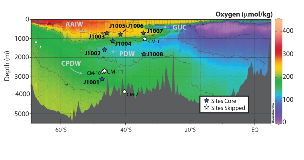 Dissolved oxygen content along WOCE line P19 showing the main water masses in the southeast Pacific with locations of sites cored (blue circles) and sites skipped (white circles). The cores are strategically positioned to intersect all of the major water masses in the southeast Pacific.