
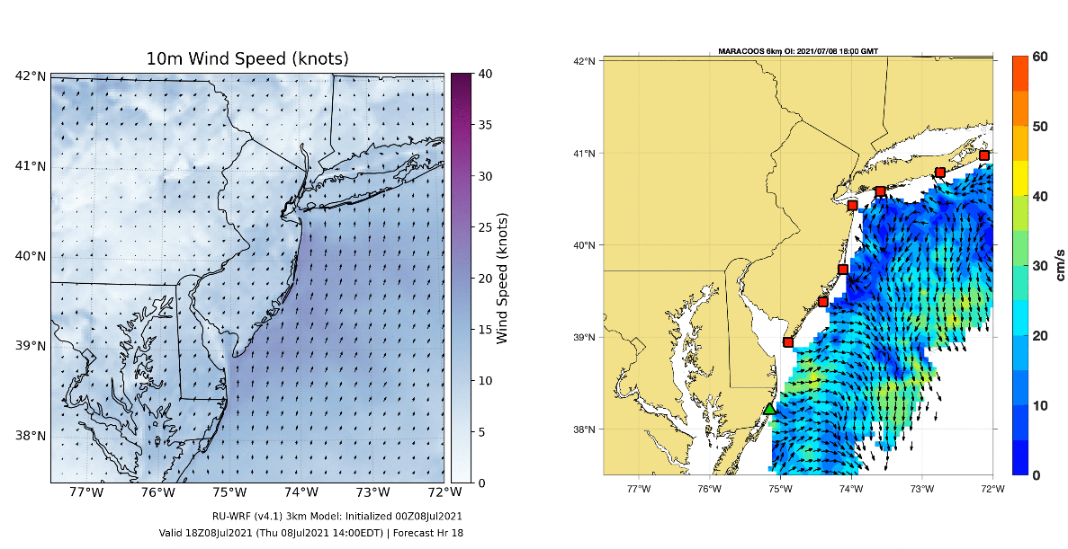
Researchers from Rutgers are analyzing the response of the ocean to the recent passage of Tropical Storm Elsa. The storm was modelled in real time by the Rutgers Weather Research and Forecasting model (RUWRF). The animation shows the surface winds as the storm moved past the Jersey Shore. The ocean surface currents were captured by the MARACOOS High Frequency Radar (HFR) Network which is supported by U.S IOOS. The animation shows the surface currents along with the 6-hour best track of the storm from the National Hurricane Center. The best track was interpolated to hourly positions to map to the update frequency of the HFR maps.
Tropical Storm Elsa moved north along the coast in a track similar to Hurricane Irene in 2011. Ahead of the eye the currents were onshore but weak. The strongest currents were observed alongshore to the right of the eye as it moved past New Jersey. This is in contrast to Hurricane Irene which displayed strong cross-shore currents and weak along-shelf currents (Glenn et al. 2016).