Using Real Time Satellite Imagery for Data Assimilation and
Constructing an Adaptive Sampling Network
By Michael F. Crowley
Presented at ASLO-99, on February 5, 1999, in Santa Fe, NM
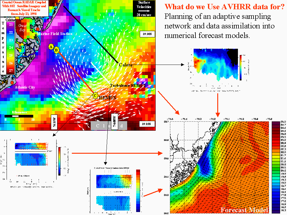
Here at the Coastal Ocean Observation Lab at Rutgers, we use AVHRR sea
surface temperature (SST) imagery and SeaWiFS ocean color data for planning our
adaptive sampling strategies during our summer research of
upwelling along the New Jersey shore. We also
use the AVHRR SST data for assimilation into our forecast models
For planning the adaptive sampling strategies, we navigate the imagery,
then find the areas of interest (ie an upwelling eddy). Then, we plan our
cruises and autonomous underwater vehicle transects accordingly to gather
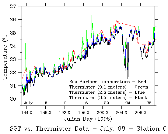
data on these areas of scientific importance(figure 1).
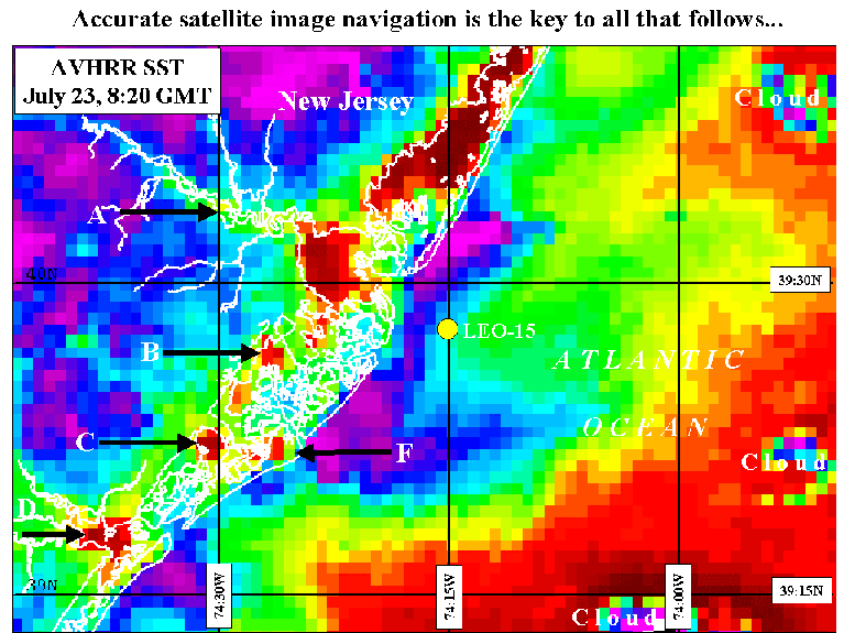
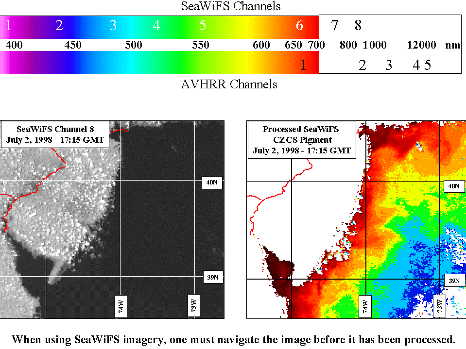
Before we can use the imagery for course plotting and assimilation, we
must navigate the image accurately. Figure 2 shows
us how this is done.
Now that the images are navigated correctly, it's time to prepare the
data for assimilation. BUT!!!! We must first remove clouds and cloud
effects from the data, or we will be putting cloud temperatures into the
models, not ocean temperatures
(Figure 3, Figure 4,
Figure 5, and Figure 6.

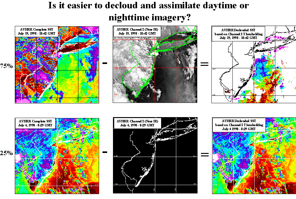
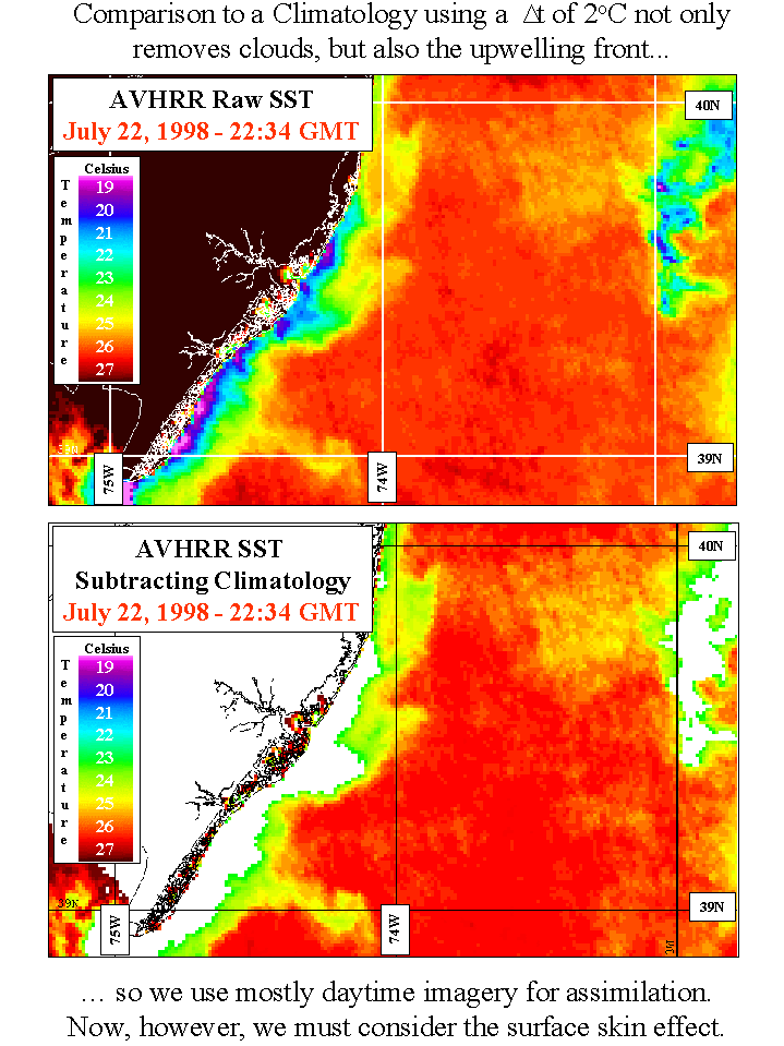
Figures 3-6 were an introduction on cloud removal
techniques used in processing our imagery. If
you are a scientist or are brave, you may want to look at
figure 7 which has a bit more complex detail on the subject. if not, I'd
suggest going down to the next section.

Now let's look at what SeaWiFS is and how we must navigate one
before we use it(figure 8).
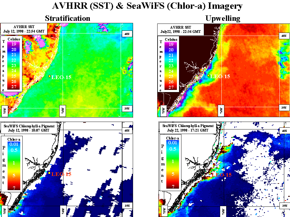
You have now seen what the SeaWiFS satellite sees, and how it is different
from AVHRR. Let's look at some comparisons of dataa
from the two satellites.
As with any good talk, there must be some sort of summary or conclusions. Well,
here's mine.
I hope you enjoyed this annotated presentation on AVHRR and SeaWiFS imagery
and how it is used by our lab. If you have any questions, just email me at the
address below.
Questions???
crowley@arctic.rutgers.edu