Figure 2 - Satellite Navigation
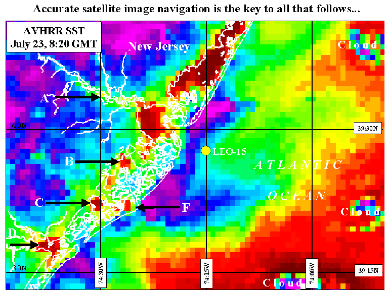
This image is a temperature image from July 23, 1998. The red colors are
warm (25C) and the Violets are cooler (20C). In this upwelling
image you can see how the temperature gradient between warm water in
Barnegat Bay, Great Bay (A), Reeds Bay (B), Lakes Bay (C) Great Egg Harbor
(D) and the cold land and ocean water make it easy to navigate a
coastline over the image. This gives us the
ability to navigate the images to within a kilometer, which is the size of
each pixel making up the image. Area F is Atlantic City. You can see the heat
from all the casinos in this early morning image.
Without accurate navigation, all data generated from the images is geographically
mislocated, and therefore useless, especially for data assimilation.