Figure 8 - SeaWiFS Navigation
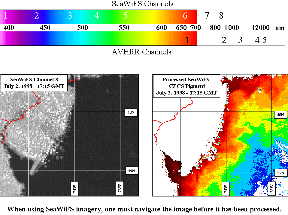
SeaWiFS channels (bands) are different from AVHRR. As you can see at the top
of this figure, SeaWiFS looks at 8 channels of data, six of which are in the
visible spectrum. AVHRR has 5 channels, only 1 of which is visble, but it also
looks at temperature wavelenghts, which SeaWiFS does not. With SeaWiFS looking
at ocean color and AVHRR looking at temperature, these two satellites compliment
eachother nicely.
Now, they also differ in one other way. You remember how we
navigated the AVHRR imagery. With SeaWiFS it is
necessary to navigate before the image is processed. In the above figure,
the image on the left is raw, while the processed image is on the right. The
processed image has lost all details of the bays and coastline, giving you
little detailed land mass to navigate off of. So we navigate the raw imagery,
and then process, while in AVHRR imagery, it is not necessary to reprocess
each raw image. One can navigate the final AVHRR SST product, unless you
are using the data for assimilation, where you remove as much land as is
removed with the SeaWiFS process.
Next step? Let's compare some AVHRR and SeaWifs
images.