Figure 9 - AVHRR vs. SeaWiFS
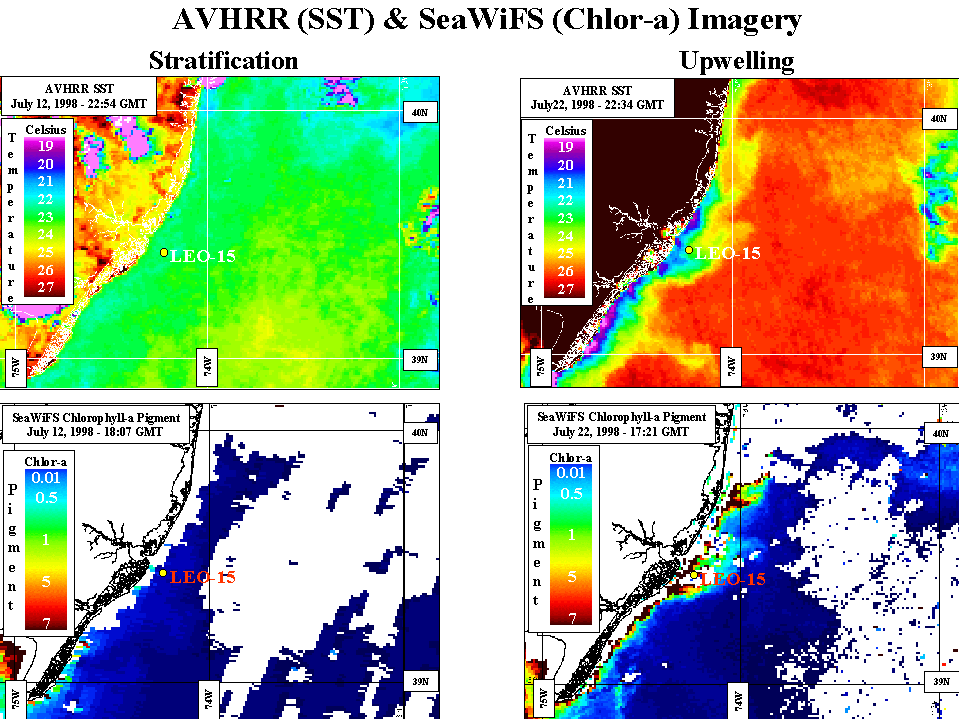
The AVHRR and SeaWiFS images on the left, are from July 12, 1998. Stratification
was in place on this day (stratification is a layering of the ocean: warm on
top, cold on the bottom). On the right, we have images from an upwelling event
on July 22, 1998. As you can see, the upwelling event shows up nicely in the
AVHRR imagery, as a cold band of water along the coast, while in the SeaWiFS
imagery, you can see an abundance of Chlorophyll-a (phytoplankton) in shore
(green/yellow/red).
These images were used to plan the physical and optical in situ boat
and AUV transects of July 22nd. The AVHRR image was also used in assimilation.
These satellites give us the ability to save money in ship time, boat time,
and most importantly people time. Without them, our ability to assess the
ocean makeup would be liminted.
Now let's summarize what we've learned.