The Use of CODAR High Frequency
Radar to Attain Wave Height Measurements

What is CODAR?
The Use of CODAR High Frequency
Radar to Attain Wave Height Measurements
What is CODAR?
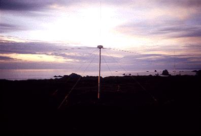
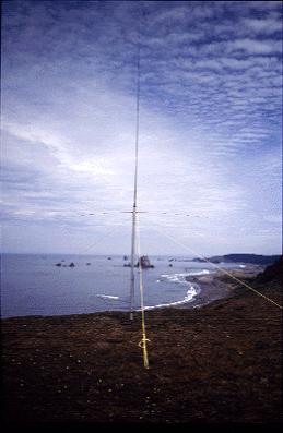
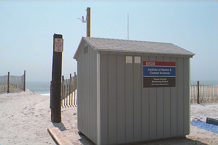
It is a omnidirectional coastal
HF radar system that maps surface currents in real time.
In its long-range mode, it can measure out to 50-70 km with a resolution of 2-3 km. By varying the frequency, resolutions as fine as 300 m can be obtained but the range is shortened.
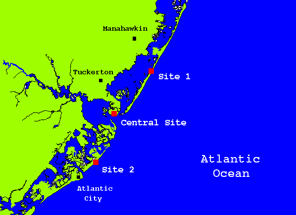
Normally CODAR employs two sites, since a single station measures only one component of the total horizontal surface current vector (though researchers at Stanford demonstrated utility of total vector maps from a single station with the sacrifice of detecting short-term effects). Spacing for a two radar system is approximately 15 to 40 km for long-range open ocean mode and 8 to 20 km for higher frequency higher resolution shorter range mode. A series of CODAR sites can be employed to obtain regional coverage.
A critical part of any HF radar is the receive antenna and its pattern. If the receive pattern is different from the assumed pattern direction data could be misinterpreted. Slight temperature and frequency dependency by the receiver and unavoidable obstacles near the receive antenna can cause these type of differences. The antenna system is calibrated by using a transponder.
Typically, CODAR data are averaged
over one hour to reduce the noisiness of the sea echo. Therefore current
maps can be produced every hour. This period can be reduced to approximately
20 minutes, however the data may become noisy over such a short period.