| Dataset | um_242-20210630T1916 |
|---|---|
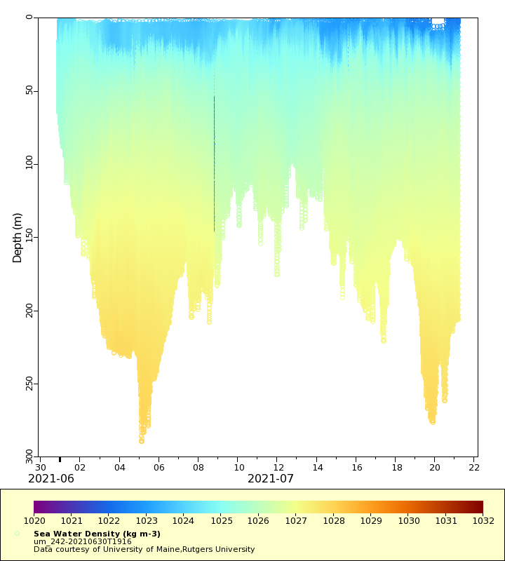
| Glider | um_242 |
| Status | Completed |
| Summary | This project is conducting seasonal deployments to investigate carbonate chemistry and monitor ocean acidification in the Mid-Atlantic Bight. The glider used for the automated observation includes an integrated deep rated version of the Ion Sensitive Field Effect Transistor (ISFET)-based pH sensor. The pH sensor unit is complemented with existing glider sensors including a CTD, a WETLabs FLBBCD ECO puck configured for simultaneous chlorophyll fluorescence and optical backscatter measurements, and an Aanderaa Optode for measuring dissolved oxygen. This approximately 21 to 30 day deployment out of Tuckerton, NJ will run a cross-shelf transect (along E line) to an offshore waypoint north of Carteret Canyon, then transect SSW to Wilmington Canyon, then NW back to Tuckerton, NJ as the battery pack allows. This glider track will cover Atlantic sea scallop and Atlantic surfclam habitats in the southern MAB. The real-time dataset contains CTD, chlorphyll a, CDOM and optical backscatter measurements. Dissolved oxygen and pH data will be processed post-deployment |
| WMO ID | 4802997 |
| Attribution | National Oceanic and Atmospheric Administration Integrated Ocean Observing System |
| Time Coverage Start | 2021-06-30 21:36:15 UTC |
| Time Coverage End | 2021-07-21 03:39:27 UTC |
| Registered | 2021-07-01 |
| Deployed | 2021-06-30 |
| Operator | University of Maine |
| Institution | University of Maine,Rutgers University |
| Data Provider | rutgers |
| # Profiles | 1538 |
| Days Deployed | 21 |
| BBox North | 44.151 |
| BBox South | 42.665 |
| BBox East | -69.931 |
| BBox West | -67.638 |
Maps
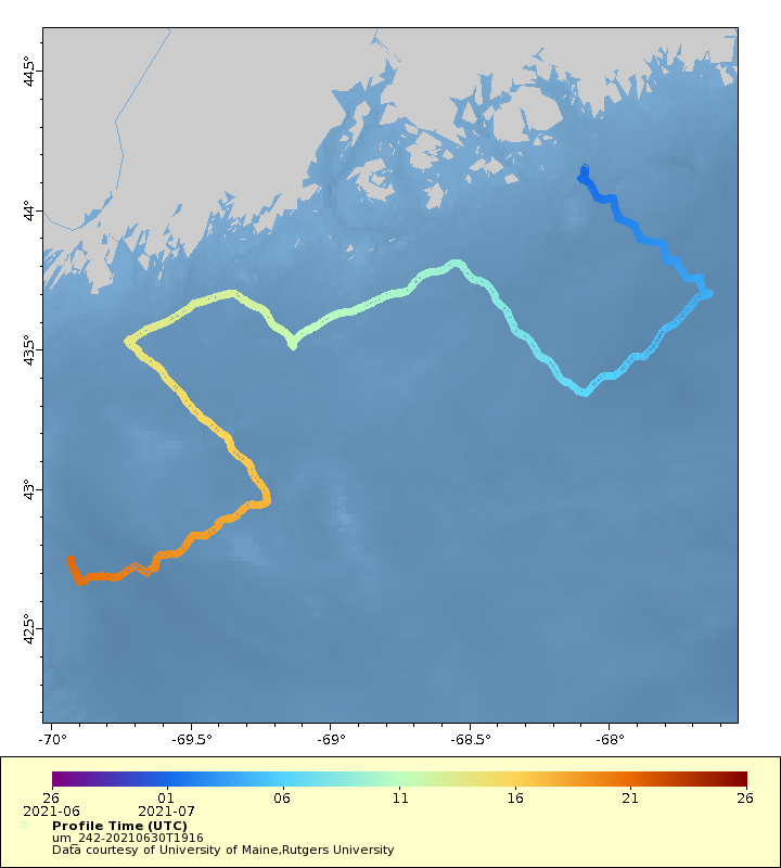
Track
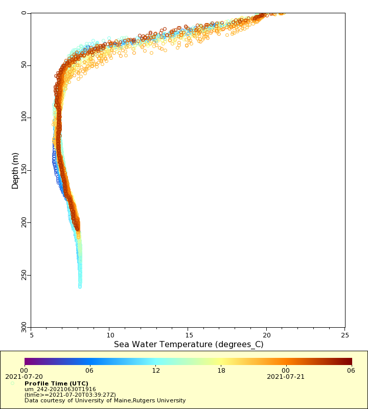
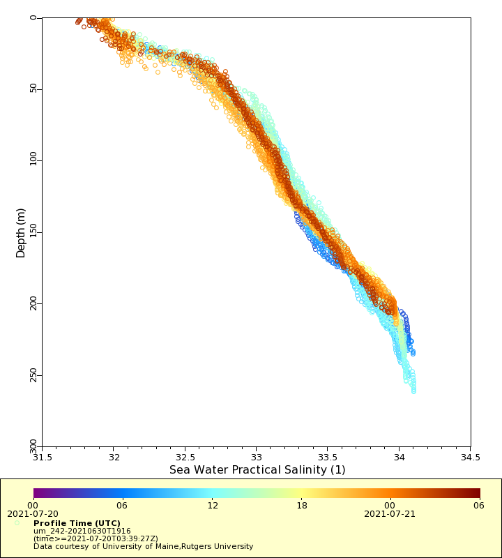
Latest Profiles
Temperature
Salinity
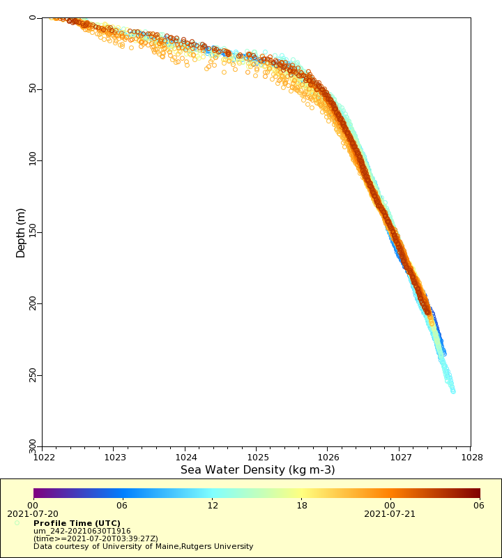
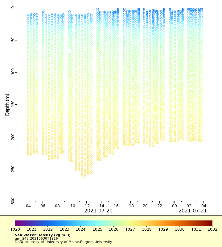
Density
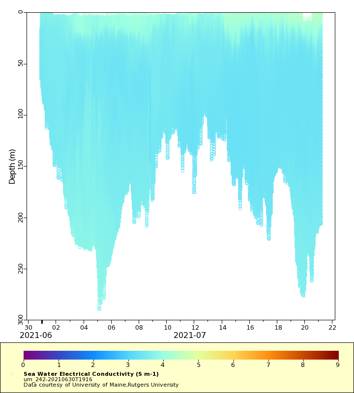
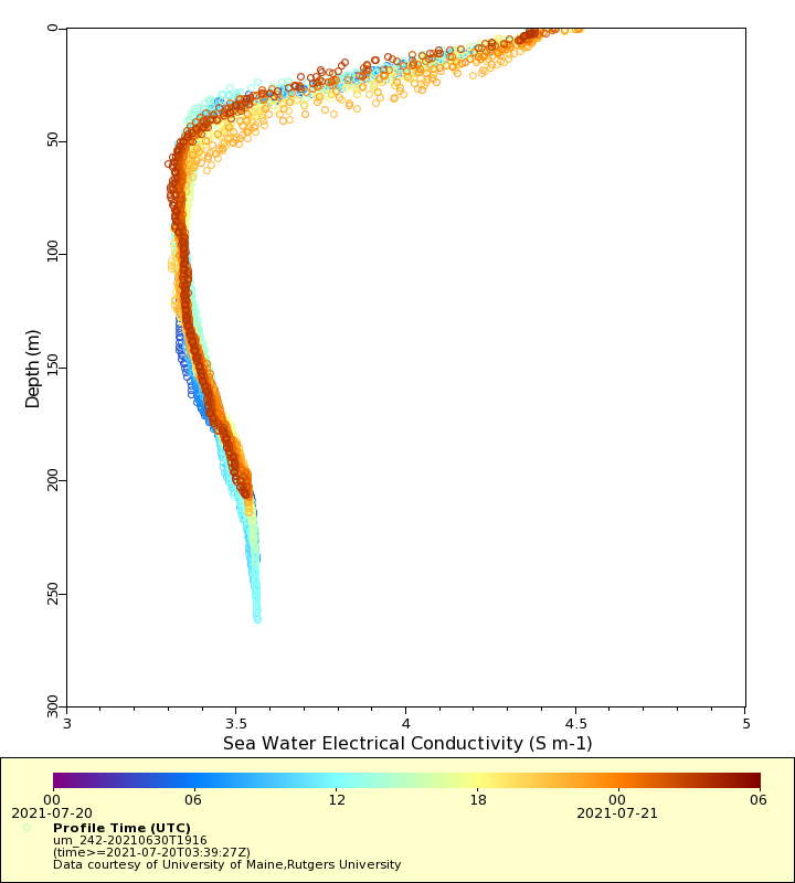
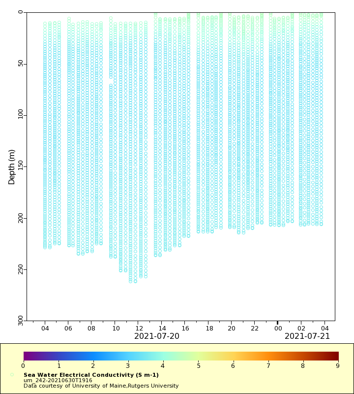
Conductivity
Latest Timeseries
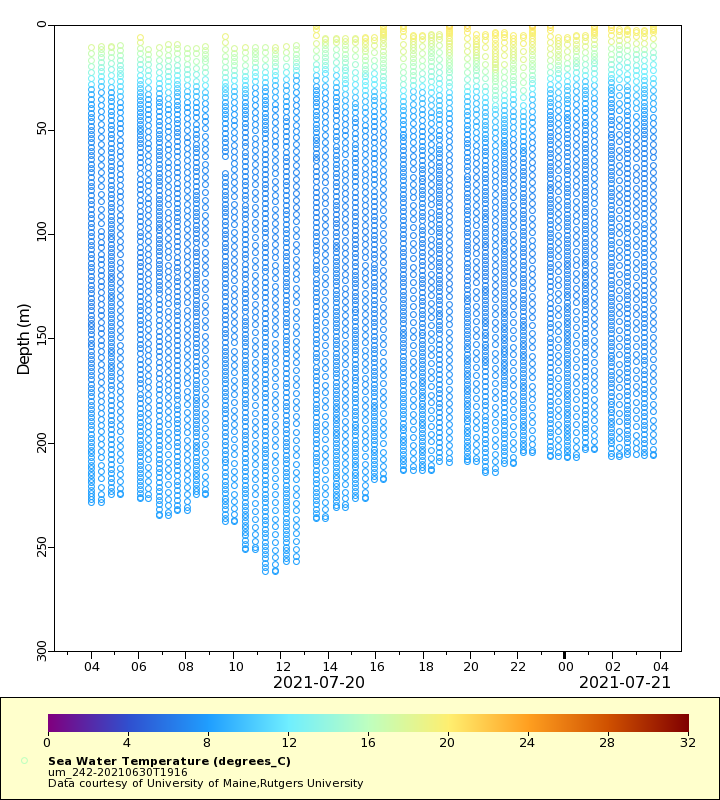
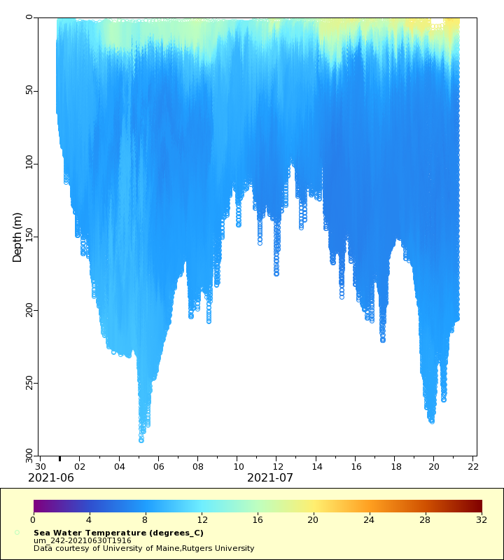
Temperature
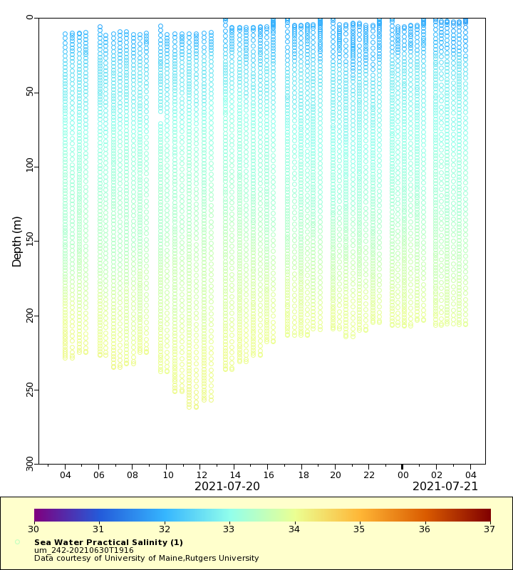
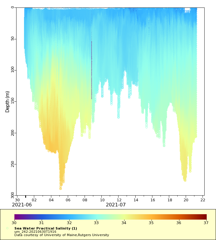
Salinity
Density
Conductivity
Synoptic Timeseries
Temperature
Salinity
Density
Conductivity