| Dataset | um_240-20211205T1918 |
|---|---|
| Glider | um_240 |
| Status | Completed |
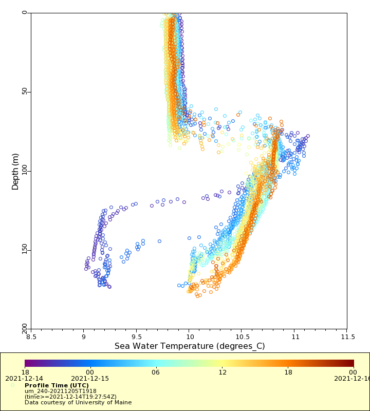
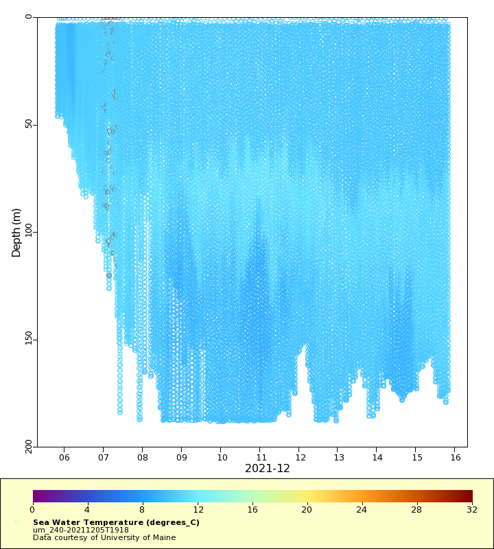
| Summary | This project is conducting a deployment of a passive acoustic glider in the eastern Gulf of Maine to monitor and survey calls of Sei, Fin, Humpback and Right whales, and physical oceanographic conditions. This approximately 21-to-30 day deployment begins in the Eastern Maine Coastal Current (EMCC), and proceeds to the UMOOS Buoy I, Jordan Basin, and Buoy M. The glider will then cruise SW toward the LMA1 restricted region that Right whales traditionally visit in the fall and where there is evidence that the area is a mating ground. The glider uses the digital acoustic monitoring (DMON) instrument and the low-frequency detection and classification software (LFDCS). The glider uses an RBR CTD, a WETLabs ECO puck configured with chlorophyll a fluorescence, CDOM, Turbidity, and an Aanderaa optode for measuring dissolved oxygen |
| WMO ID | 4803945 |
| Attribution | Broad Reach Fund |
| Time Coverage Start | 2021-12-05 19:32:17 UTC |
| Time Coverage End | 2022-01-04 14:25:04 UTC |
| Registered | 2021-12-07 |
| Deployed | 2021-12-05 |
| Operator | University of Maine |
| Institution | University of Maine |
| Data Provider | rutgers |
| # Profiles | 1429 |
| Days Deployed | 30 |
| BBox North | 44.25 |
| BBox South | 43.096 |
| BBox East | -69.545 |
| BBox West | -67.889 |
Maps
Track

Latest Profiles
Temperature
Salinity

Density

Conductivity

Latest Timeseries
Temperature

Salinity

Density

Conductivity

Synoptic Timeseries
Temperature
Salinity

Density

Conductivity
