| Dataset | sp034-20220616T1622 |
|---|---|
| Glider | sp034 |
| Status | Completed |
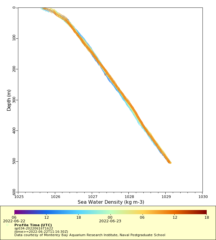
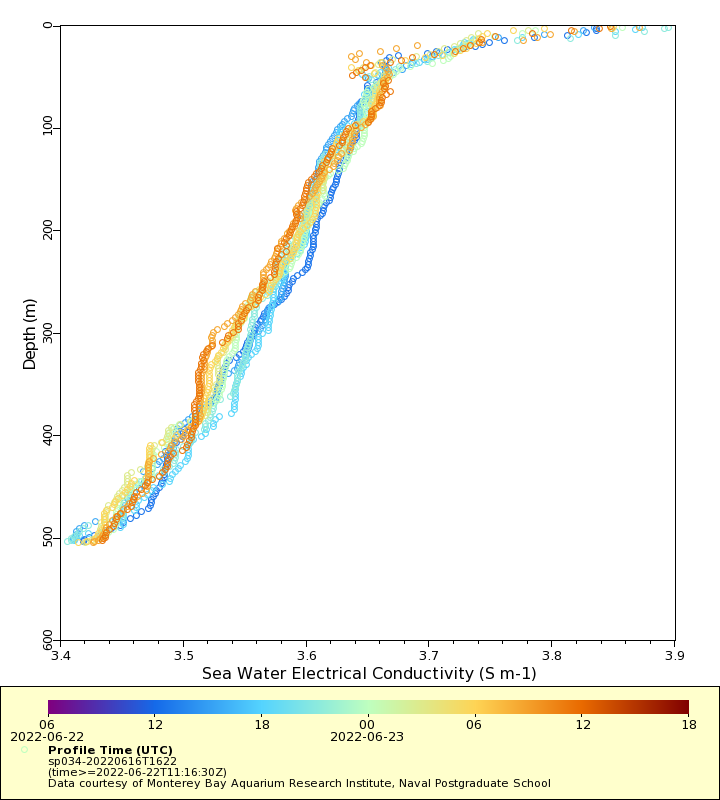
| Summary | This dataset is comprised of routine deployments of two underwater gliders off the coast of Central California, inside or near Monterey Bay. Missions typically last several weeks, and include process studies inside Monterey Bay, or transects to ~250 km offshore from Monterey Bay. The gliders are equipped with a CTD to measure temperature, salinity, and depth, as well as biogeochemical sensors for dissolved oxygen, chlorophyll fluorescence or optical backscatter, and pH |
| WMO ID | 4801959 |
| Attribution | |
| Time Coverage Start | 2022-06-16 17:19:30 UTC |
| Time Coverage End | 2022-07-07 16:56:30 UTC |
| Registered | 2022-06-21 |
| Deployed | 2022-06-16 |
| Operator | MBARI |
| Institution | Monterey Bay Aquarium Research Institute, Naval Postgraduate School |
| Data Provider | castelao |
| # Profiles | 211 |
| Days Deployed | 21 |
| BBox North | 36.803 |
| BBox South | 36.697 |
| BBox East | -122.412 |
| BBox West | -121.846 |
Maps
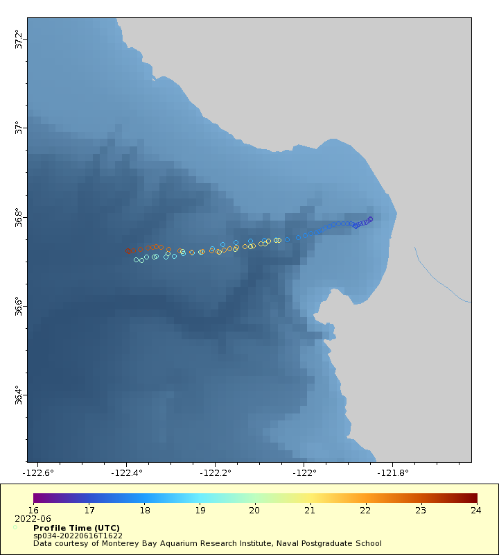
Track
Latest Profiles
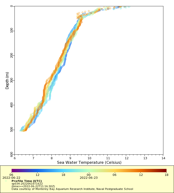
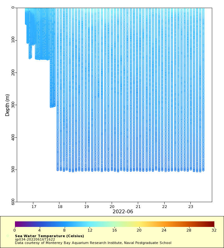
Temperature
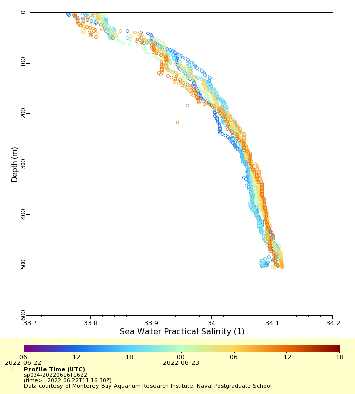
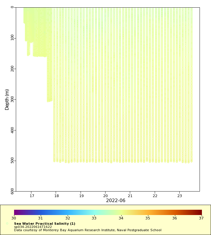
Salinity
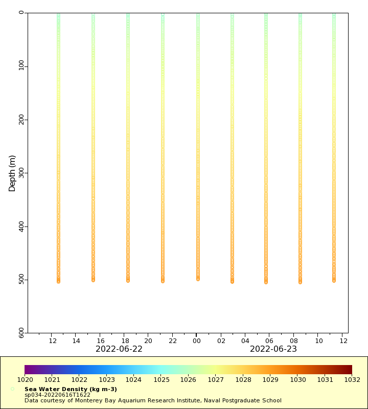
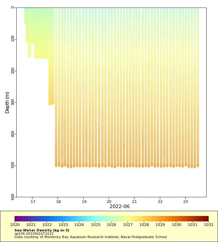
Density
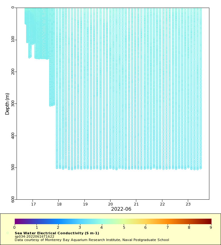
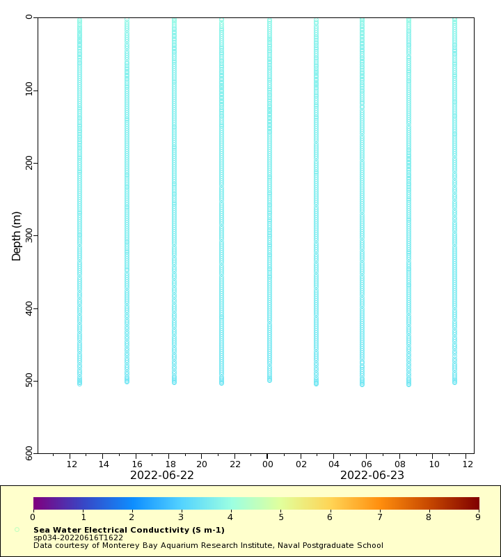
Conductivity
Latest Timeseries
Temperature
Salinity
Density
Conductivity
Synoptic Timeseries
Temperature
Salinity
Density
Conductivity