| Dataset | sp007-20220330T1436 |
|---|---|
| Glider | sp007 |
| Status | Completed |
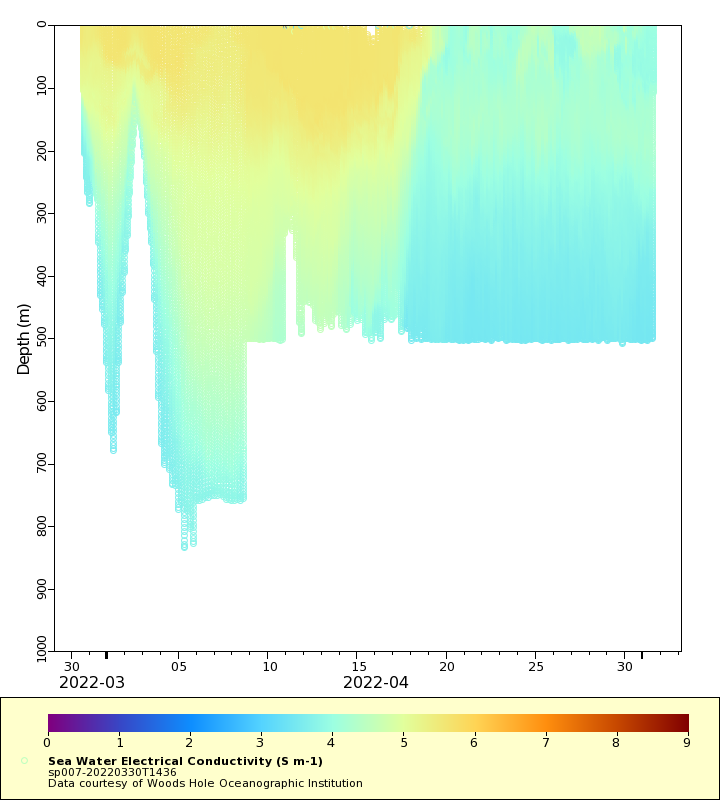
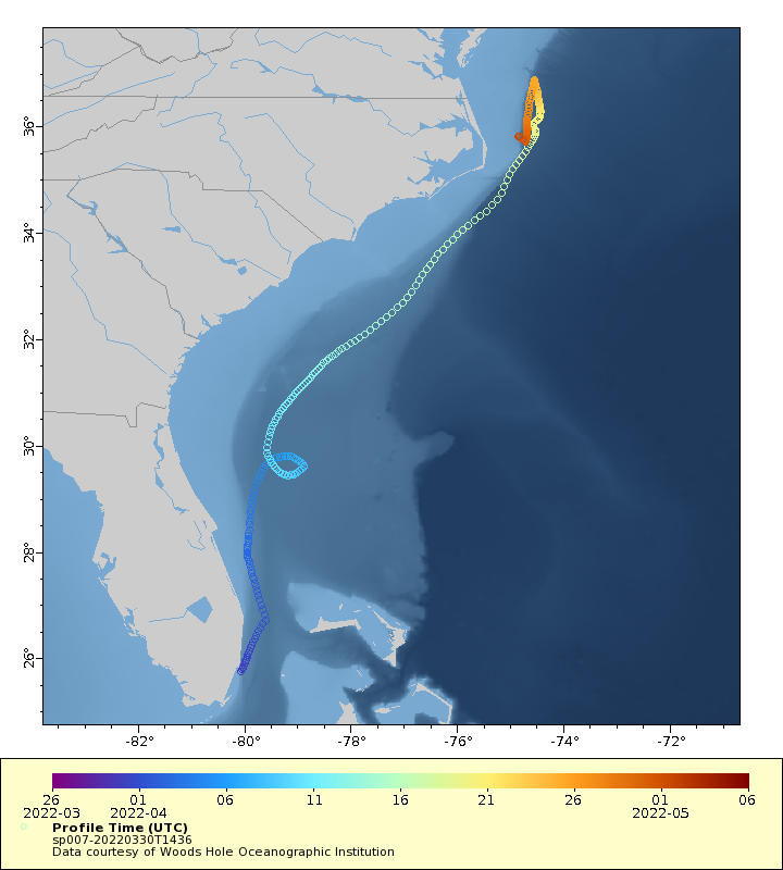
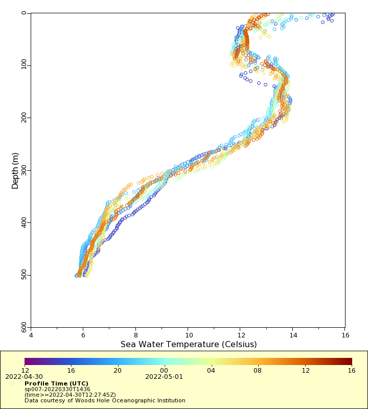
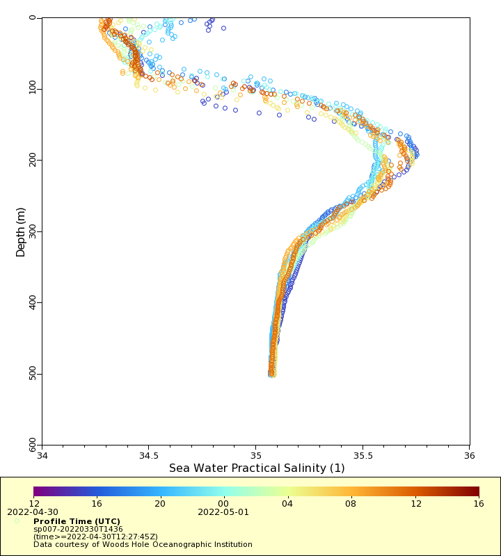
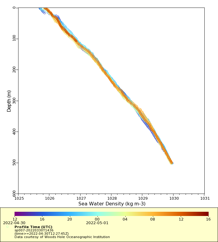
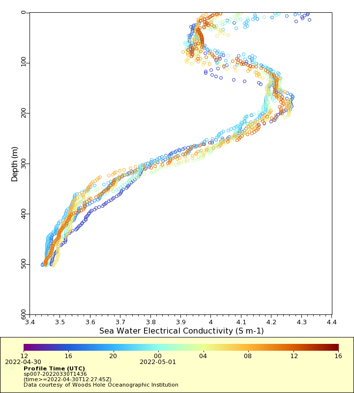
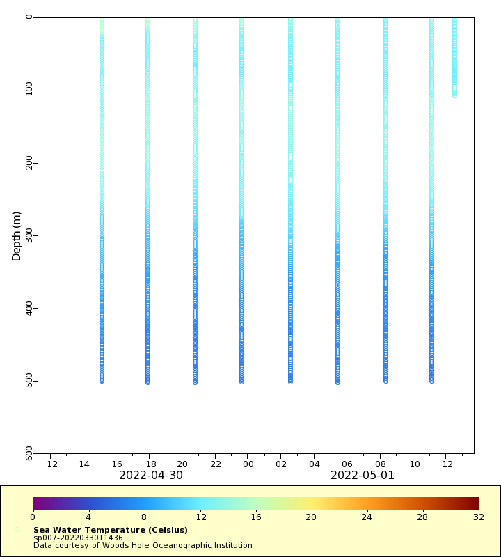
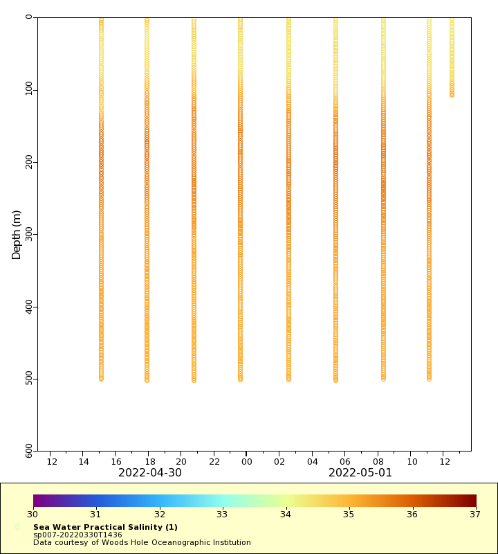
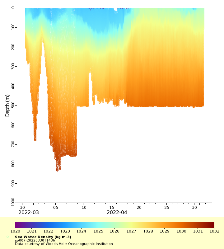
| Summary | The overarching goal of this project is to collect high resolution transects across the Gulf Stream. Though the speed of the Gulf Stream greatly exceeds the speed of a glider, gliders can be flown across the current as they are advected downstream. Missions prior to 2015 were conducted downstream (northeast) of Cape Hatteras, primarily between Cape Cod and Bermuda; missions since 2015 begin in Miami, FL and are planned to end on the New England continental shelf. During a typical 100-day mission between Miami and Cape Cod, a single glider completes 6-10 crossings of the Gulf Stream, returning approximately 800 profiles to the shallower of the sea floor or 1000 m. The current operational goal is to maintain at least one glider in the Gulf Stream at all times. Additional plots of these data are available at http://gliders.whoi.edu |
| WMO ID | 4801974 |
| Attribution | |
| Time Coverage Start | 2022-03-30 15:57:15 UTC |
| Time Coverage End | 2022-05-01 12:27:45 UTC |
| Registered | 2022-03-30 |
| Deployed | 2022-03-30 |
| Operator | Woods Hole Oceanographic Institution |
| Institution | Woods Hole Oceanographic Institution |
| Data Provider | castelao |
| # Profiles | 295 |
| Days Deployed | 32 |
| BBox North | 36.861 |
| BBox South | 25.753 |
| BBox East | -80.052 |
| BBox West | -74.427 |
Maps
Track
Latest Profiles
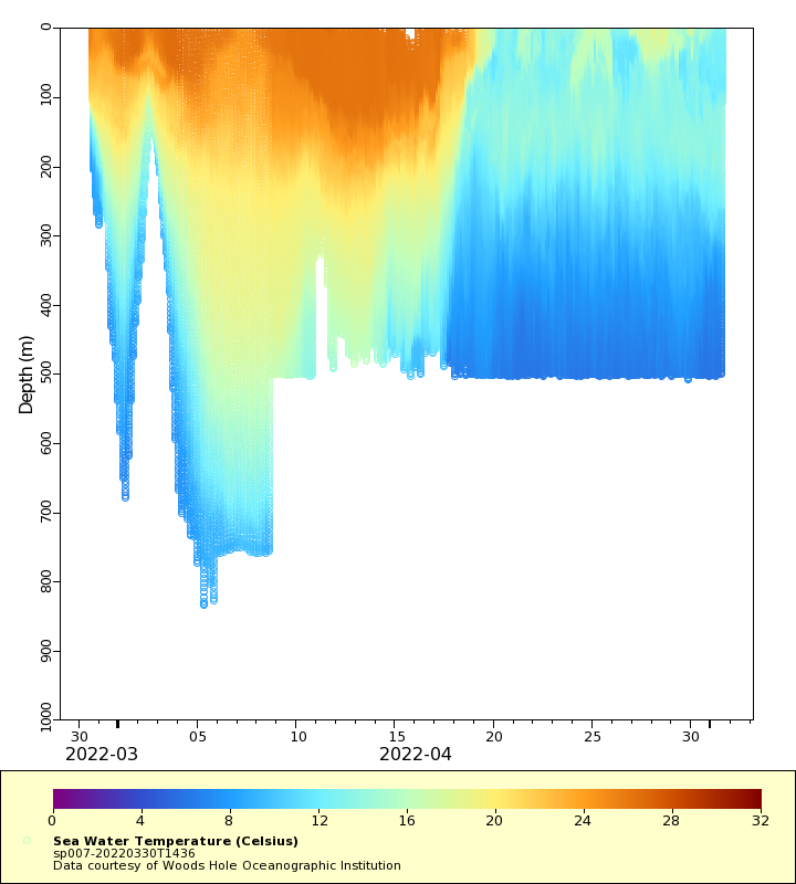
Temperature
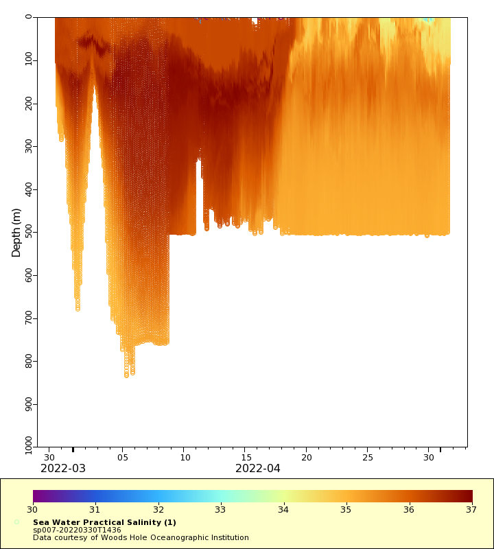
Salinity
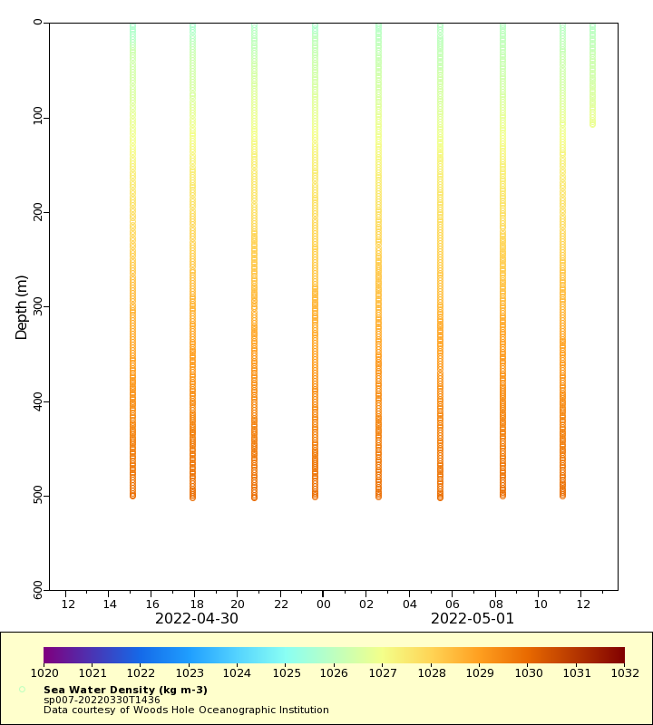
Density
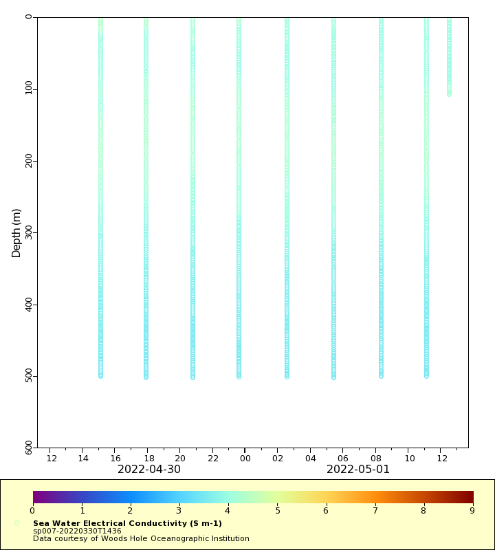
Conductivity
Latest Timeseries
Temperature
Salinity
Density
Conductivity
Synoptic Timeseries
Temperature
Salinity
Density
Conductivity