| Dataset | sbu01-20210226T1902 |
|---|---|
| Glider | sbu01 |
| Status | Completed |
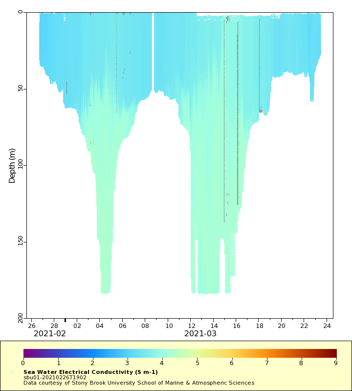
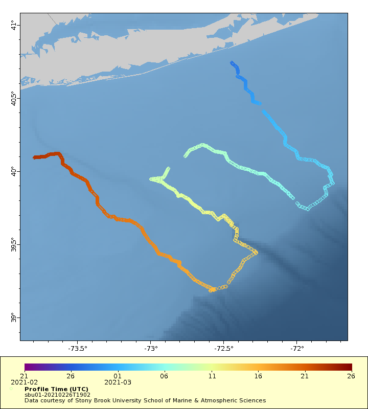
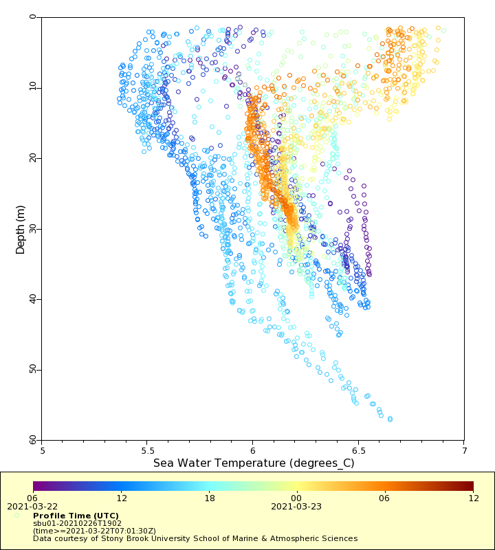
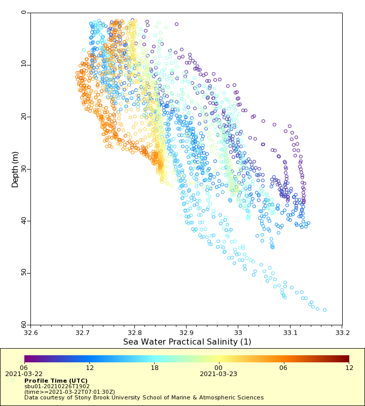
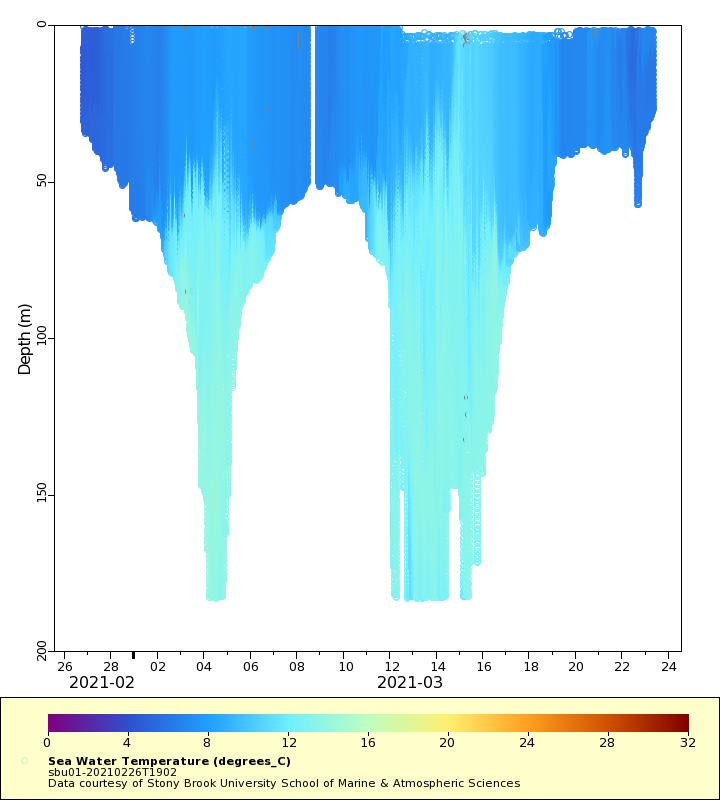
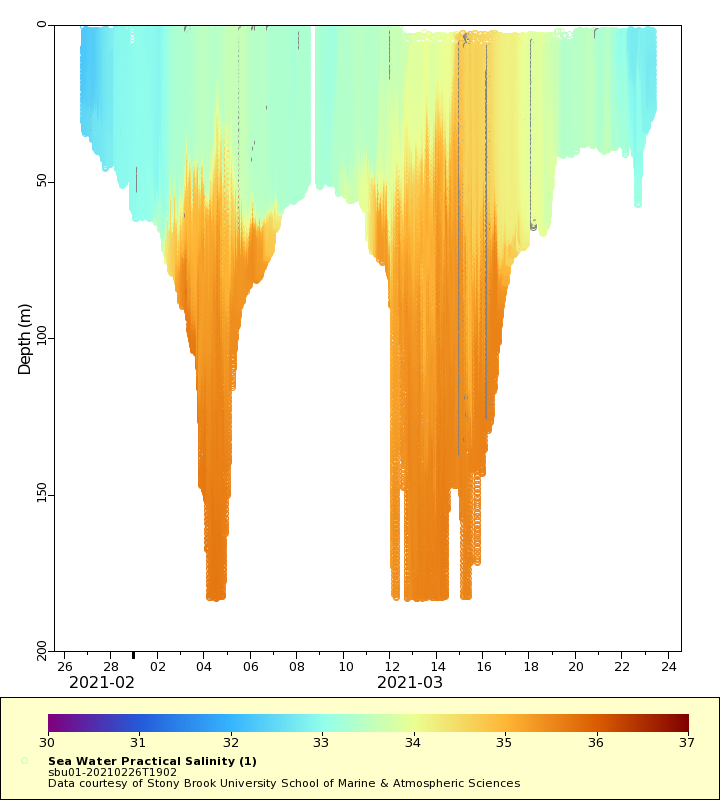
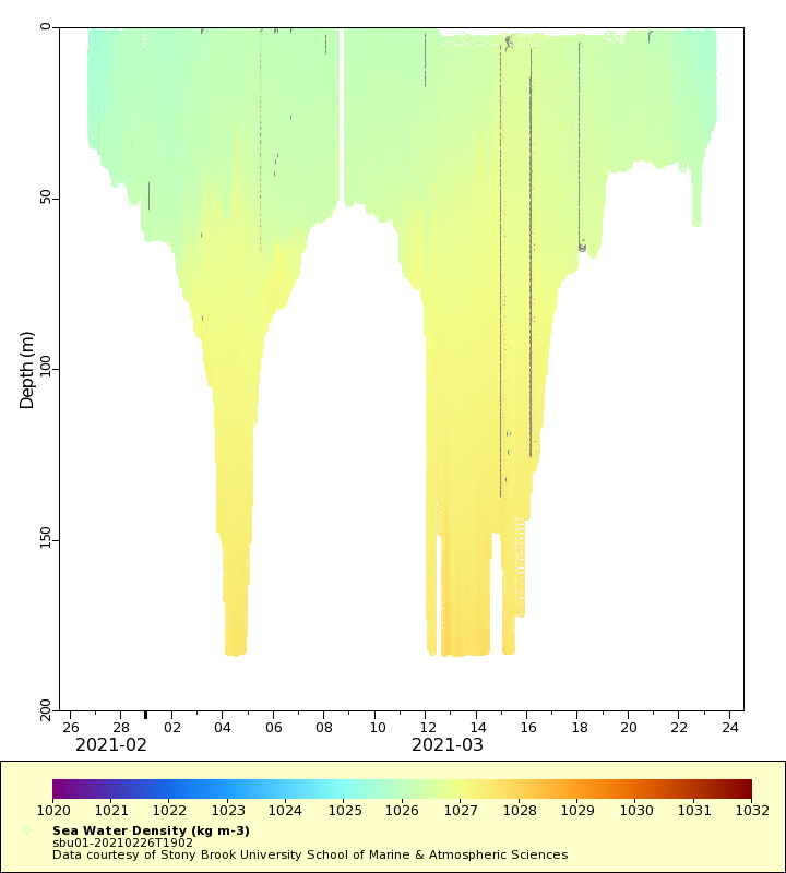
| Summary | Stony Brook University's ocean glider project at the School of Marine and Atmospheric Sciences is part of a multi-disciplinary 10 year effort to monitor the physical, chemical and biological conditions within the New York Bight. The program is supported by New York state's Department of Environmental Conservation. The glider program will consist of four seasonal cruises covering the area between eastern Long Island and New Jersey, and out to the shelf break. The other program components include seasonal cruises to acoustically survey plankton and fish with net tow ground truthing combined with physical/chemical hydrocast measurements and marine mammal surveys. This real-time dataset includes measurments of temperature, salinity, chlorophyll a, colored dissovled organic matter, optical backscatter and oxygent concentration and saturation. The glider was deployed south of Shinnecock Bay and proceed southeast to the shelf break, then back inshore, then offshore through the Hudson Canyon and make it's way back to be recovered off of Tuckerton, New Jersey, USA. This real-time dataset contains measurements of temperature, salinity, chlorophyll a, beta700nm, CDOM, oxygen concentration and pH |
| WMO ID | 4802959 |
| Attribution | New York Department of Environmental Conservation |
| Time Coverage Start | 2021-02-26 19:16:33 UTC |
| Time Coverage End | 2021-03-23 07:01:30 UTC |
| Registered | 2021-02-28 |
| Deployed | 2021-02-26 |
| Operator | Stony Brook University |
| Institution | Stony Brook University School of Marine & Atmospheric Sciences |
| Data Provider | rutgers |
| # Profiles | 1559 |
| Days Deployed | 25 |
| BBox North | 40.742 |
| BBox South | 39.18 |
| BBox East | -73.791 |
| BBox West | -71.752 |
Maps
Track
Latest Profiles
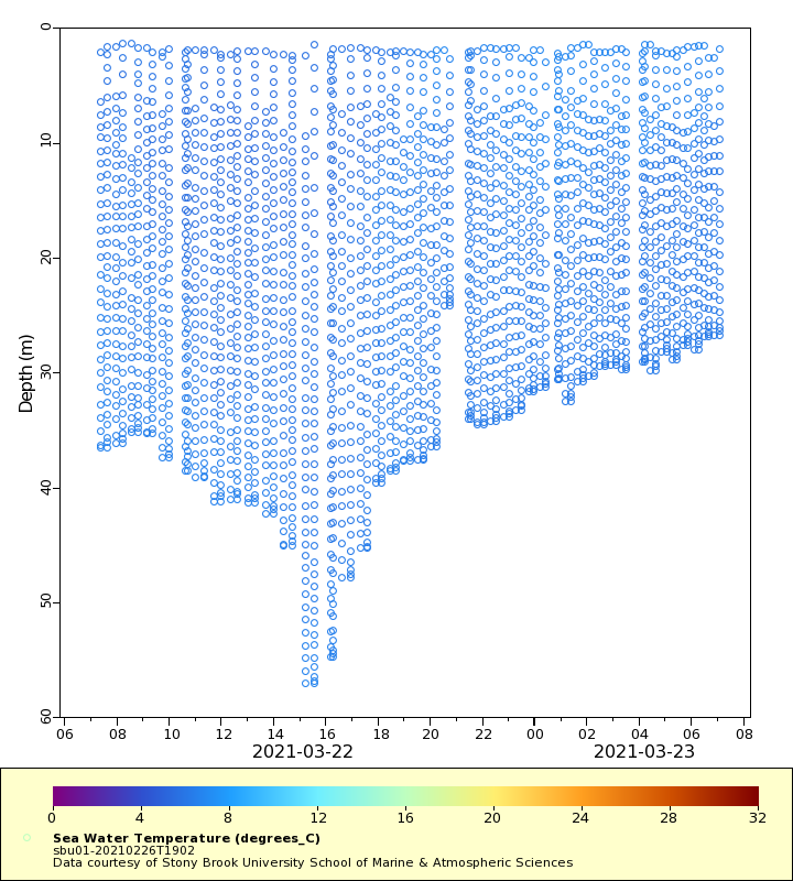
Temperature
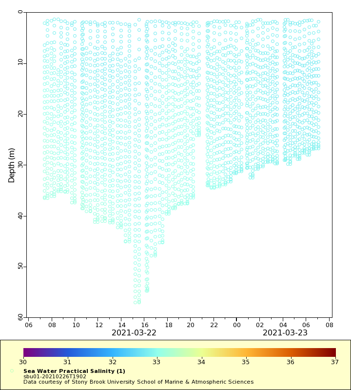
Salinity
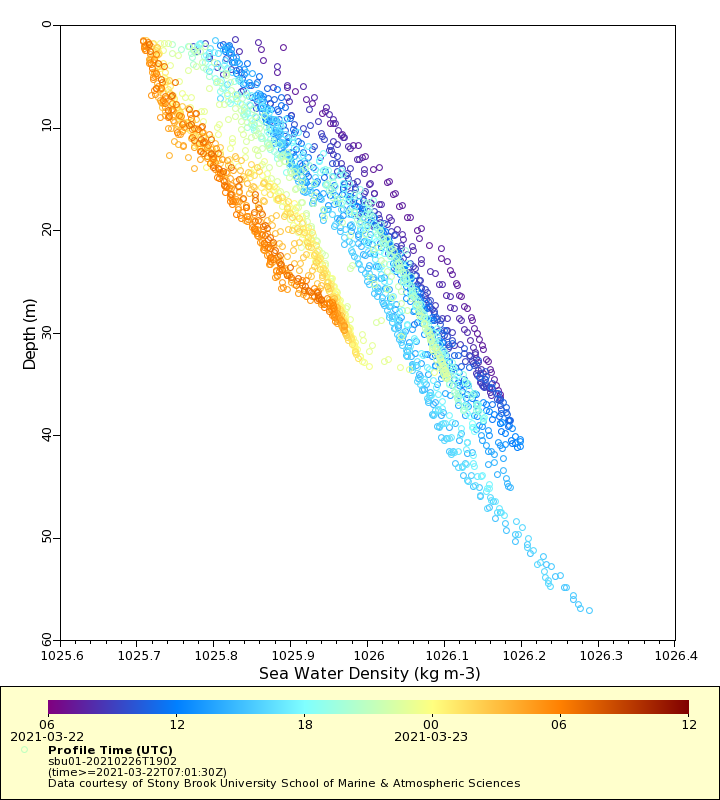
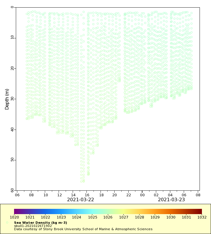
Density
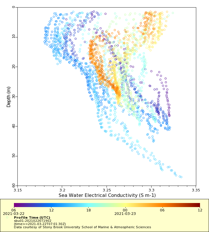
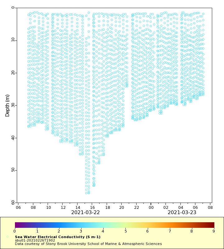
Conductivity
Latest Timeseries
Temperature
Salinity
Density
Conductivity
Synoptic Timeseries
Temperature
Salinity
Density
Conductivity