| Dataset | ru29-20210908T1943 |
|---|---|
| Glider | ru29 |
| Status | Completed |
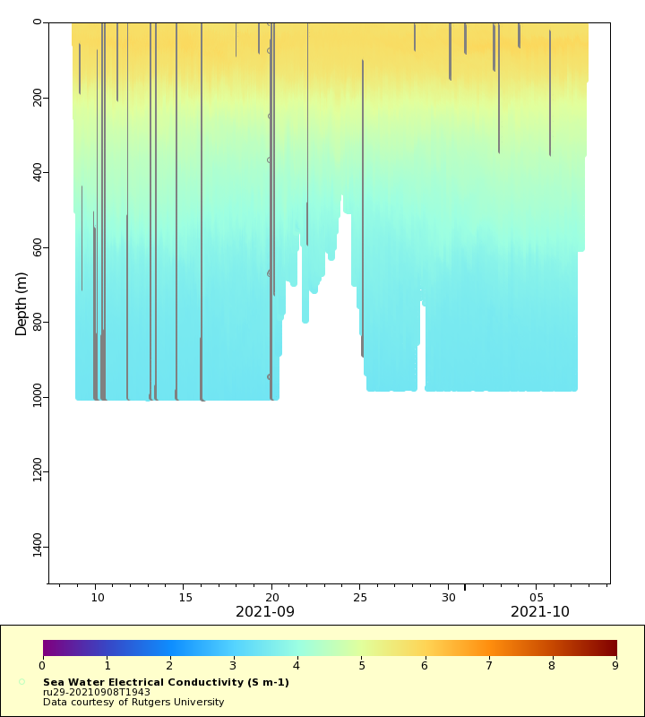
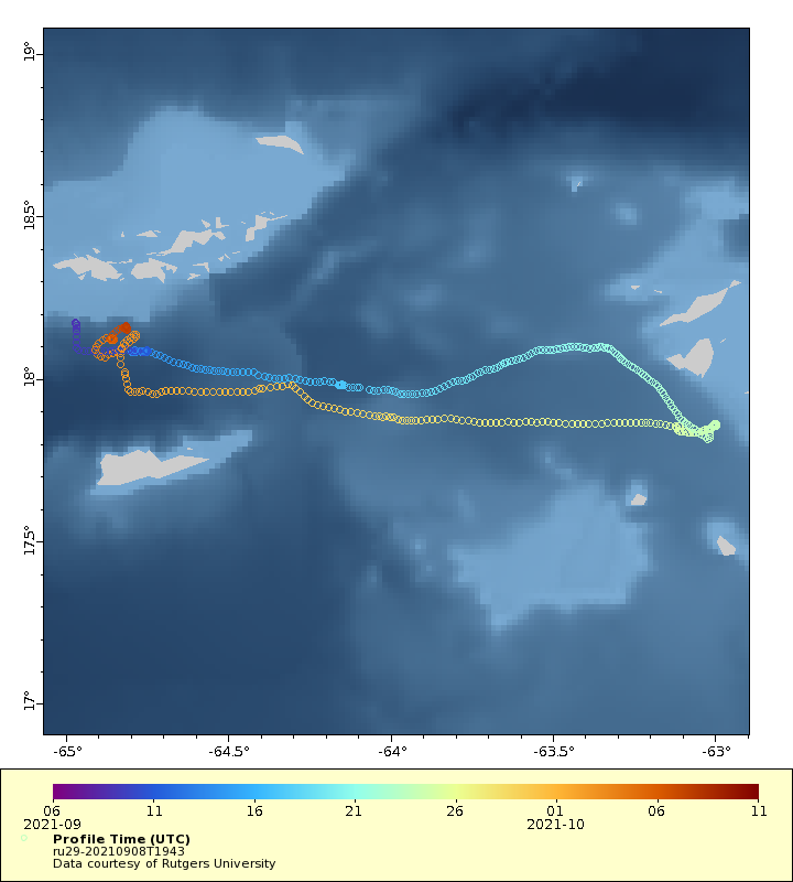
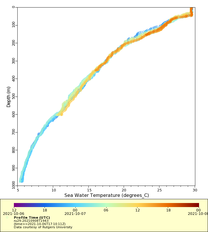
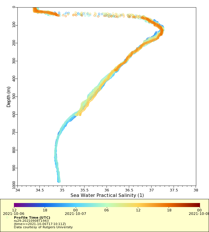
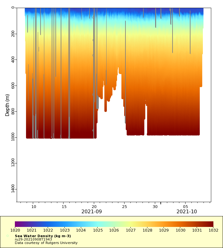
| Summary | Second deployment of ru29 in the United States Virgin Islands in 2021. This second deployment is a continuation of the first deployment on June 30, 2021, which was recovered for maintenance. The Challenger Glider Mission is a re-creation of the first global scientific ocean survey conducted by the HMS Challenger from 1872-1876. The goals of the mission are to establish a collaborative international network of autonomous underwater glider ports, to assess global ocean model predictive skill while contributing real-time profile data for assimilation in ocean forecast models by operational centers worldwide, and to crowd source student-based ocean research and discovery. This glider is providing temperature, conductivity, salinity, density and current profile observations. The current profiles are logged via external Nortek AD2CP files and are not available in this real-time dataset. The glider is also equipped with a Cetacean Research Acousonde 3A passive acoustic recorder. RU29s planned mission extends from the US Virgin Islands, British Virgin Islands, Anguilla, St. Martin (Fr), Sint Maarten (NED), St. Barth\u00e9lemy (Fr), Antigua and Barbuda, St. Kitts and Nevis, and Guadaloupe, areas commonly impacted by tropical cyclones. Real-time datasets will include CTD data that will be provided to the IOOS Glider DAC and GTS to support ocean and atmospheric weather forecasting |
| WMO ID | 4802960 |
| Attribution | G. Unger Vetlesen Foundation, OCOVI and CARICOOS |
| Time Coverage Start | 2021-09-08 19:50:09 UTC |
| Time Coverage End | 2021-10-07 17:10:11 UTC |
| Registered | 2021-09-09 |
| Deployed | 2021-09-08 |
| Operator | Rutgers University |
| Institution | Rutgers University |
| Data Provider | rutgers |
| # Profiles | 476 |
| Days Deployed | 29 |
| BBox North | 18.172 |
| BBox South | 17.814 |
| BBox East | -64.971 |
| BBox West | -62.997 |
Maps
Track
Latest Profiles
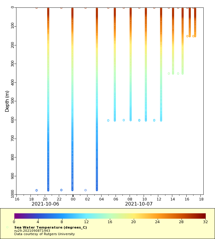
Temperature
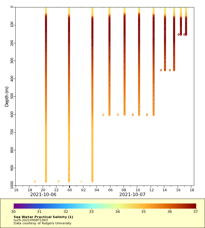
Salinity
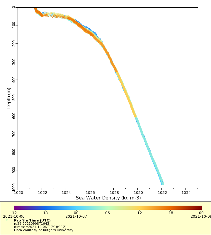
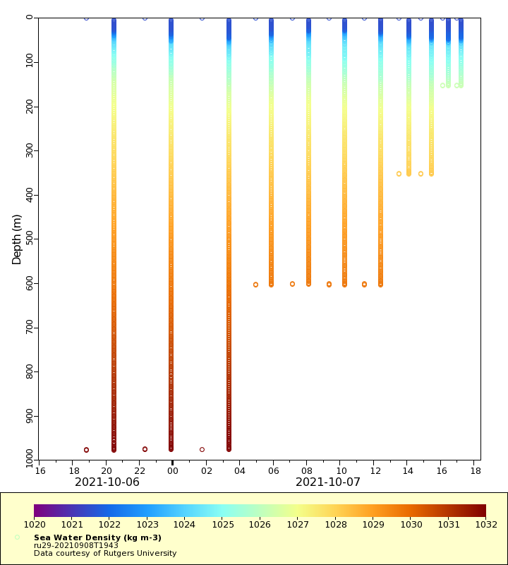
Density
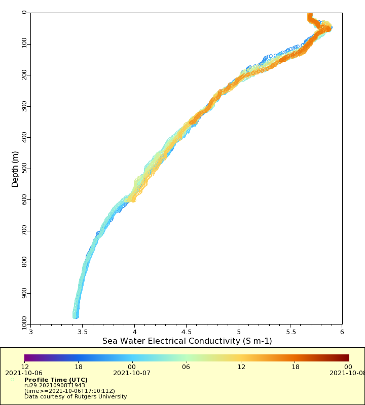
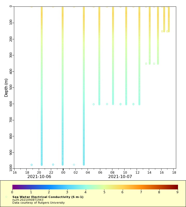
Conductivity
Latest Timeseries
Temperature
Salinity
Density
Conductivity
Synoptic Timeseries
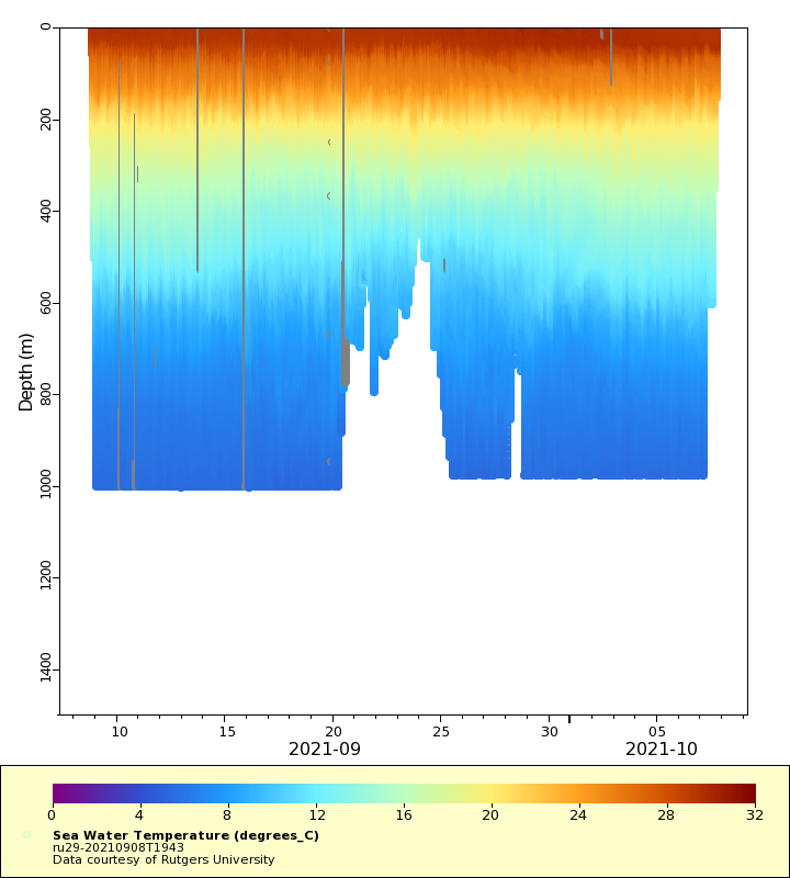
Temperature
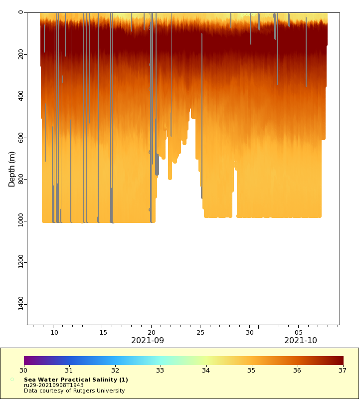
Salinity
Density
Conductivity