| Dataset | ru29-20200908T1623 |
|---|---|
| Glider | ru29 |
| Status | Completed |
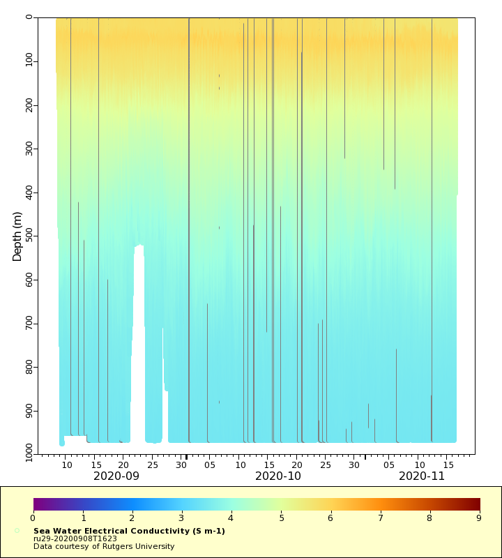
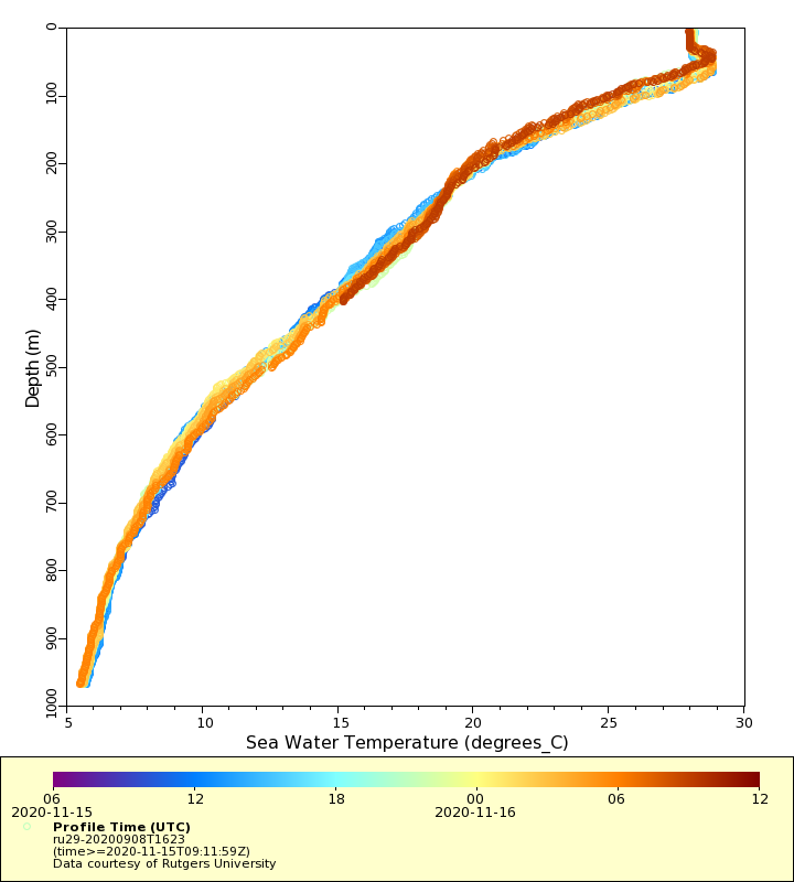
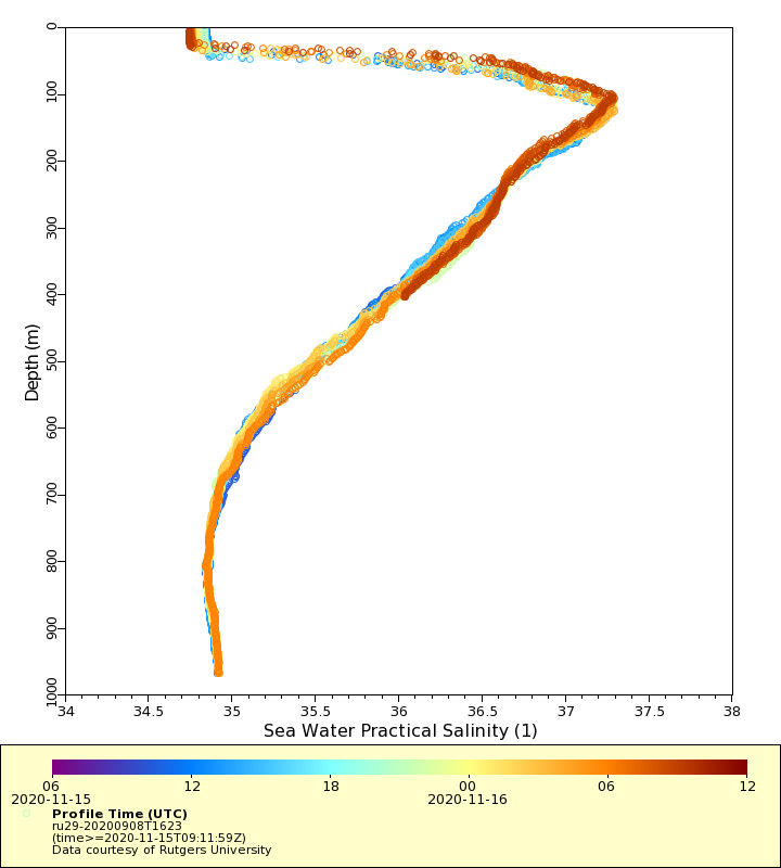
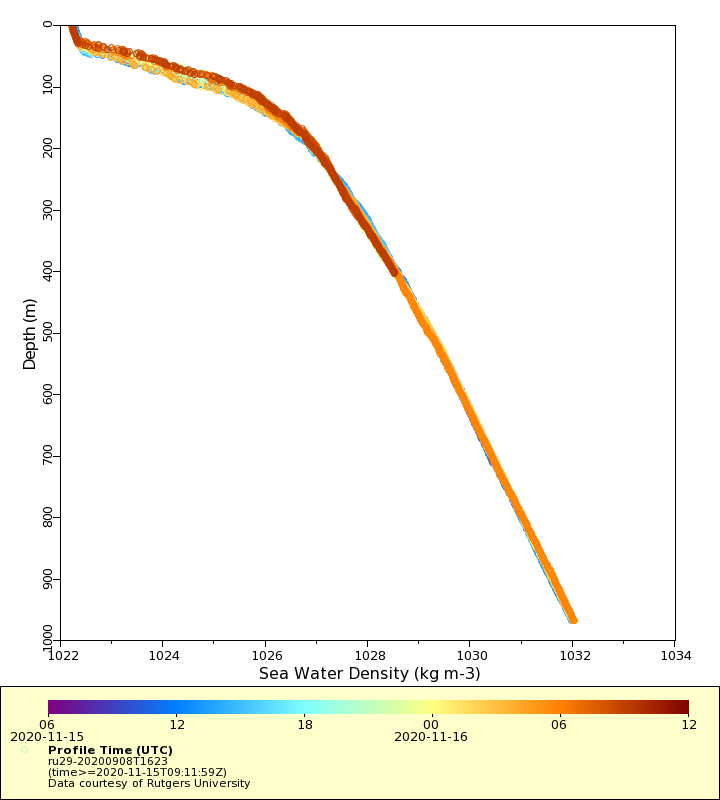
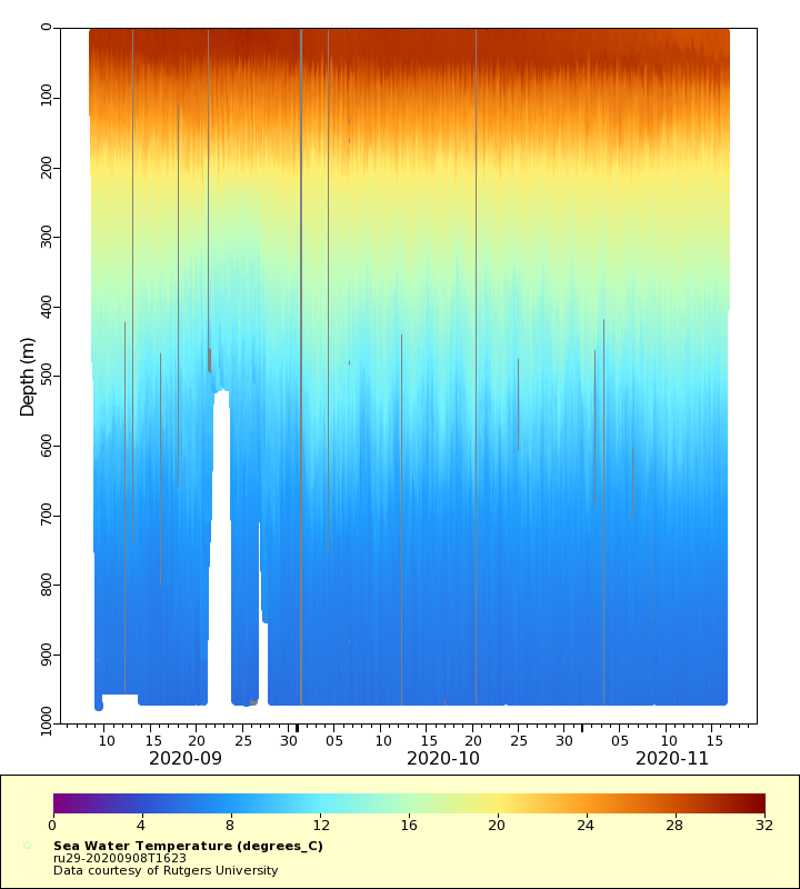
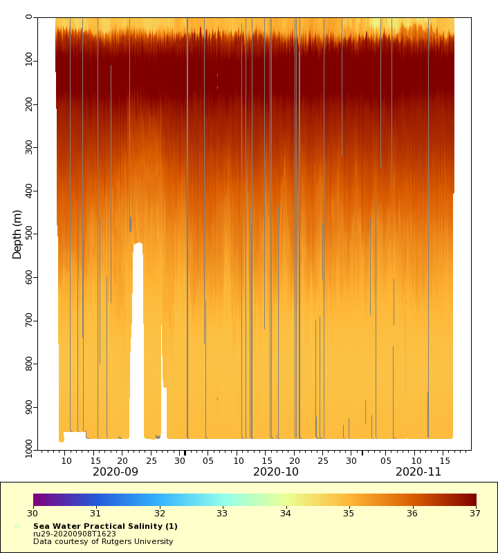
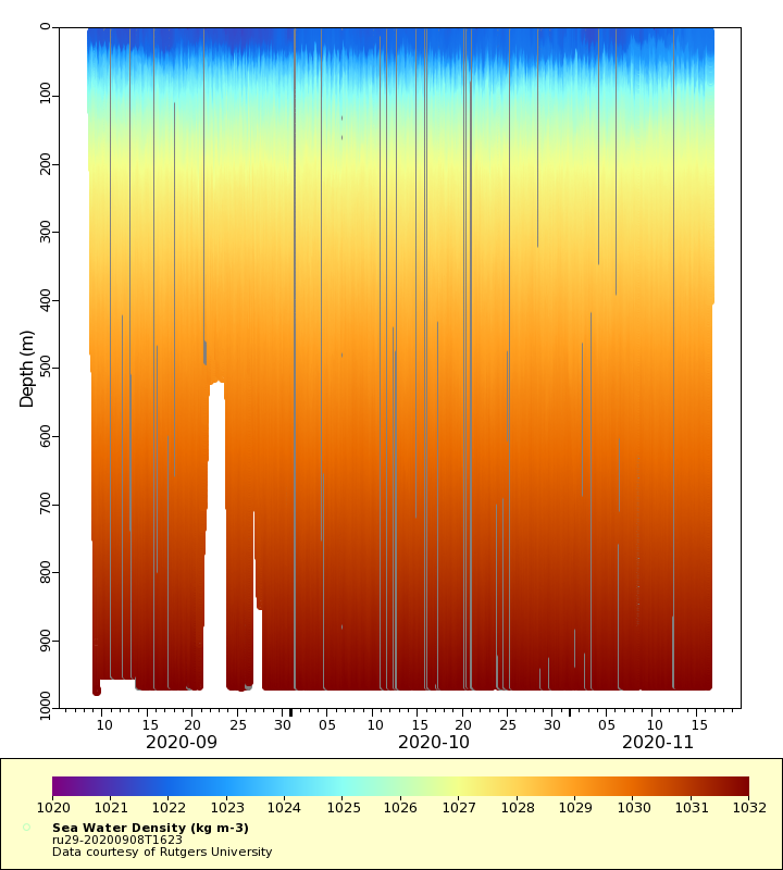
| Summary | The Challenger Glider Mission is a re-creation of the first global scientific ocean survey conducted by the HMS Challenger from 1872-1876. The goals of the mission are to establish a collaborative international network of autonomous underwater glider ports, to assess global ocean model predictive skill while contributing real-time profile data for assimilation in ocean forecast models by operational centers worldwide, and to crowd source student-based ocean research and discovery. Glider is providingtemperature, conductivity, salinity, density and current profile observations. The current profiles are logged via external pd0 files and are not available in this real-time dataset. RU29 is flying in the vicinity of the Anegada Passage and throughout the surrounding island regions to monitor heat transport between the Caribbean Sea and the Tropical North Atlantic. This region includes the US Virgin Islands, British Virgin Islands, and Anguilla, areas commonly impacted by tropical cyclones. This real-time data set contains CTD, chlorophyll, CDOM, beta700nm and ADCP measurements |
| WMO ID | 4802960 |
| Attribution | G. Unger Vetlesen Foundation, OCOVI and CARICOOS |
| Time Coverage Start | 2020-09-08 16:34:05 UTC |
| Time Coverage End | 2020-11-16 12:51:14 UTC |
| Registered | 2020-09-09 |
| Deployed | 2020-09-08 |
| Operator | Rutgers University |
| Institution | Rutgers University |
| Data Provider | rutgers |
| # Profiles | 1070 |
| Days Deployed | 69 |
| BBox North | 18.179 |
| BBox South | 17.424 |
| BBox East | -64.979 |
| BBox West | -63.943 |
Maps
Track

Latest Profiles
Temperature
Salinity
Density
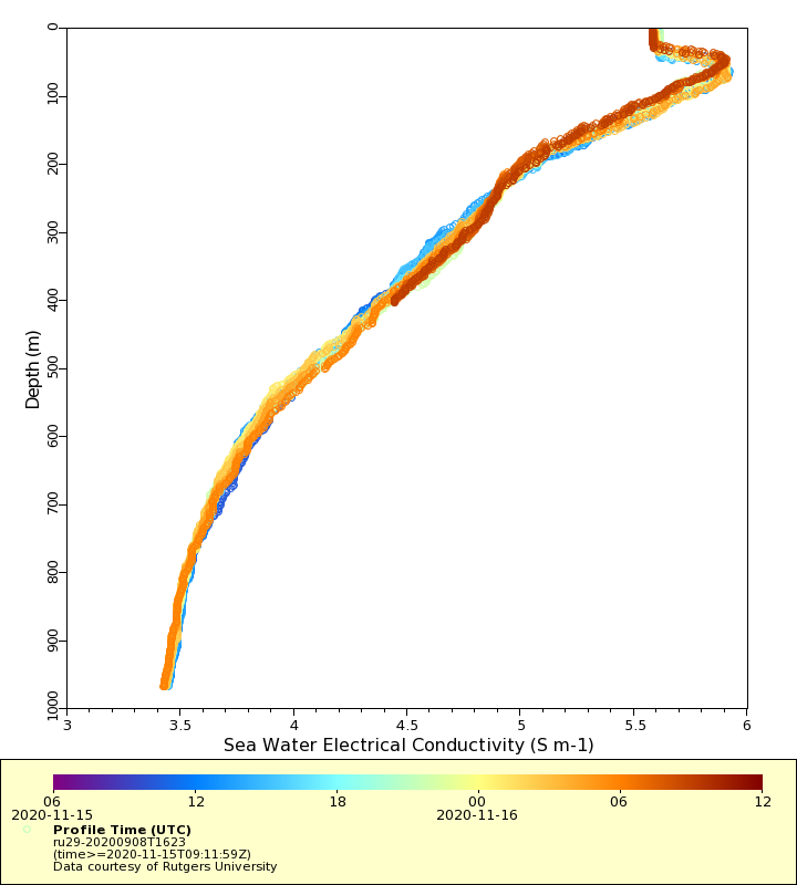
Conductivity
Latest Timeseries
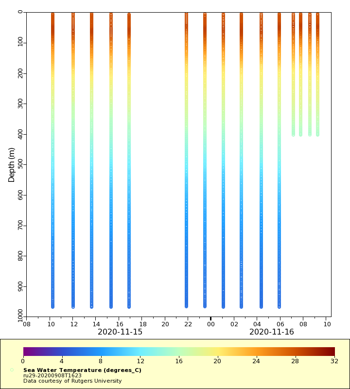
Temperature
Salinity

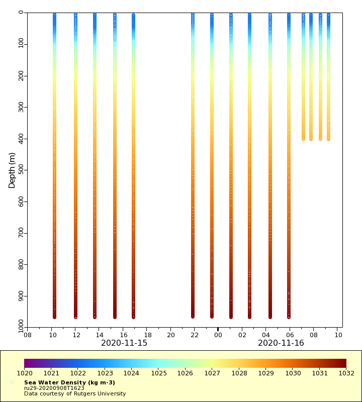
Density
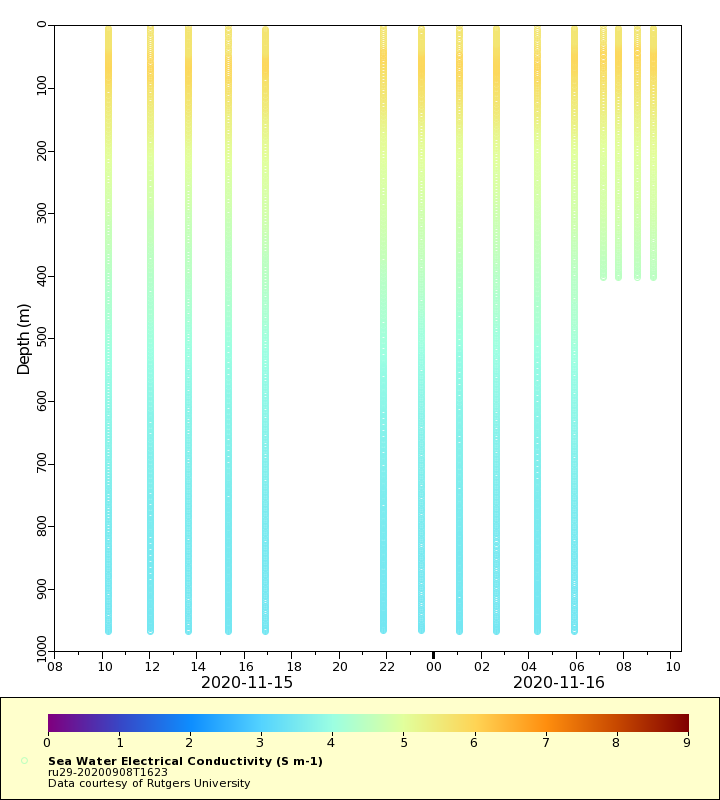
Conductivity
Synoptic Timeseries
Temperature
Salinity
Density
Conductivity