| Dataset | ru29-20180812T0220 |
|---|---|
| Glider | ru29 |
| Status | Completed |
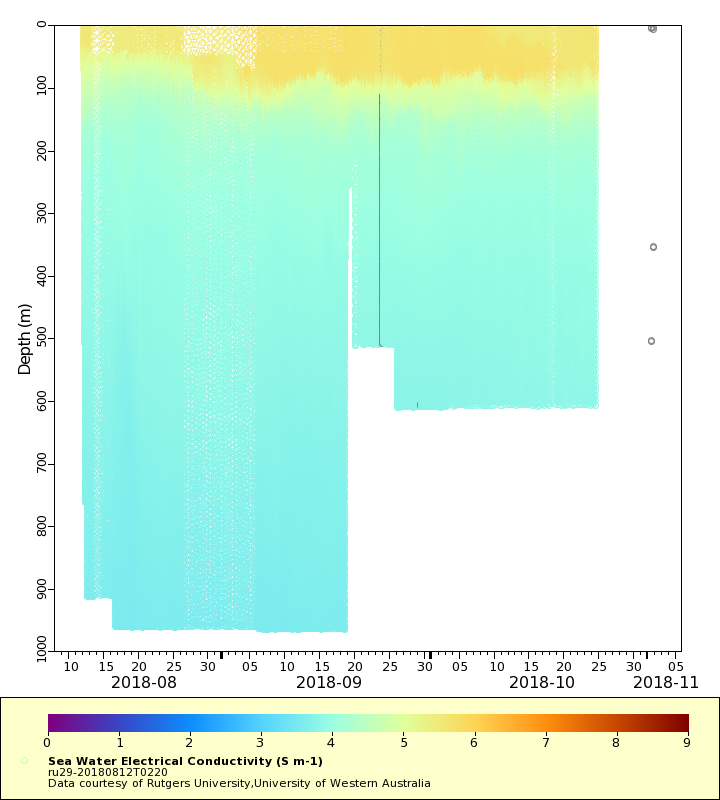
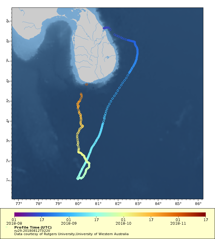
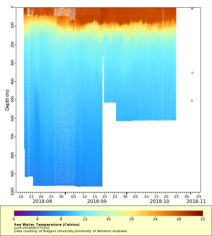
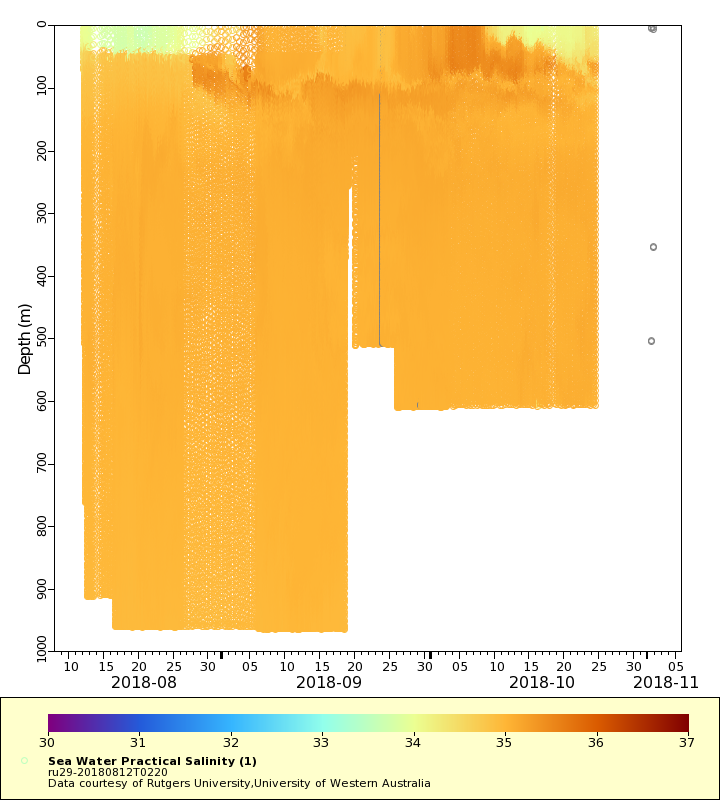
| Summary | The Challenger Glider Mission is a re-creation of the first global scientific ocean survey conducted by the HMS Challenger from 1872-1876. The goals of the mission are to establish a collaborative international network of autonomous underwater glider ports, to assess global ocean model predictive skill while contributing real-time profile data for assimilation in ocean forecast models by operational centers worldwide, and to crowd source student-based ocean research and discovery. This Indian Ocean leg of the mission begins in Sri Lanka and runs toward Mauritius. Dataset contains temperature, conductivity, salinity and density profile observation |
| WMO ID | 2801900 |
| Attribution | G. Unger Vetlesen Foundation, Iridium, Teledyne Marine, U.S. Integrated Ocean Observing System (IOOS), Australian Integrated Marine Observing System (IMOS), National Aquatic Resources Research and Development Agency (NARA), University of Western Australia and Rutgers University |
| Time Coverage Start | 2018-08-12 02:36:01 UTC |
| Time Coverage End | 2018-11-01 14:55:49 UTC |
| Registered | 2018-08-16 |
| Deployed | 2018-08-12 |
| Operator | Rutgers University |
| Institution | Rutgers University,University of Western Australia |
| Data Provider | rutgers |
| # Profiles | 957 |
| Days Deployed | 82 |
| BBox North | 8.665 |
| BBox South | 1.088 |
| BBox East | 79.952 |
| BBox West | 82.981 |
Maps
Track
Latest Profiles
Temperature
Salinity

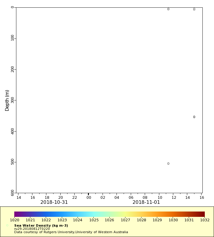
Density
Conductivity

Latest Timeseries
Temperature

Salinity

Density
Conductivity

Synoptic Timeseries
Temperature
Salinity
Density

Conductivity