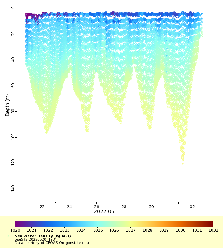
| Dataset | osu592-20220520T1934 |
|---|---|
| Glider | osu592 |
| Status | Completed |
| Summary | The goal of the IOOS/NANOOS project is to make recurring maps of oceanographic properties over the\ncentral Washington shelf in collaboration with the Columbia River Intertribal Fish Commission (CRITFC)\nand the Quinault Indian Nation. The goal of the OMAO project is to make glider-based observations,\nincluding bioacoustics, near ocean fronts over the central Washington shel |
| WMO ID | 4803959 |
| Attribution | NOAA, both IOOS/NANOOS and OMAO |
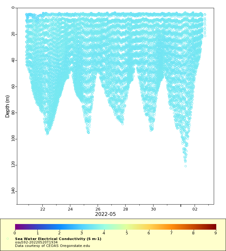
| Time Coverage Start | 2022-05-20 19:40:37 UTC |
| Time Coverage End | 2022-06-02 16:59:24 UTC |
| Registered | 2022-05-25 |
| Deployed | 2022-05-20 |
| Operator | Oregon State University Glider Research Group |
| Institution | CEOAS Oregonstate.edu |
| Data Provider | osugliders |
| # Profiles | 1316 |
| Days Deployed | 13 |
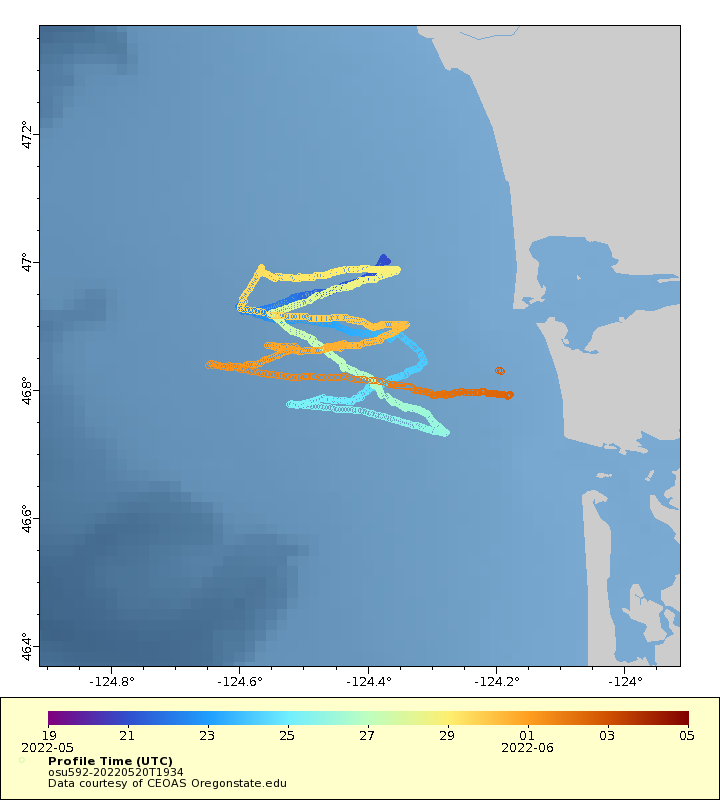
| BBox North | 47.006 |
| BBox South | 46.732 |
| BBox East | -124.648 |
| BBox West | -124.177 |
Maps
Track
Latest Profiles
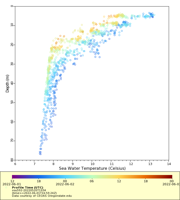
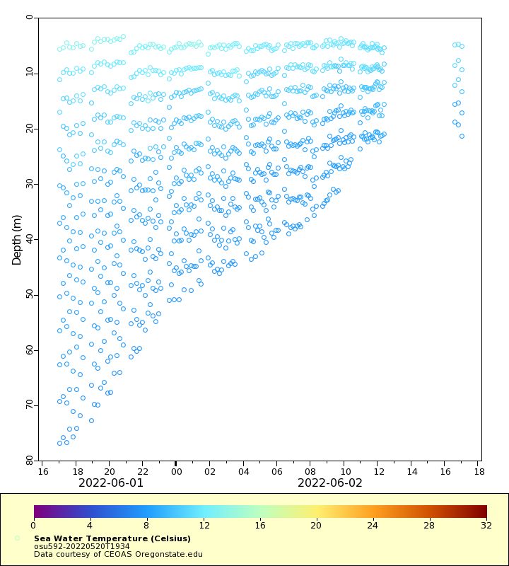
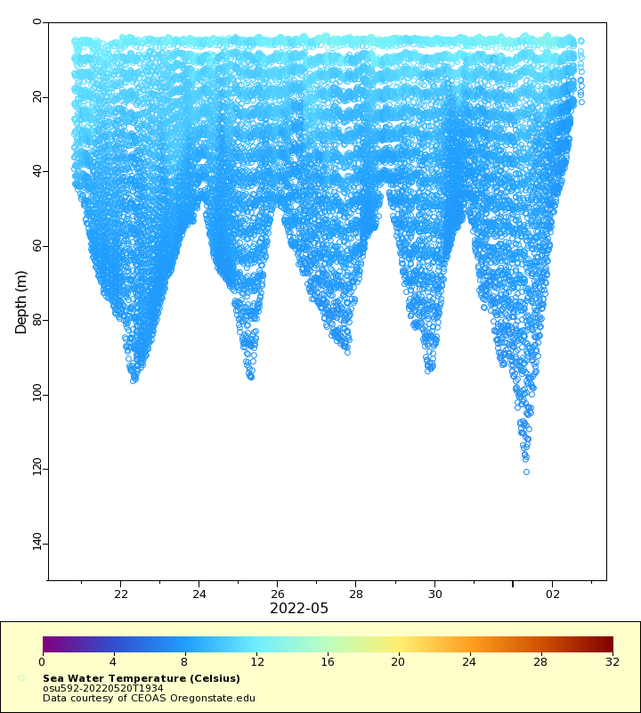
Temperature
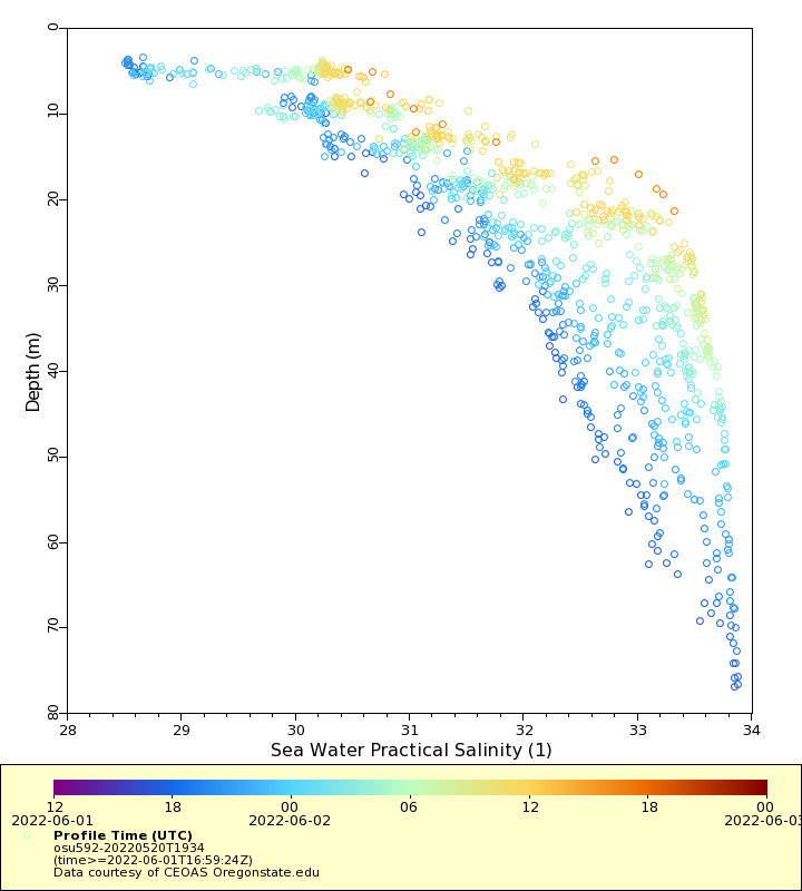
Salinity
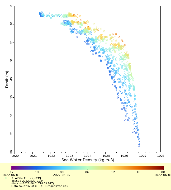
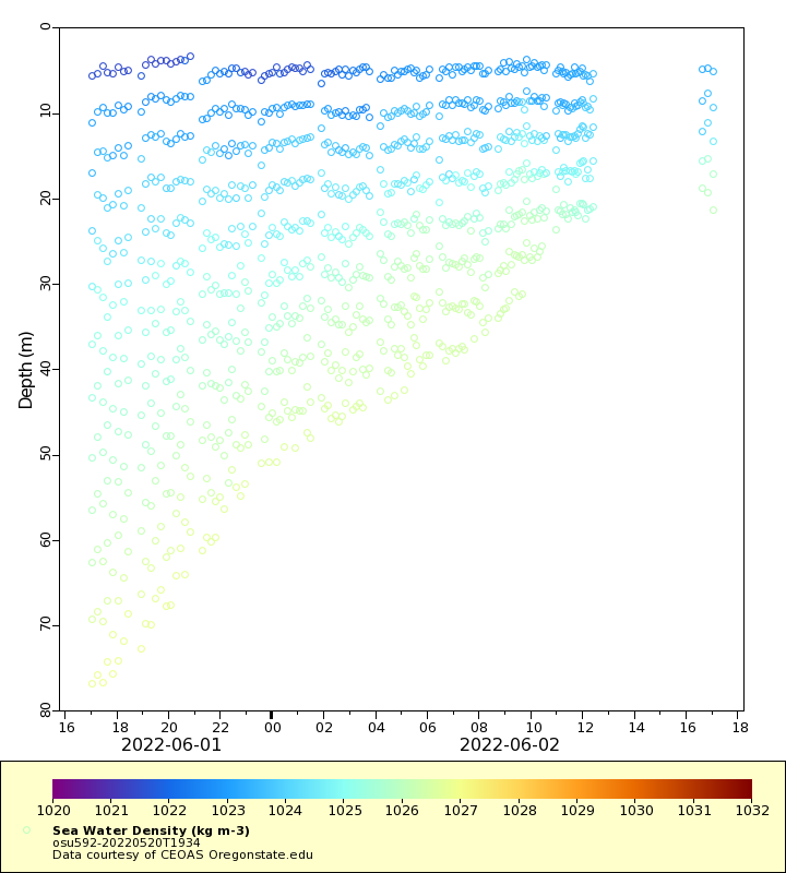
Density
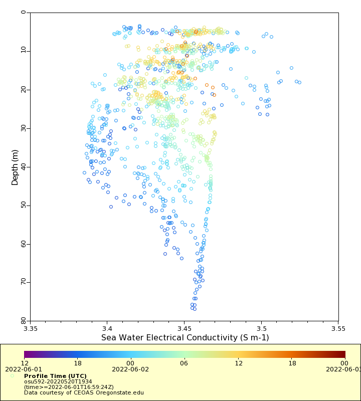
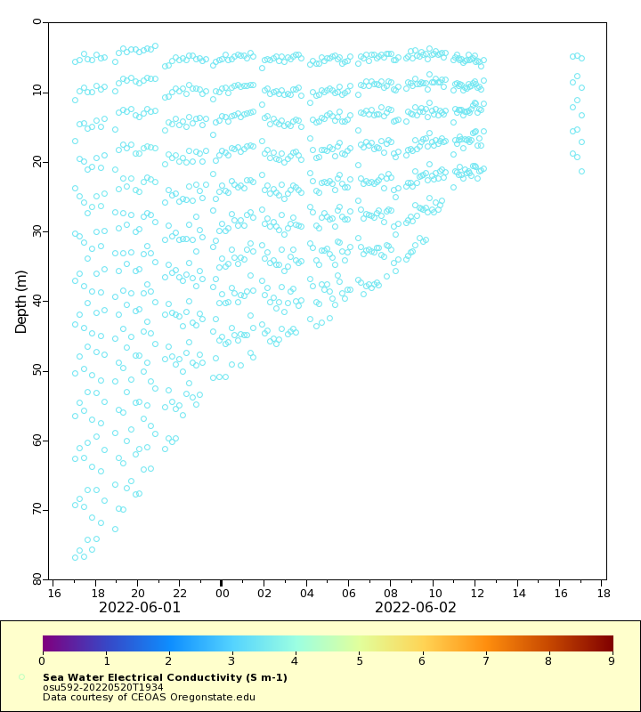
Conductivity
Latest Timeseries
Temperature
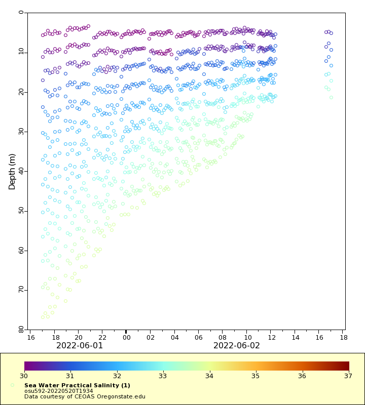
Salinity
Density
Conductivity
Synoptic Timeseries
Temperature
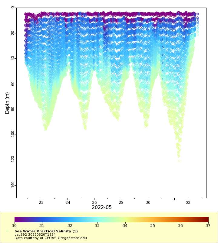
Salinity
Density
Conductivity