| Dataset | ng735-20220810T0000 |
|---|---|
| Glider | ng735 |
| Status | Completed |
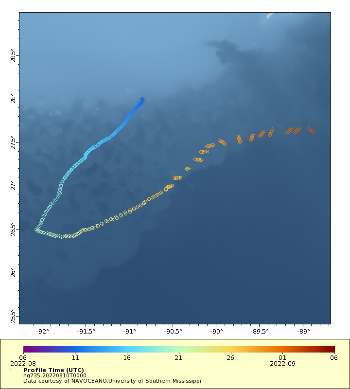
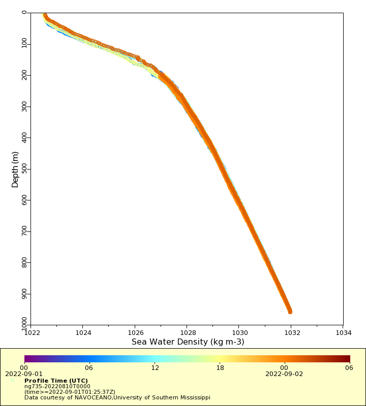
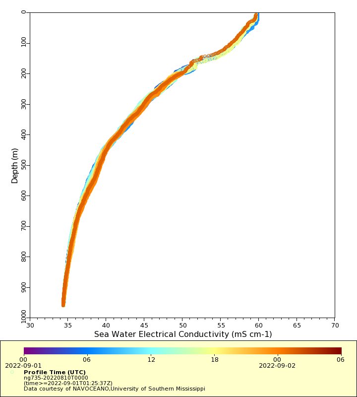
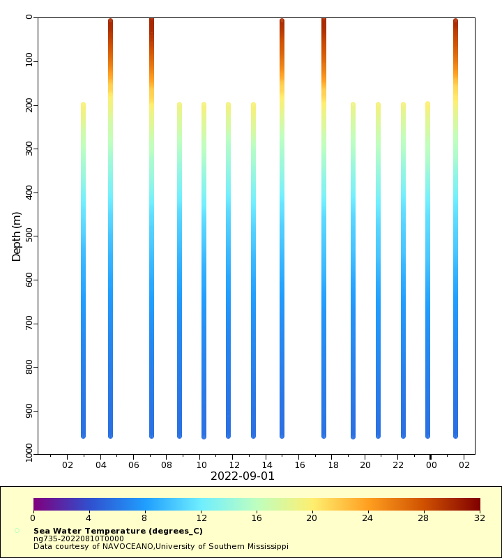
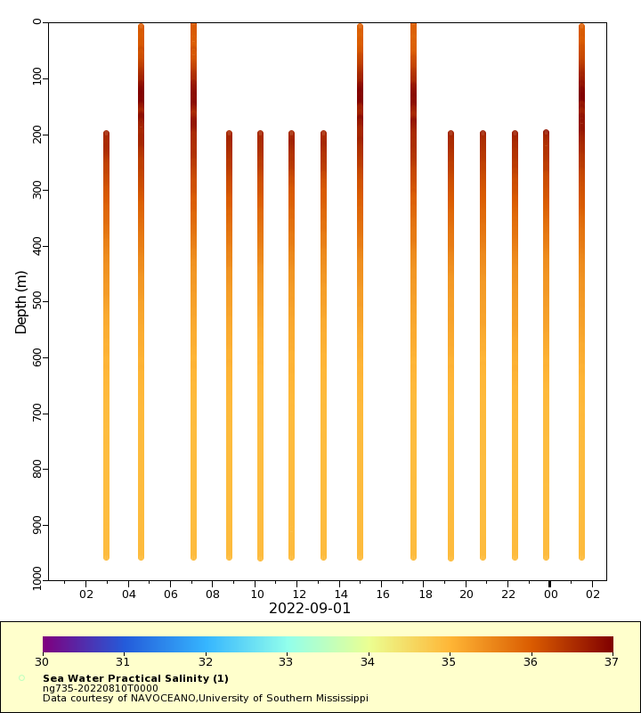
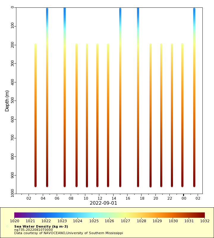
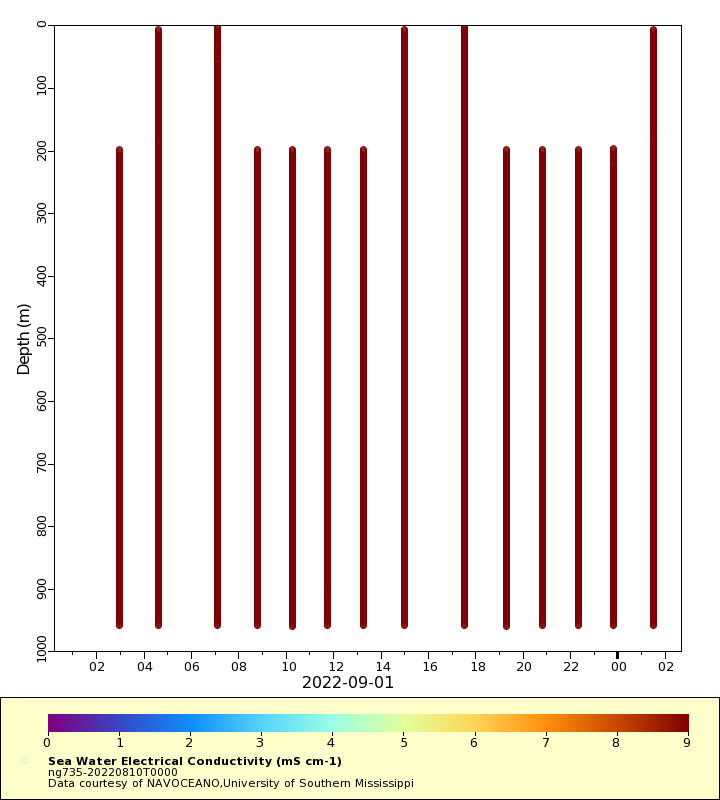
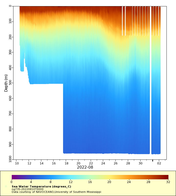
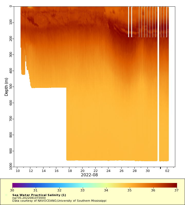
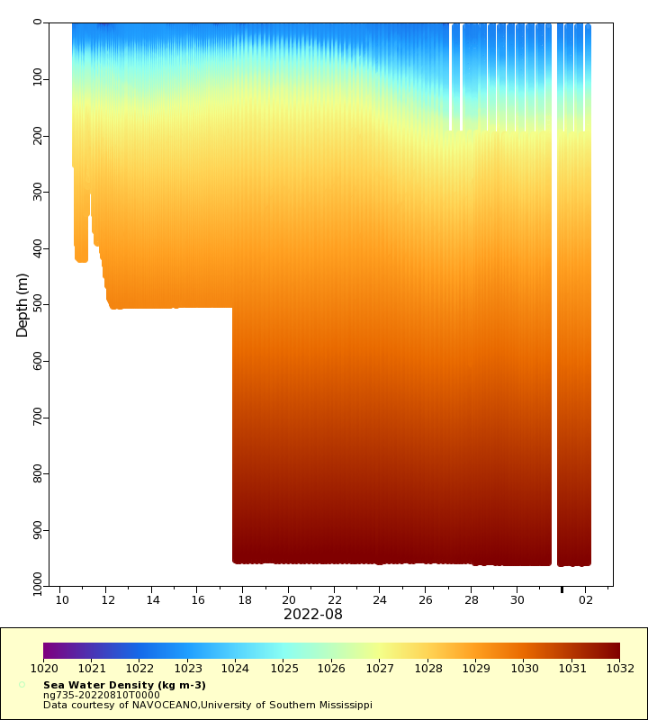
| Summary | Deployment of a Littoral Battlespace Sensing (LBS) glider owned and operated by the Naval Oceanographic Office (NAVOCEANO). This glider was deployed to replace ng219-20220803T0000, which malfunctioned. This glider was deployed Southwest of the Mississippi Canyon in the Gulf of Mexico. The glider will traverse a series of 3 waypoints forming a triangle in the central Gulf of Mexico. LBS gliders collect temperature and salinity profiles in the water column. These gliders were provided and operated by the Naval Oceanographic Office (NAVOCEANO) and are part of a larger effort to deploy and operate over 100 gliders simultaneously. Data collected by these Littoral Battlespace Sensing (LBS) gliders is assimilated for use in underwater ocean forecasts that support a wide range of naval operations. The glider will initially head south towards the Loop Current, aiming for the center of westward flowing Loop Current eddies and other large scale events for model validation. New waypoints may be sent to the glider to modify the planned track as needed. |
| WMO ID | 4803962 |
| Attribution | NOAA, United States Navy, IFAA, OAR, AOML |
| Time Coverage Start | 2022-08-10 15:36:30 UTC |
| Time Coverage End | 2022-12-01 15:01:42 UTC |
| Registered | 2022-08-09 |
| Deployed | 2022-08-10 |
| Operator | NAVOCEANO |
| Institution | NAVOCEANO,University of Southern Mississippi |
| Data Provider | rutgers |
| # Profiles | 875 |
| Days Deployed | 113 |
| BBox North | 29.205 |
| BBox South | 25.889 |
| BBox East | -92.065 |
| BBox West | -87.58 |
Maps
Track
Latest Profiles
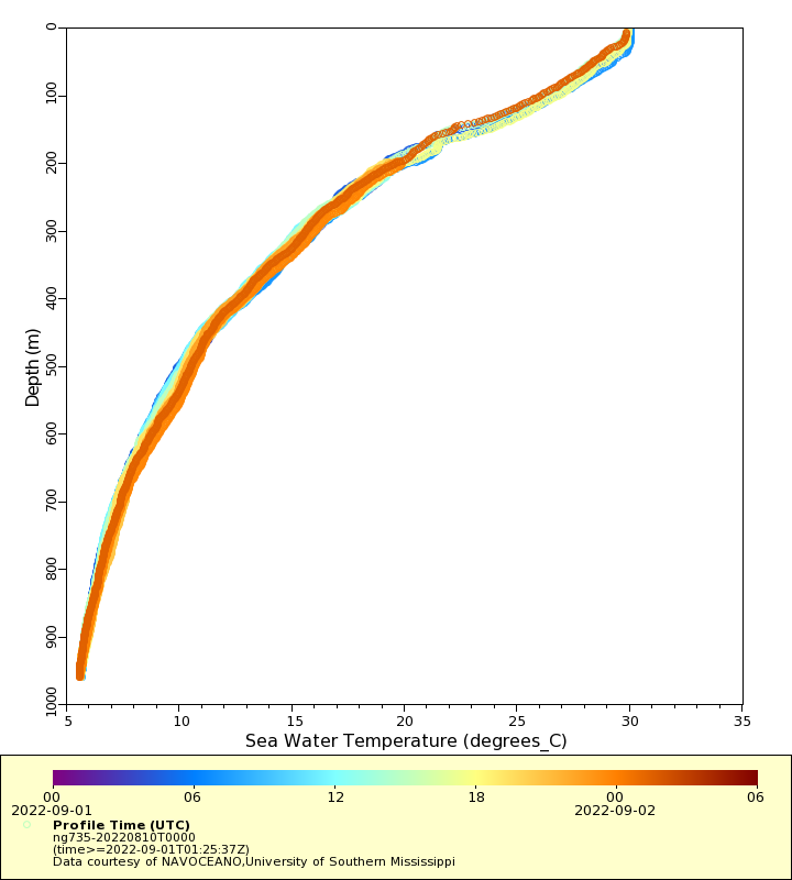
Temperature
Salinity
Density
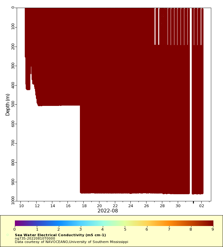
Conductivity
Latest Timeseries
Temperature
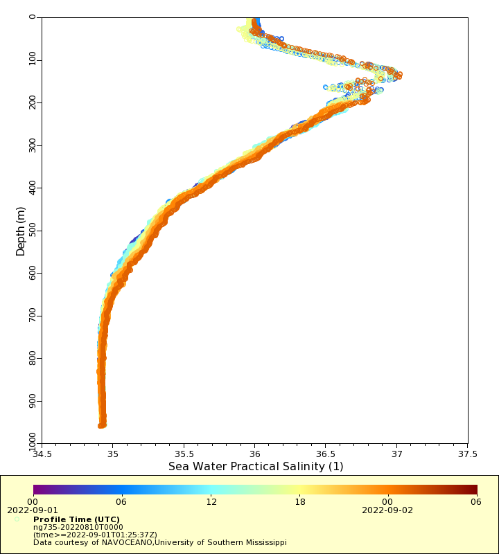
Salinity
Density
Conductivity
Synoptic Timeseries
Temperature
Salinity
Density
Conductivity