| Dataset | ng657-20211002T0000 |
|---|---|
| Glider | ng657 |
| Status | Completed |
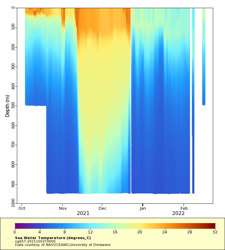
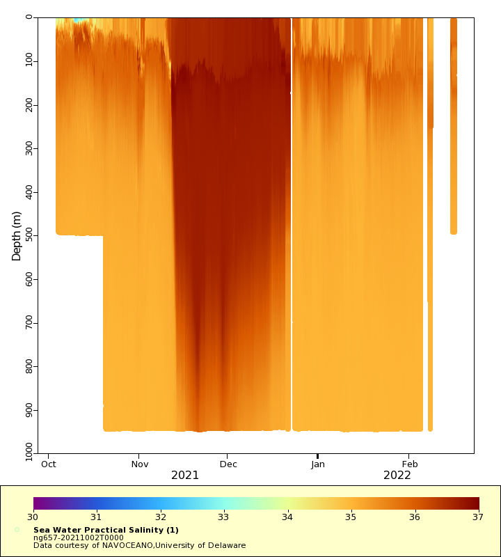
| Summary | Deployment of a Littoral Battlespace Sensing (LBS) glider owned and operated by the Naval Oceanographic Office (NAVOCEANO). This glider was deployed in the coastal waters of New Jersey in the Mid-Atlantic Bight. LBS gliders collect temperature and salinity profiles in the water column. These gliders were provided and operated by the Naval Oceanographic Office (NAVOCEANO) and are part of a larger effort to deploy and operate over 100 gliders simultaneously. Data collected by these Littoral Battlespace Sensing (LBS) gliders is assimilated for use in underwater ocean forecasts that support a wide range of naval operations |
| WMO ID | 4803944 |
| Attribution | NOAA, United States Navy, IFAA, OAR, AOML |
| Time Coverage Start | 2021-10-04 06:26:50 UTC |
| Time Coverage End | 2022-02-16 08:06:55 UTC |
| Registered | 2021-10-04 |
| Deployed | 2021-10-02 |
| Operator | NAVOCEANO |
| Institution | NAVOCEANO,University of Delaware |
| Data Provider | rutgers |
| # Profiles | 1590 |
| Days Deployed | 136 |
| BBox North | 38.622 |
| BBox South | 35.397 |
| BBox East | -74.357 |
| BBox West | -69.34 |
Maps
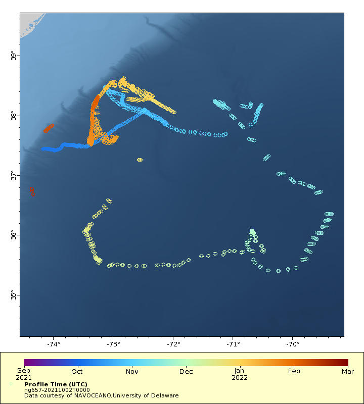
Track
Latest Profiles
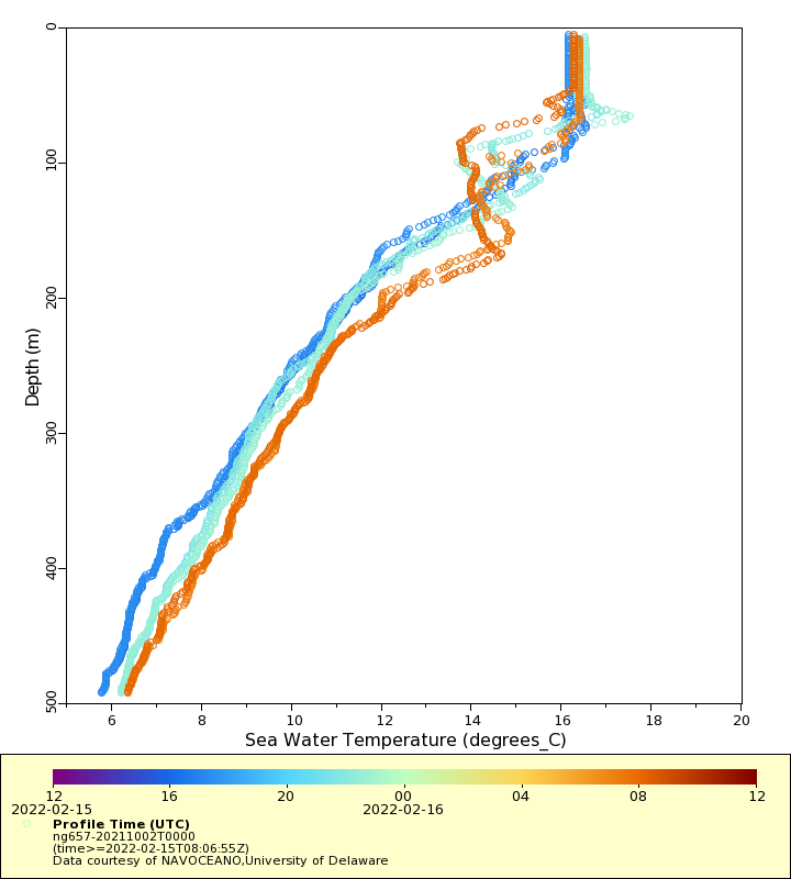
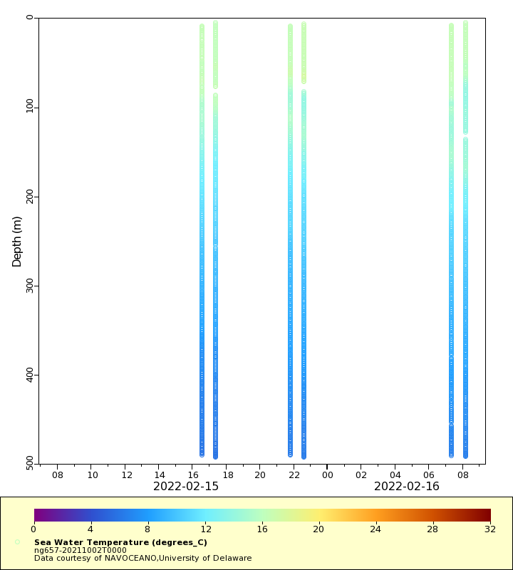
Temperature
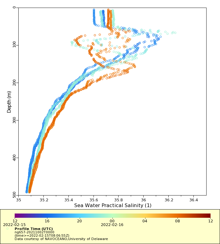
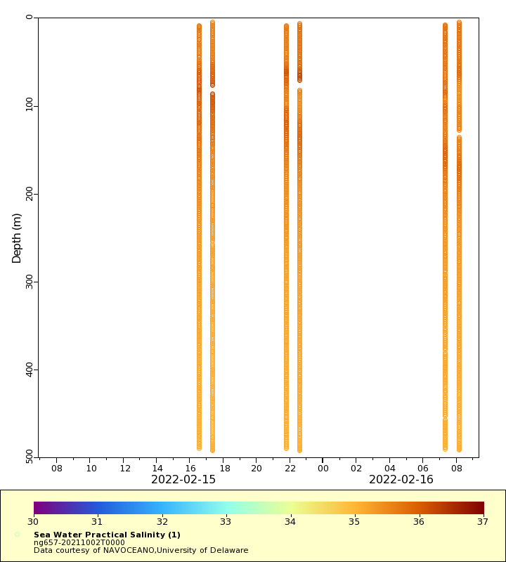
Salinity
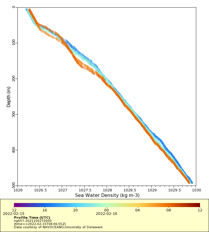
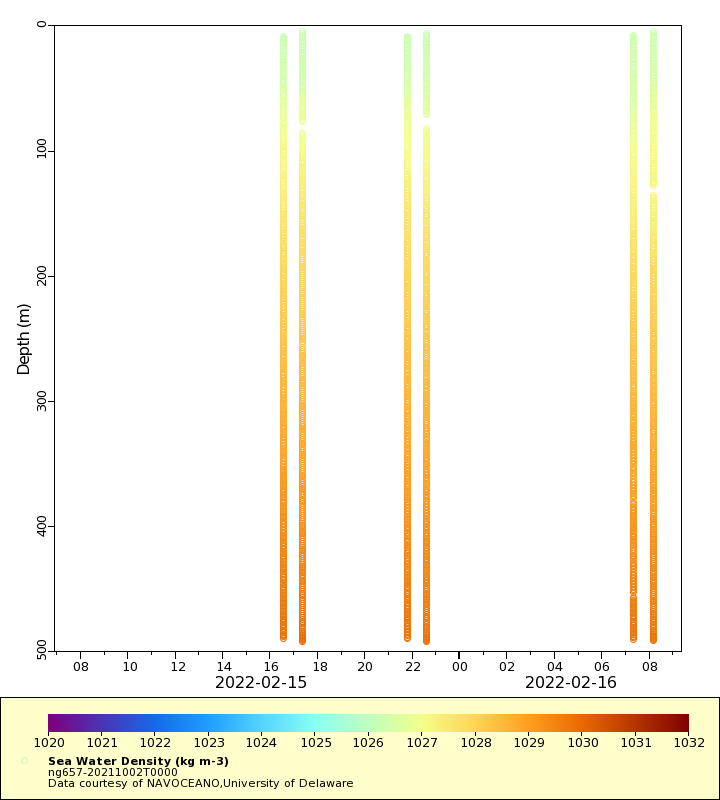
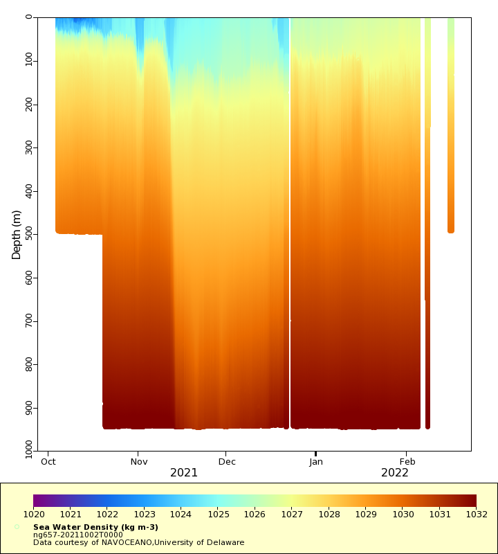
Density
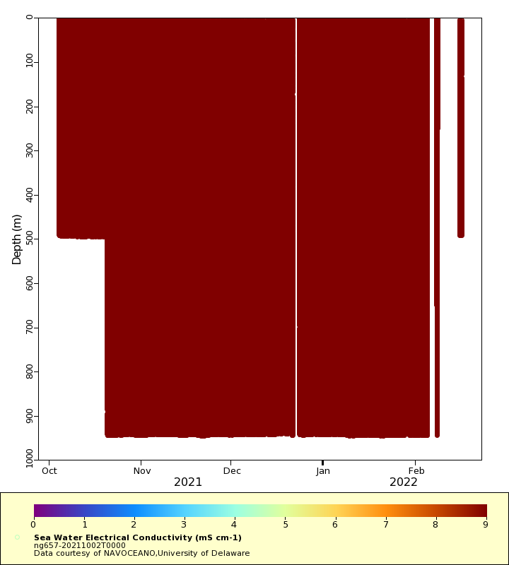
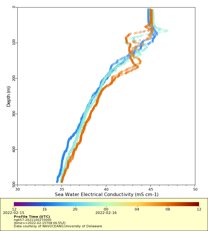
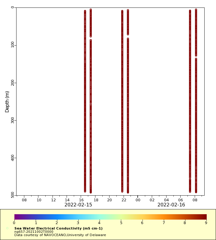
Conductivity
Latest Timeseries
Temperature
Salinity
Density
Conductivity
Synoptic Timeseries
Temperature
Salinity
Density
Conductivity