| Dataset | ng278-20220722T0000 |
|---|---|
| Glider | ng278 |
| Status | Completed |
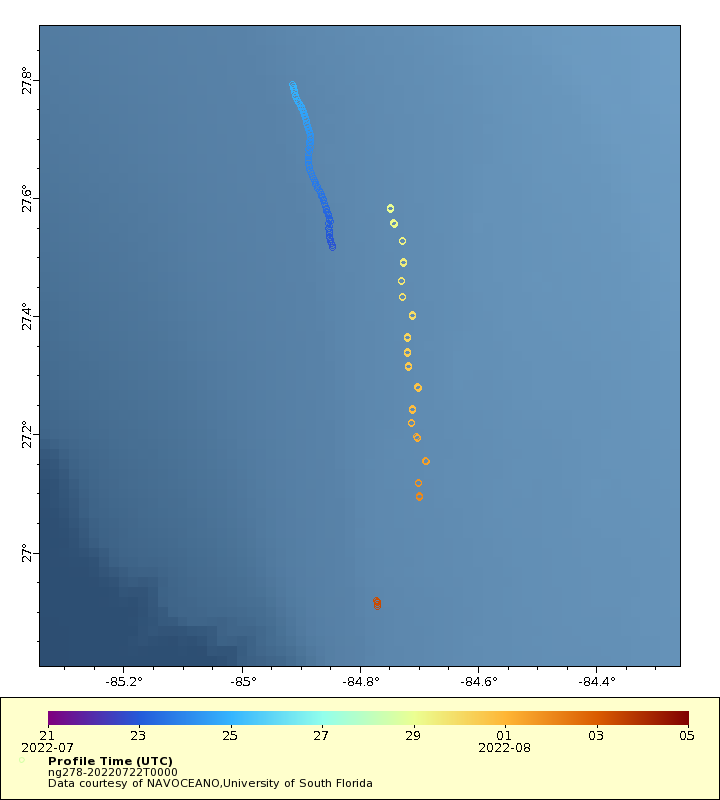
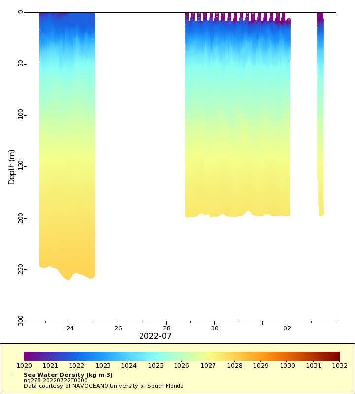
| Summary | Deployment of a Littoral Battlespace Sensing (LBS) glider owned and operated by the Naval Oceanographic Office (NAVOCEANO). LBS gliders collect temperature and salinity profiles in the water column. These gliders were provided and operated by the Naval Oceanographic Office (NAVOCEANO) and are part of a larger effort to deploy and operate over 100 gliders simultaneously. Data collected by these Littoral Battlespace Sensing (LBS) gliders is assimilated for use in underwater ocean forecasts that support a wide range of naval operations. The glider will be deployed in 200-300m water depth, inshore of the loop current in the Gulf of Mexico, approximately 200km west of Tampa Bay, FL. The glider will then fly NW to the northern side of the loop current to allow the glider to enter deeper water. Details of a sustained deeper water repeatable segment of waypoints will be determined by oceanographic conditions when the glider approaches this deeper region on the northern side of the loop current. The intent will be to have the glider return to the eastern Gulf on the West Florida Shelf for recovery at an appropriate battery consumption level |
| WMO ID | 4802964 |
| Attribution | NOAA, United States Navy, IFAA, OAR, AOML |
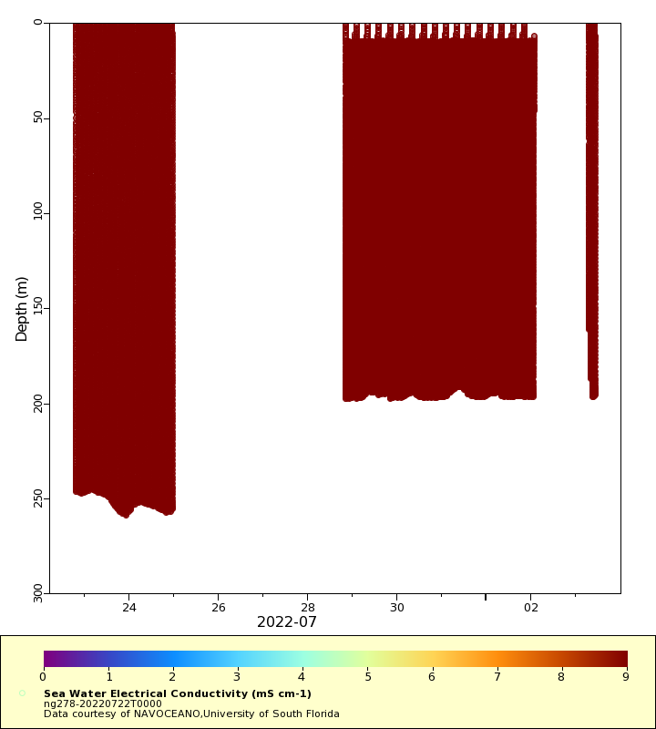
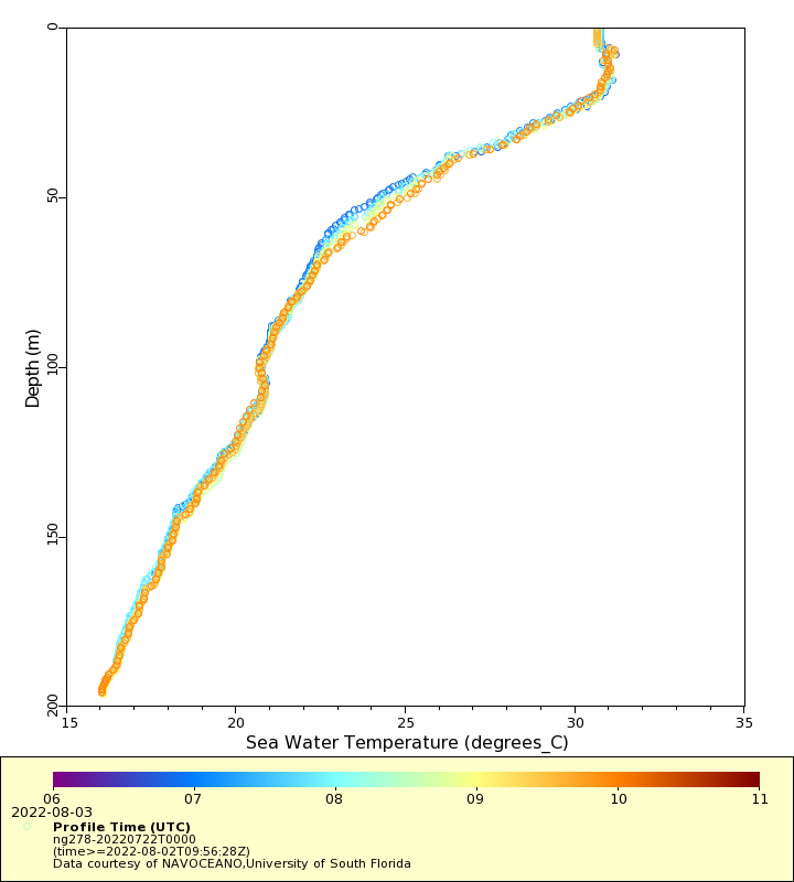
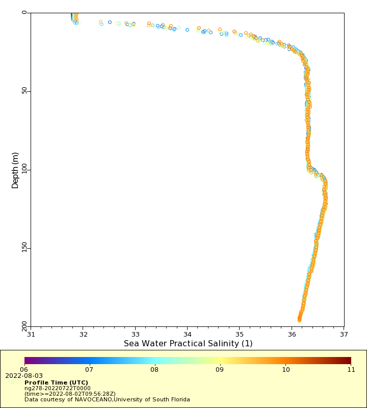
| Time Coverage Start | 2022-07-22 19:34:16 UTC |
| Time Coverage End | 2022-08-03 09:56:28 UTC |
| Registered | 2022-07-22 |
| Deployed | 2022-07-22 |
| Operator | NAVOCEANO |
| Institution | NAVOCEANO,University of South Florida |
| Data Provider | rutgers |
| # Profiles | 370 |
| Days Deployed | 12 |
| BBox North | 27.792 |
| BBox South | 26.908 |
| BBox East | -84.913 |
| BBox West | -84.688 |
Maps
Track
Latest Profiles
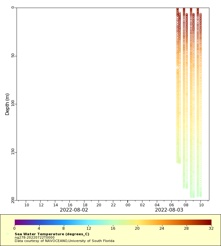
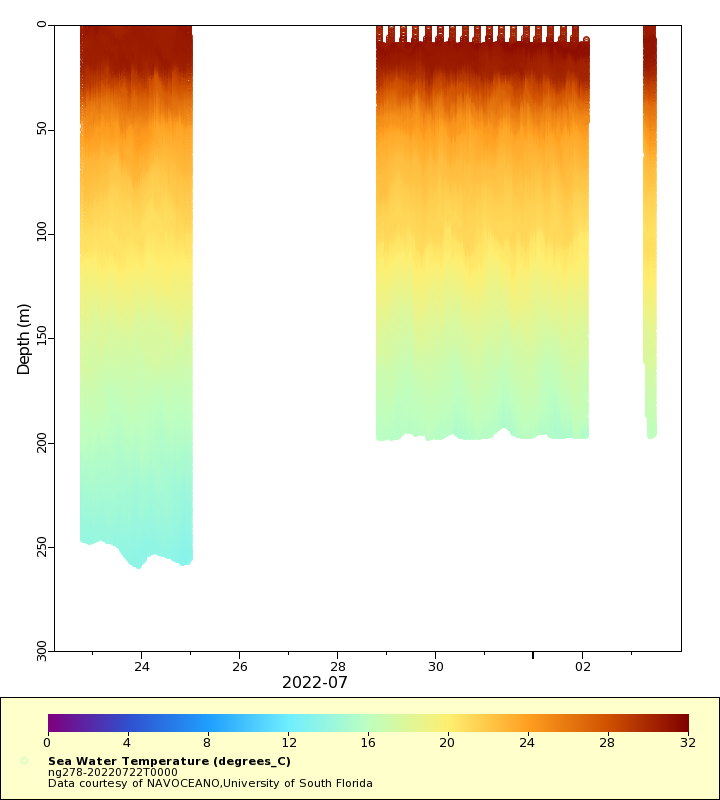
Temperature
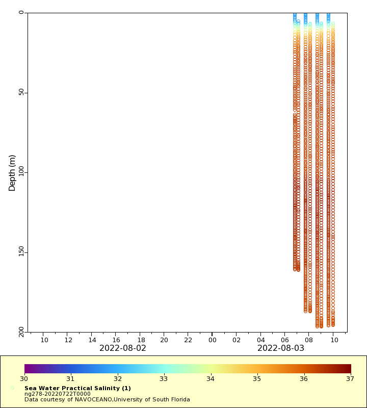
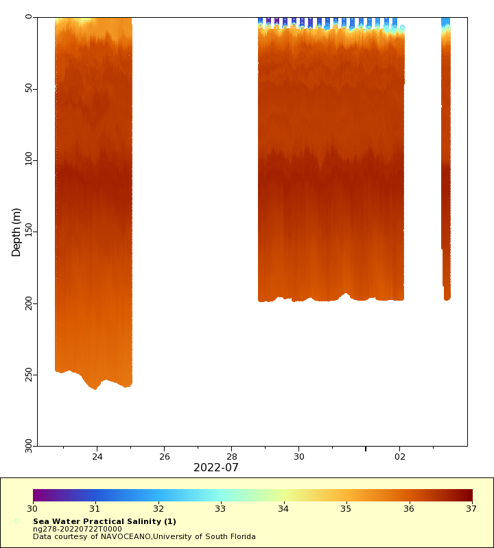
Salinity
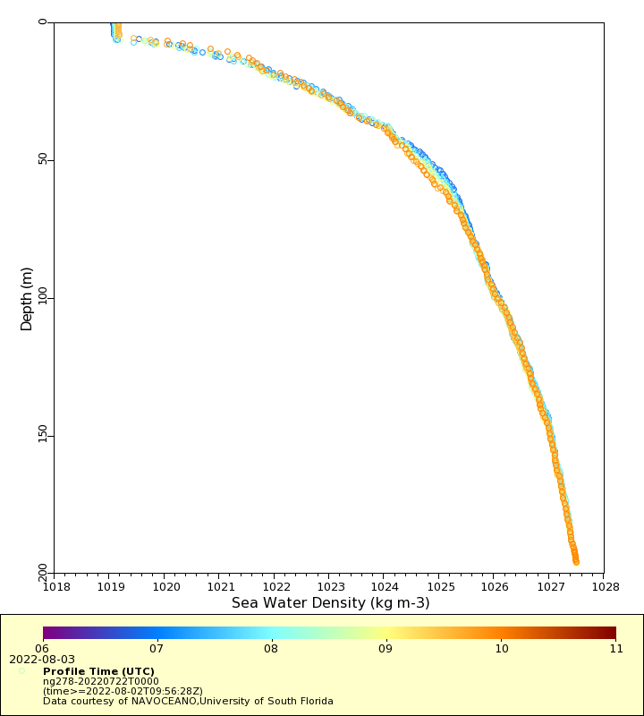
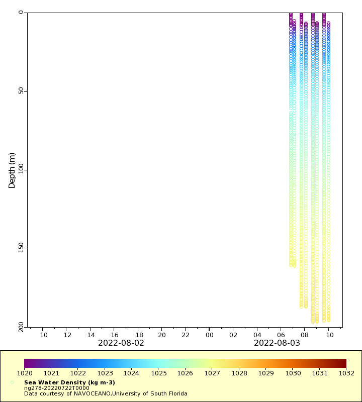
Density
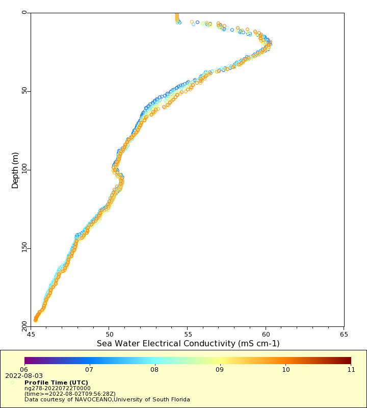
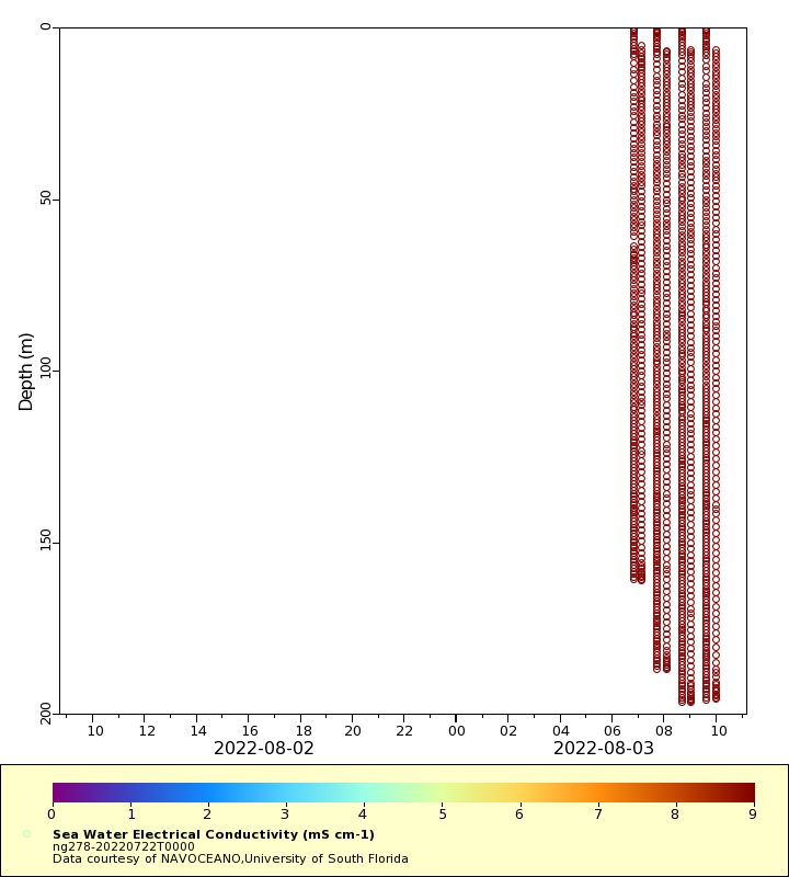
Conductivity
Latest Timeseries
Temperature
Salinity
Density
Conductivity
Synoptic Timeseries
Temperature
Salinity
Density
Conductivity