| Dataset | ng230-20210928T0000 |
|---|---|
| Glider | ng230 |
| Status | Completed |
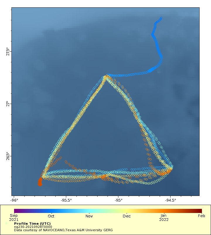
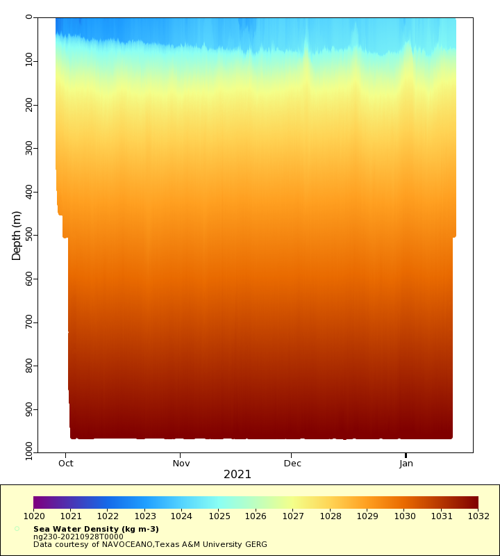
| Summary | Deployment of a Littoral Battlespace Sensing (LBS) glider owned and operated by the Naval Oceanographic Office (NAVOCEANO). This glider was deployed in the Gulf of Mexico. LBS gliders collect temperature and salinity profiles in the water column. These gliders were provided and operated by the Naval Oceanographic Office (NAVOCEANO) and are part of a larger effort to deploy and operate over 100 gliders simultaneously. Data collected by these Littoral Battlespace Sensing (LBS) gliders is assimilated for use in underwater ocean forecasts that support a wide range of naval operations |
| WMO ID | 4802934 |
| Attribution | NOAA, United States Navy, IFAA, OAR, AOML |
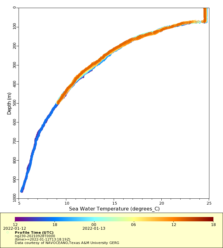
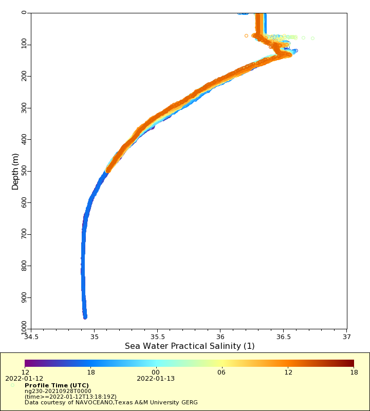
| Time Coverage Start | 2021-09-28 21:58:47 UTC |
| Time Coverage End | 2022-01-13 13:18:19 UTC |
| Registered | 2021-09-28 |
| Deployed | 2021-09-28 |
| Operator | NAVOCEANO |
| Institution | NAVOCEANO,Texas A&M University GERG |
| Data Provider | rutgers |
| # Profiles | 1556 |
| Days Deployed | 107 |
| BBox North | 27.82 |
| BBox South | 26.221 |
| BBox East | -95.763 |
| BBox West | -94.482 |
Maps
Track
Latest Profiles
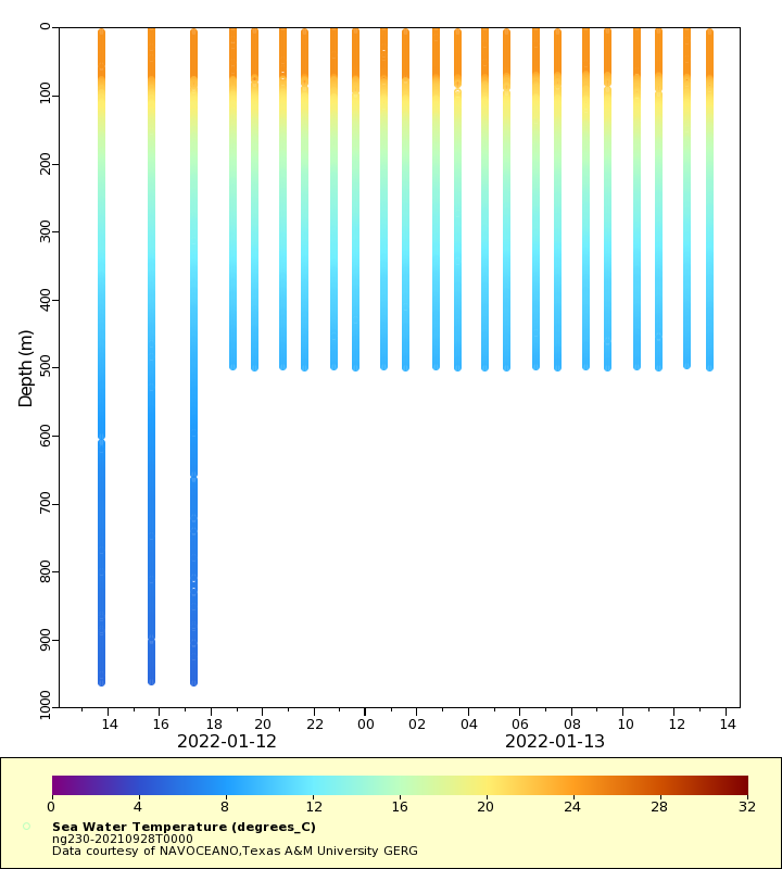
Temperature
Salinity
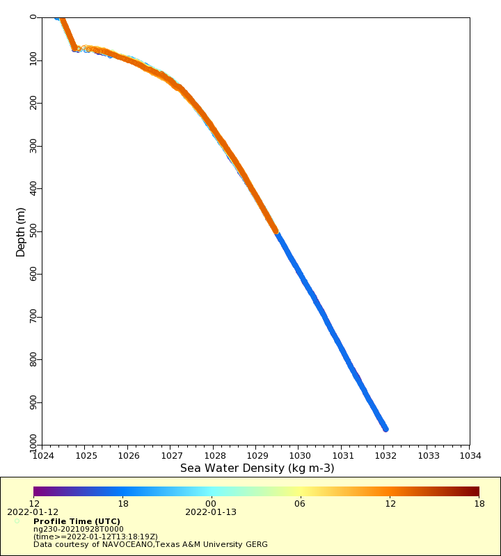
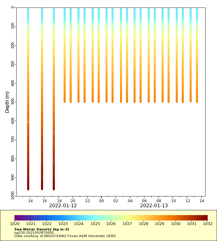
Density
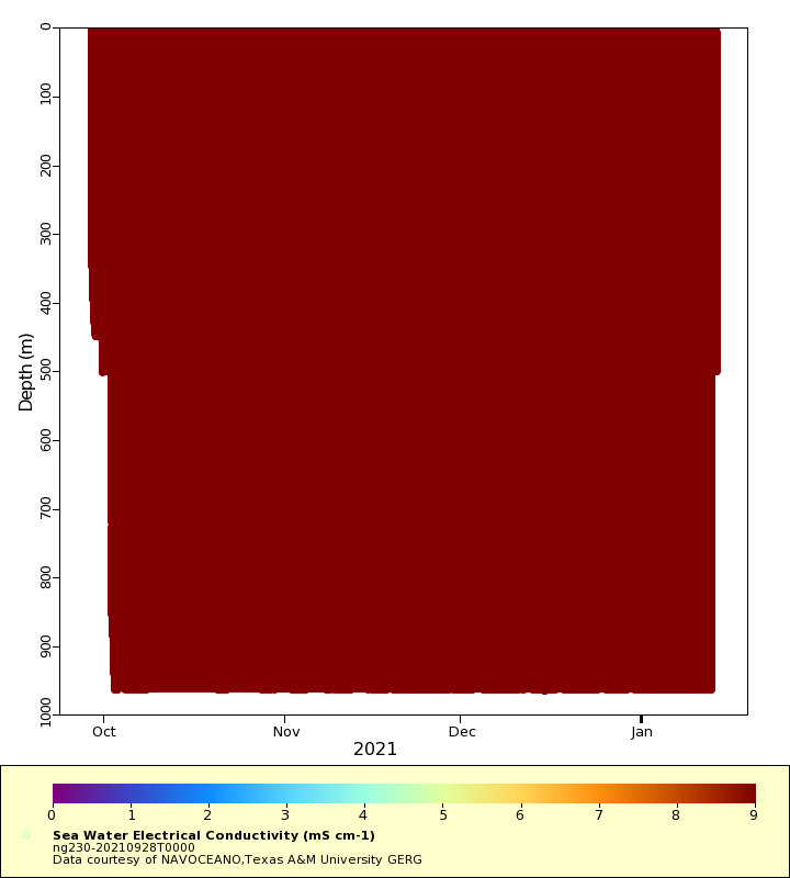
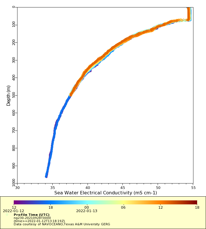
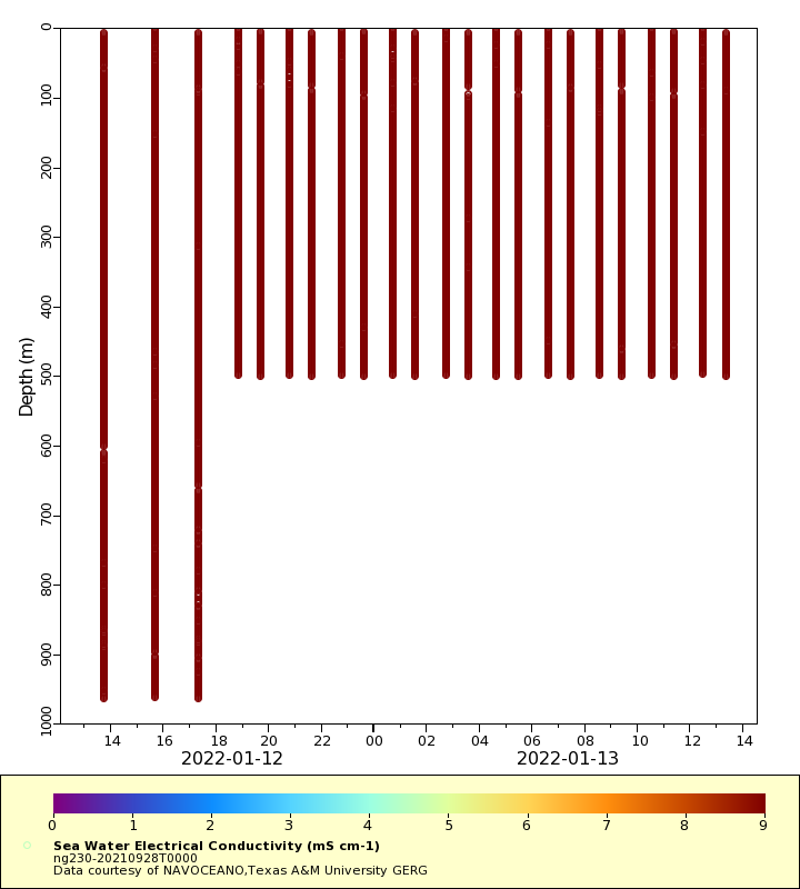
Conductivity
Latest Timeseries
Temperature
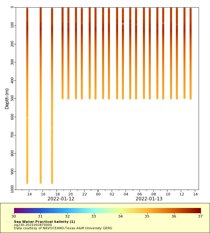
Salinity
Density
Conductivity
Synoptic Timeseries
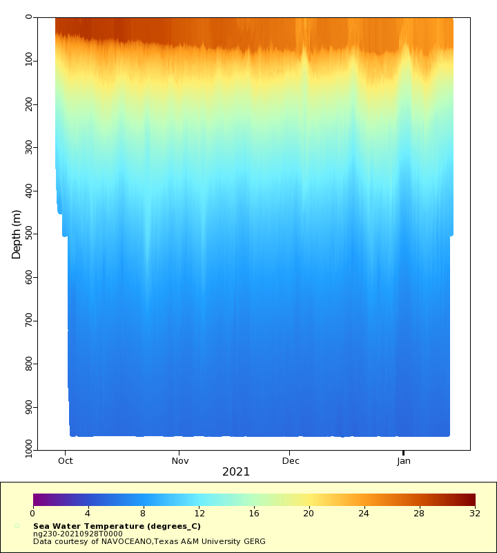
Temperature
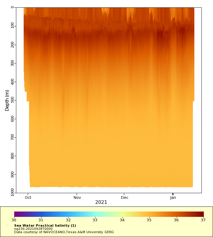
Salinity
Density
Conductivity