| Dataset | maracoos_01-20220914T1748 |
|---|---|
| Glider | maracoos_01 |
| Status | Completed |
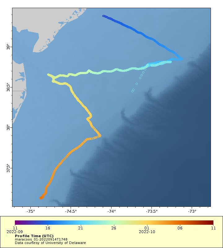
| Summary | This project supports the deployment and realtime data delivery of autonomous underwater gliders in the coastal ocean to better resolve and understand essential ocean features and processes that contribute to hurricane intensification or weakening prior to making landfall. This is a partnership between NOAA Ocean and Atmospheric Research (OAR) through the Atlantic Oceanographic and Meteorological Laboratory (AOML) and Integrated Ocean Observing System (IOOS) regional associations such as MARACOOS, SECOORA, CariCOOS and institutions including the University of Puerto Rico, University of the Virgin Islands, Skidaway Institute of Oceanography, University of Delaware, and Rutgers University. The goal of the project is to provide realtime data for ocean model validation and assimilation throughout hurricane season. This project is supported by the Disaster Recovery Act. Furthermore, the addition of the Sea Mammal Research Unit tag will take simultaneous measurements of thermally stratified water column conditions in the Mid-Atlantic Bight with both the glider CTD and mounted CTD animal tag (prototype). Measurements from both devices will be compared in order to verify the tag accuracy and potential temperature sensor lag during stratified conditions for future animal-mounted missions. The glider will be deployed out of Tuckerton, NJ and will transect in a \u201cW\u201d pattern offshore to the shelf break and back inshore, while traveling southward toward Chincoteague, VA |
| WMO ID | 4802973 |
| Attribution | NOAA, United States Navy, OAR, AOML |
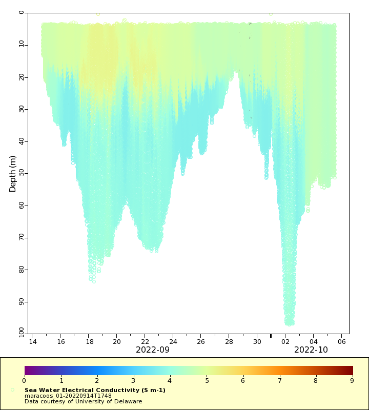
| Time Coverage Start | 2022-09-14 17:53:31 UTC |
| Time Coverage End | 2022-10-06 15:58:23 UTC |
| Registered | 2022-09-15 |
| Deployed | 2022-09-14 |
| Operator | Rutgers University |
| Institution | University of Delaware |
| Data Provider | rutgers |
| # Profiles | 3434 |
| Days Deployed | 22 |
| BBox North | 39.382 |
| BBox South | 37.122 |
| BBox East | -75.036 |
| BBox West | -73.117 |
Maps
Track
Latest Profiles
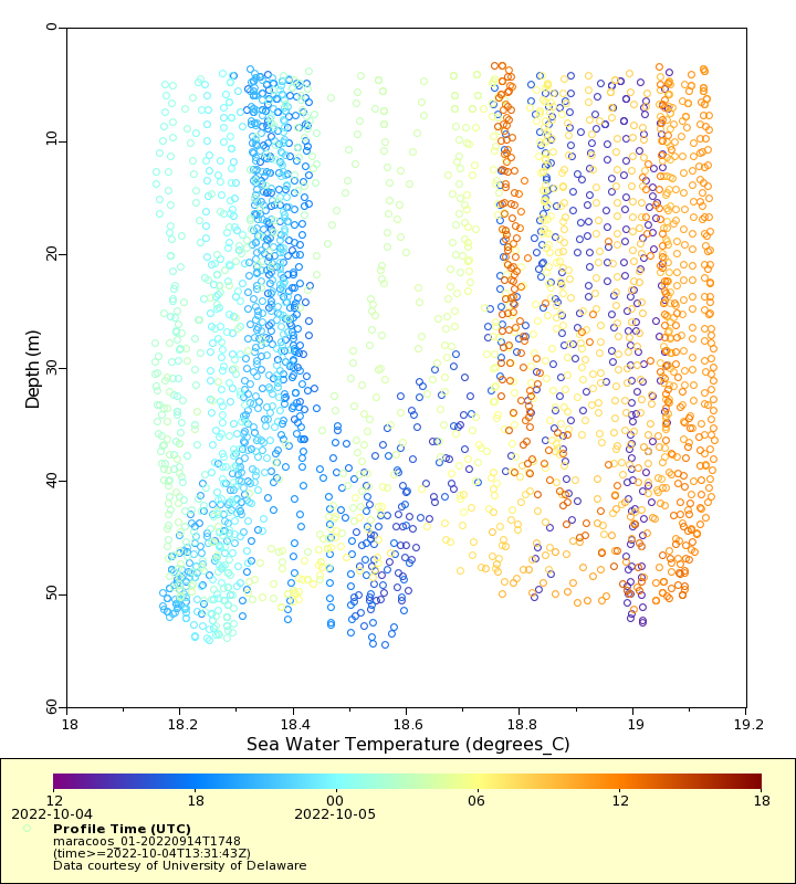
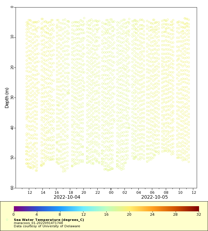
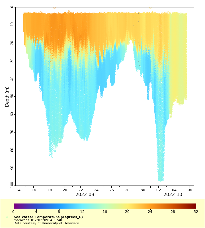
Temperature
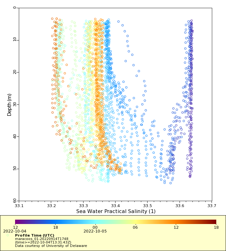
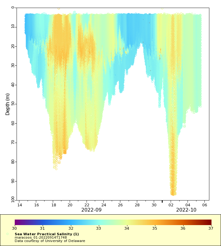
Salinity
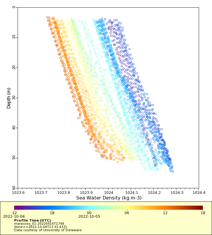
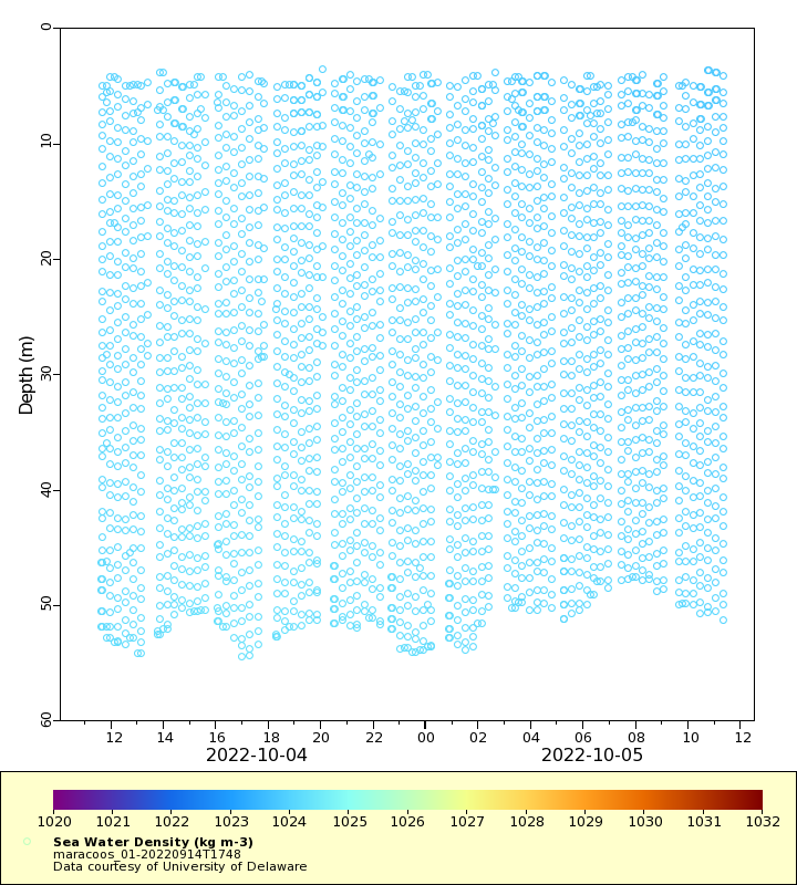
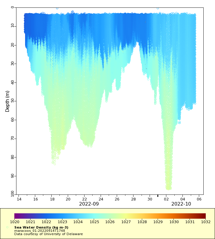
Density
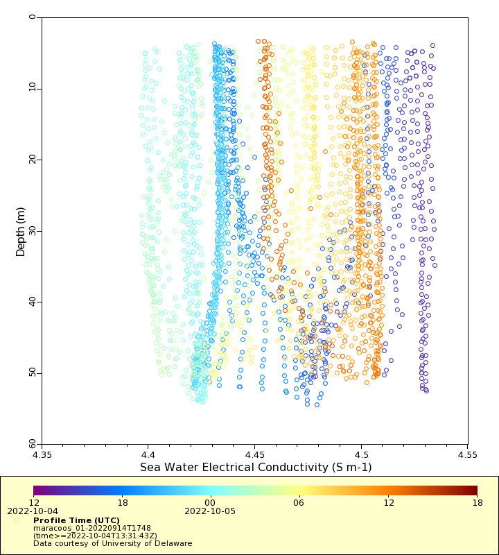
Conductivity
Latest Timeseries
Temperature
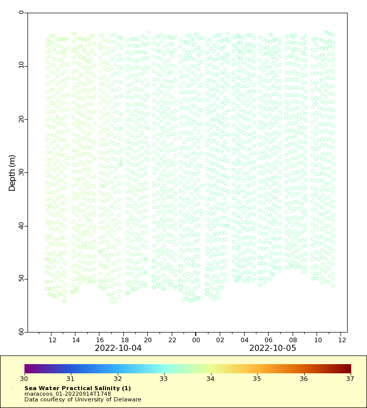
Salinity
Density
Conductivity

Synoptic Timeseries
Temperature
Salinity
Density
Conductivity