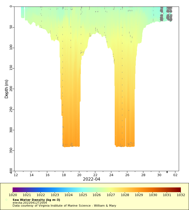
| Dataset | electa-20220412T2004 |
|---|---|
| Glider | electa |
| Status | Completed |
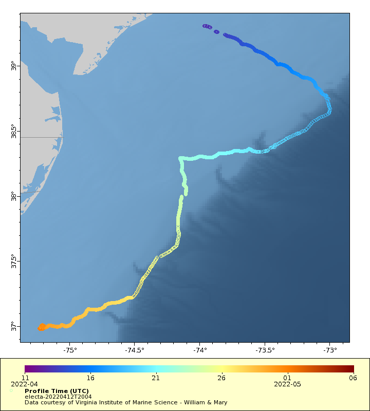
| Summary | This project supports the deployment and realtime data delivery of autonomous underwater gliders in the coastal ocean in support of the MARACOOS project. This is a partnership between NOAA Integrated Ocean Observing System (IOOS), MARACOOS, and academic institutions. The goal of the project is to provide realtime data for assimilation into numerical models. This project is supported by NOAA IOOS. The glider will conduct W shaped paths between Tuckerton, NJ and Wachapreague, VA |
| WMO ID | 4803929 |
| Attribution | National Oceanic and Atmospheric Administration Integrated Ocean Observing System |
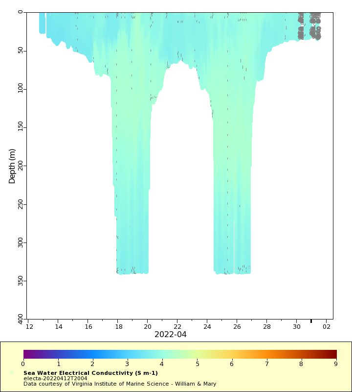
| Time Coverage Start | 2022-04-12 20:07:03 UTC |
| Time Coverage End | 2022-05-01 12:58:01 UTC |
| Registered | 2022-04-13 |
| Deployed | 2022-04-12 |
| Operator | Virginia Institute of Marine Science |
| Institution | Virginia Institute of Marine Science - William & Mary |
| Data Provider | rutgers |
| # Profiles | 3750 |
| Days Deployed | 19 |
| BBox North | 39.306 |
| BBox South | 36.976 |
| BBox East | -75.229 |
| BBox West | -72.997 |
Maps
Track
Latest Profiles
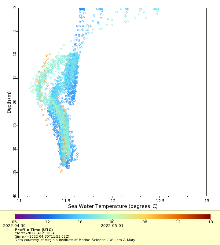
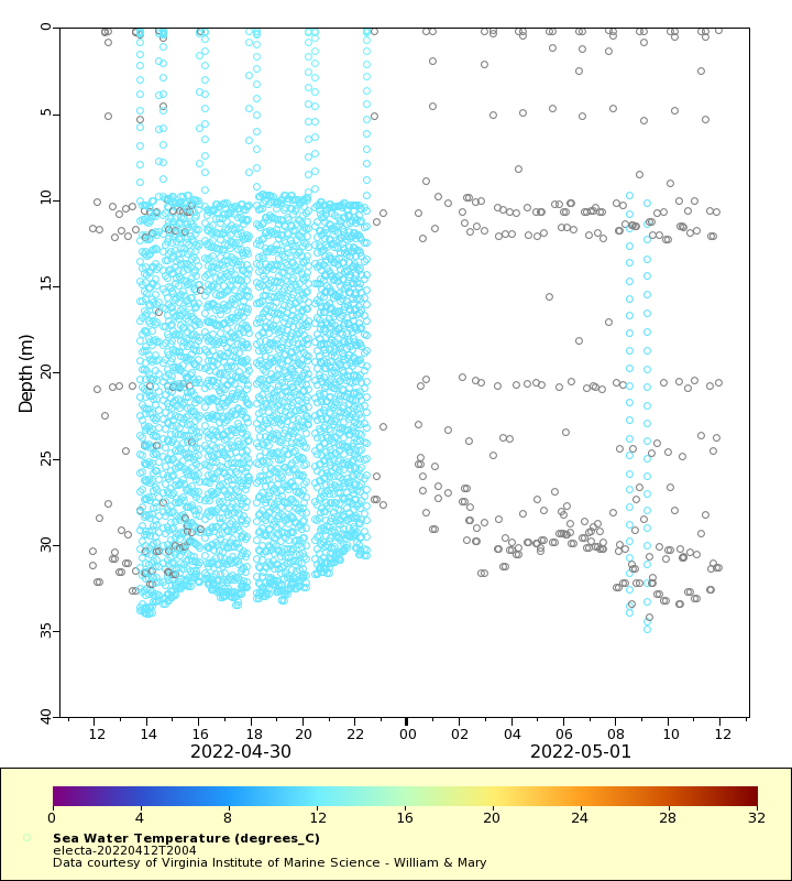
Temperature
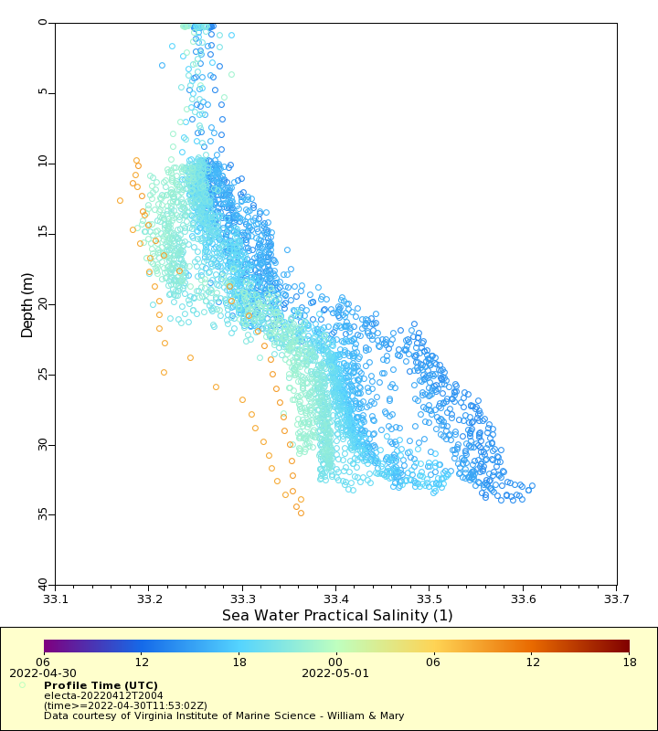
Salinity
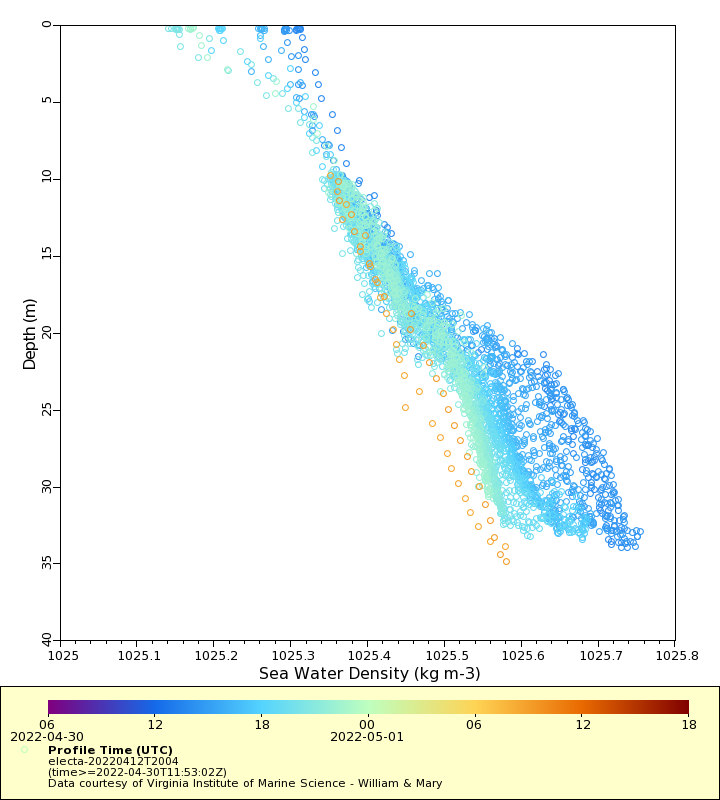
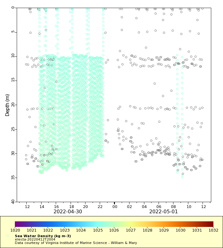
Density
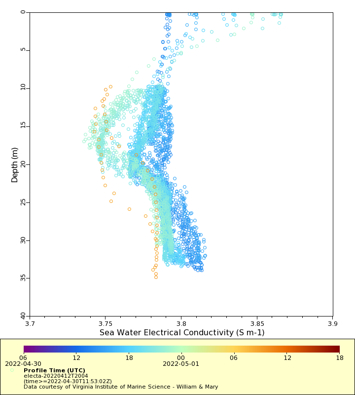
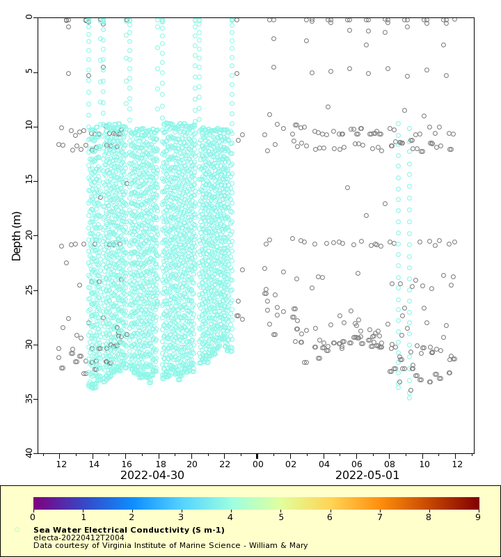
Conductivity
Latest Timeseries
Temperature
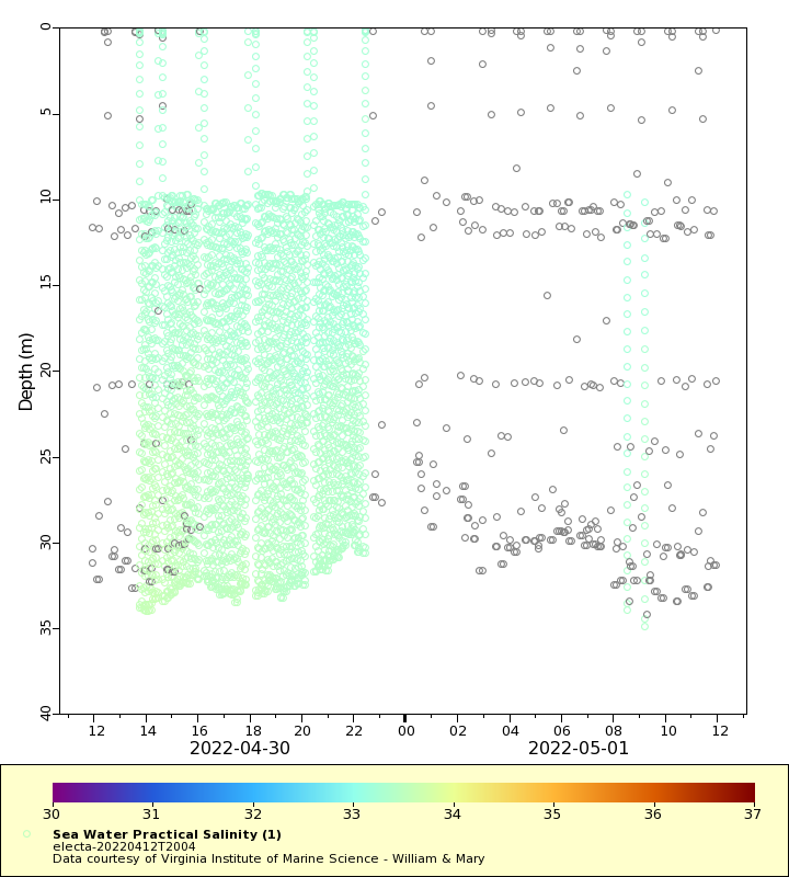
Salinity
Density
Conductivity
Synoptic Timeseries
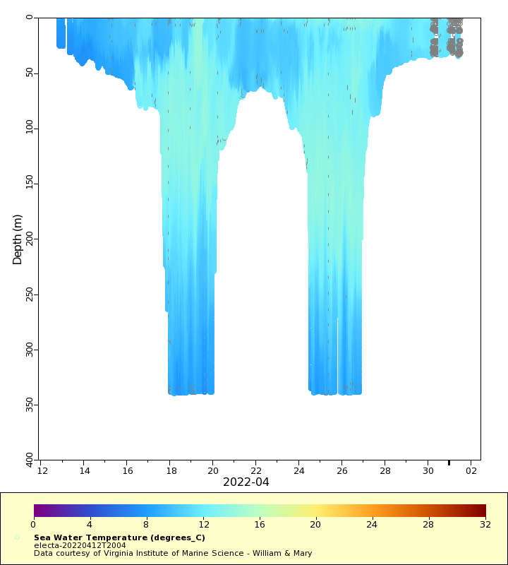
Temperature
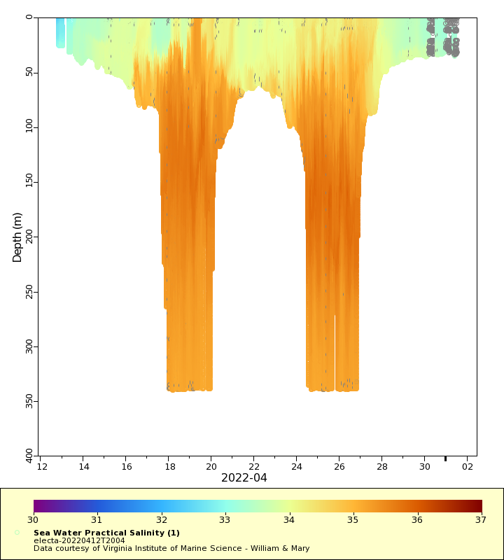
Salinity
Density
Conductivity