| Dataset | cp_583-20200819T1925 |
|---|---|
| Glider | cp_583 |
| Status | Completed |
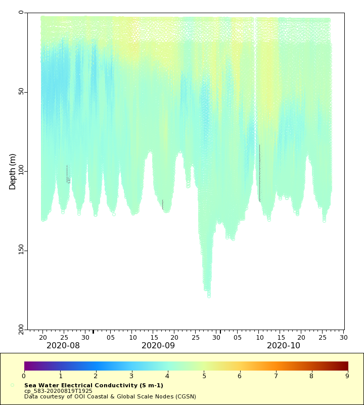
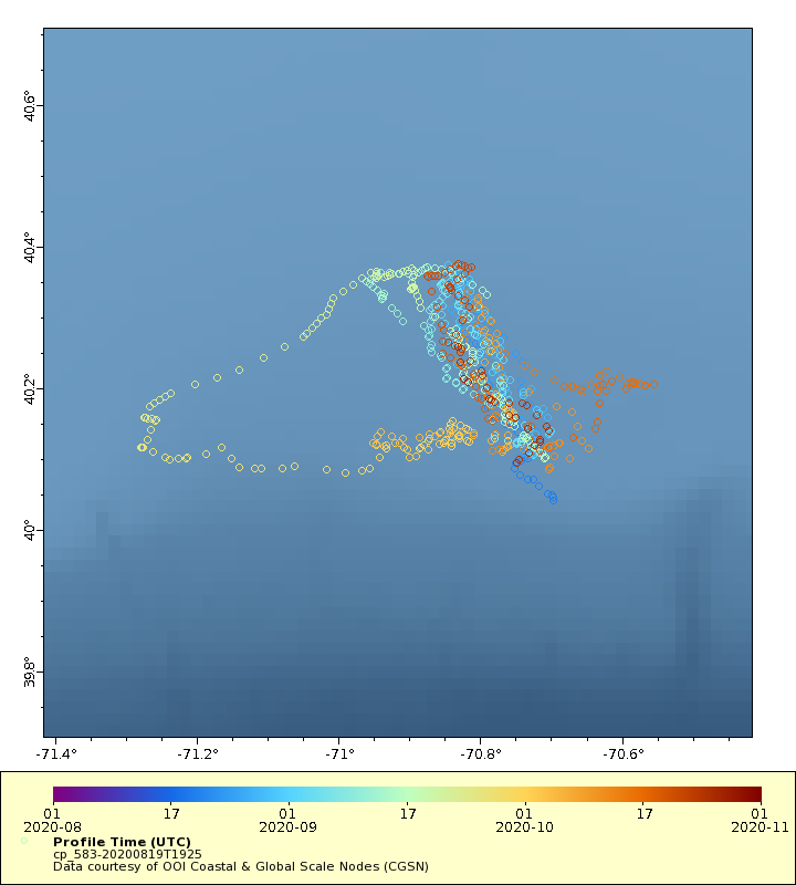
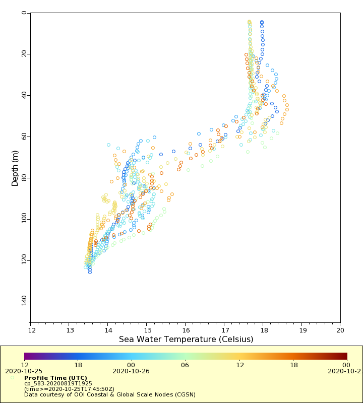
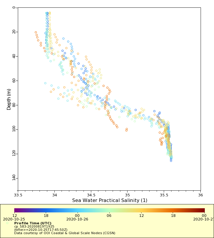
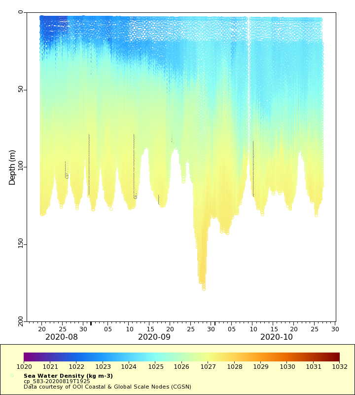
| Summary | The Pioneer Array is located on the continental shelf and slope south of Martha's Vineyard. The shelf-slope area is home to a highly productive ecosystem, and coincident with a persistent ocean frontal system where heat, salt, nutrients and other properties are exchanged between the shelf and the deep ocean. Data from gliders operating over the shelf contribute to understanding of the frontal system while those over the slope provide information about mesoscale features that may impinge on the front. This dataset contains raw Slocum glider data parsed directly from the native glider file format. No corrections or other quality control algorithms have been applied |
| WMO ID | 4801990 |
| Attribution | National Science Foundation |
| Time Coverage Start | 2020-08-19 19:40:47 UTC |
| Time Coverage End | 2020-10-29 14:30:05 UTC |
| Registered | 2020-08-24 |
| Deployed | 2020-08-19 |
| Operator | OOI-CGSN |
| Institution | OOI Coastal & Global Scale Nodes (CGSN) |
| Data Provider | OOI-CGSN |
| # Profiles | 663 |
| Days Deployed | 71 |
| BBox North | 40.376 |
| BBox South | 40.04 |
| BBox East | -71.278 |
| BBox West | -70.556 |
Maps
Track
Latest Profiles
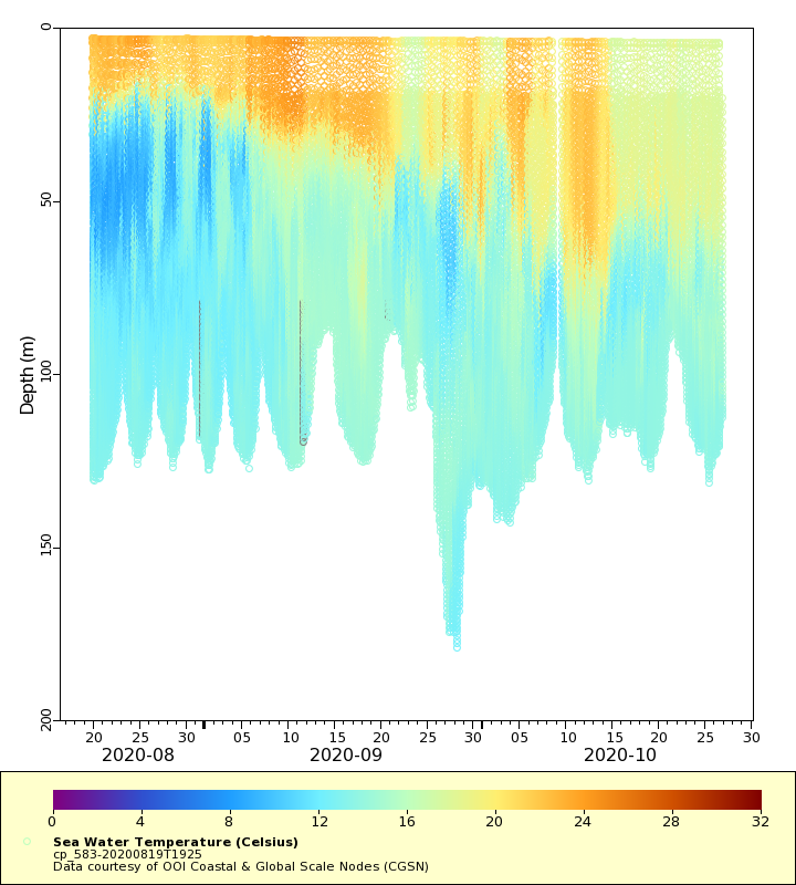
Temperature
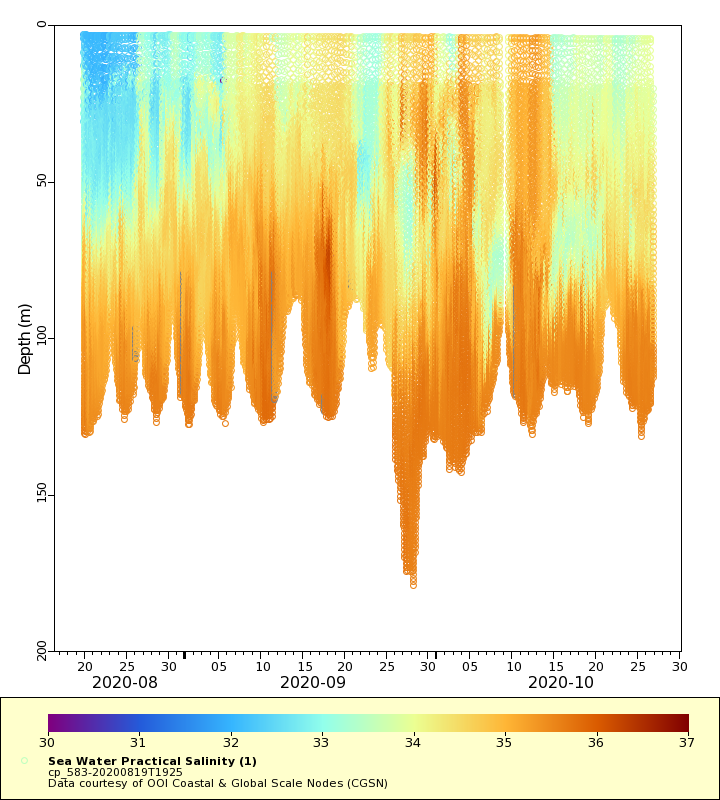
Salinity
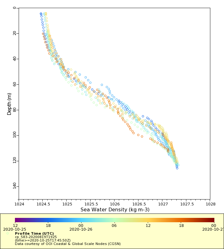
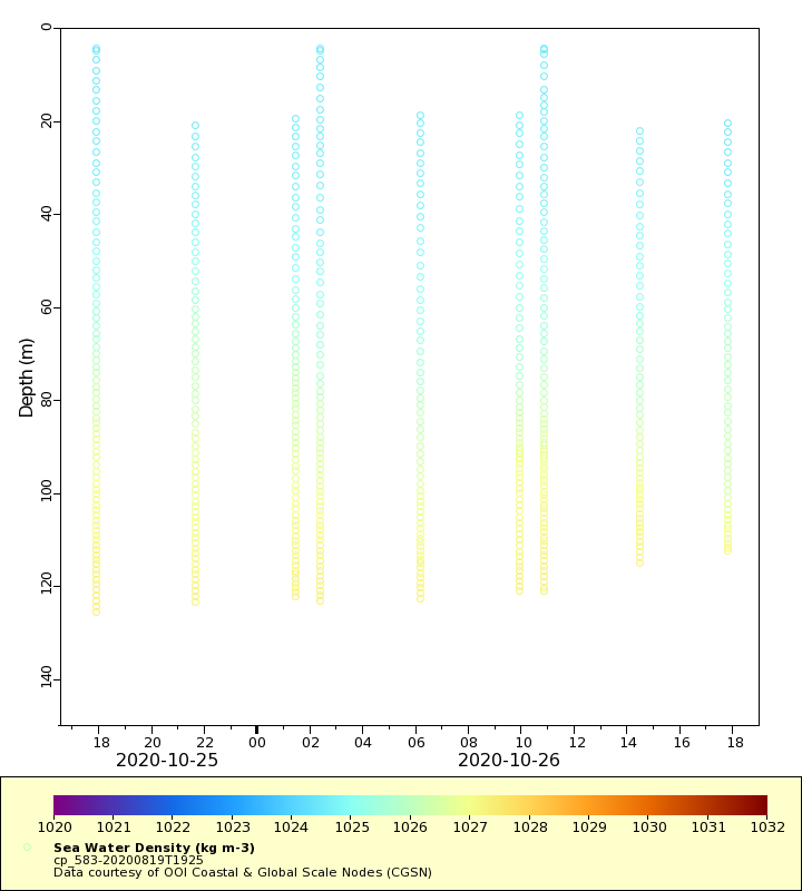
Density
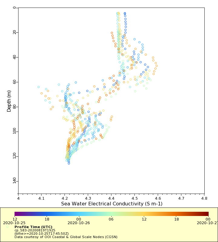
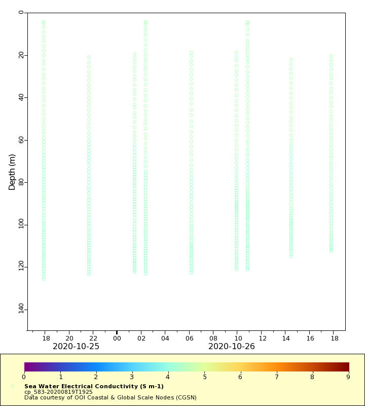
Conductivity
Latest Timeseries
Temperature
Salinity
Density
Conductivity
Synoptic Timeseries
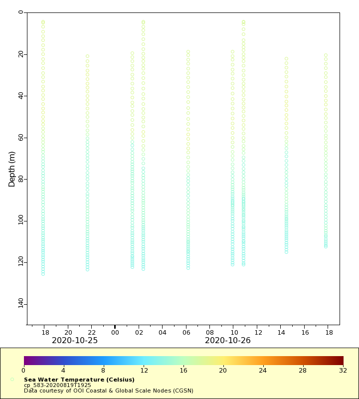
Temperature
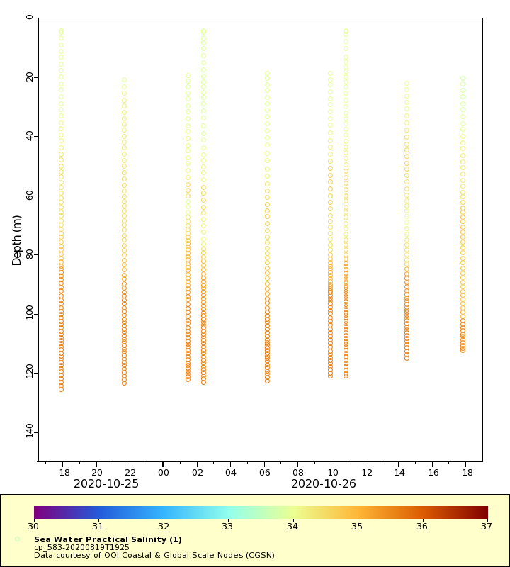
Salinity
Density
Conductivity