| Dataset | ce_320-20210429T1754 |
|---|---|
| Glider | ce_320 |
| Status | Completed |
| Summary | The Endurance Array is a multi-scaled array utilizing fixed and mobile assets to\nobserve cross-shelf and along-shelf variability in the coastal upwelling region\noff the Oregon and Washington coasts. The array also provides an extensive\nspatial footprint that encompasses a prototypical eastern boundary current\nregime and connectivity with the Cabled Array. OOI Coastal Glider deployments\nbridge the distances between the fixed sites of the Coastal Endurance Array and\nallow for adaptive sampling of the coastal waters of Washington and Oregon.\nThis dataset contains raw Slocum glider data parsed directly from the native\nglider file format. No corrections or other quality control algorithms have been\napplied |
| WMO ID | 4801966 |
| Attribution | Funding provided by the National Science Foundation. Glider deployed by OOI Coastal Endurance personnel at Oregon State University |
| Time Coverage Start | 2021-04-29 18:48:35 UTC |
| Time Coverage End | 2021-07-17 15:40:25 UTC |
| Registered | 2021-05-10 |
| Deployed | 2021-04-29 |
| Operator | OOI-CE |
| Institution | OOI Coastal Endurance |
| Data Provider | OOI-CE |
| # Profiles | 2233 |
| Days Deployed | 79 |
| BBox North | 44.67 |
| BBox South | 43.297 |
| BBox East | -126.781 |
| BBox West | -124.319 |
Maps
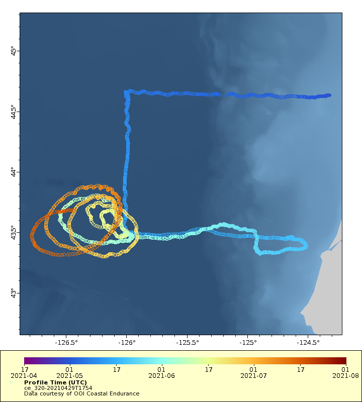
Track
Latest Profiles
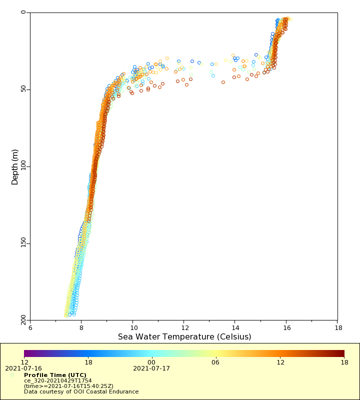
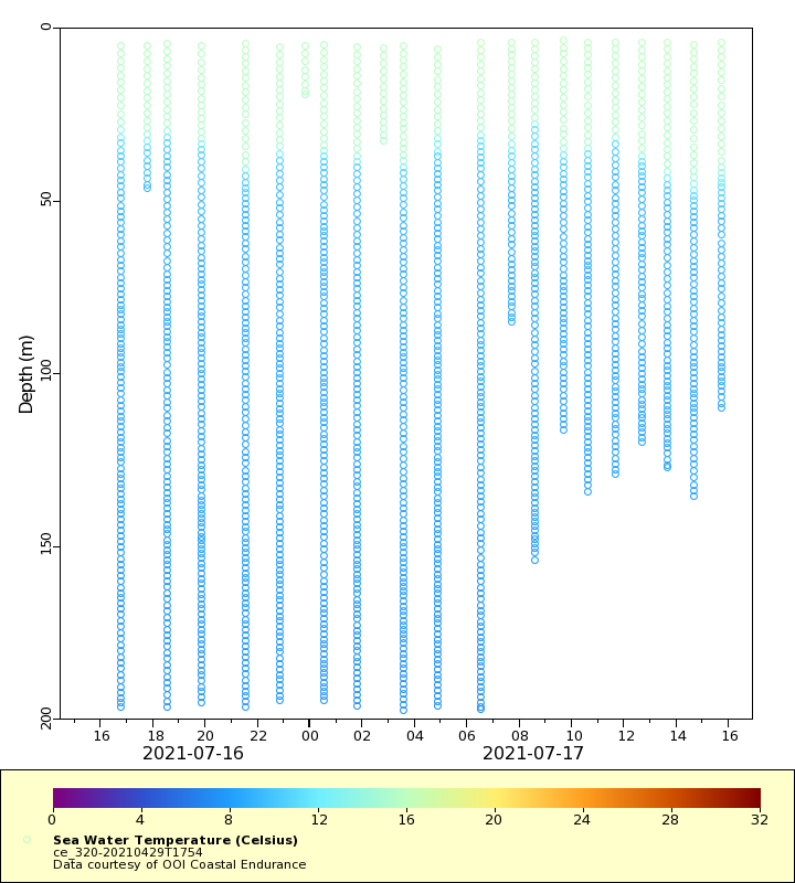
Temperature
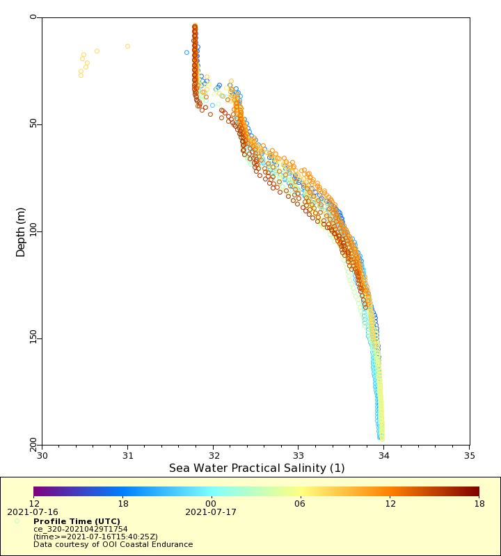
Salinity
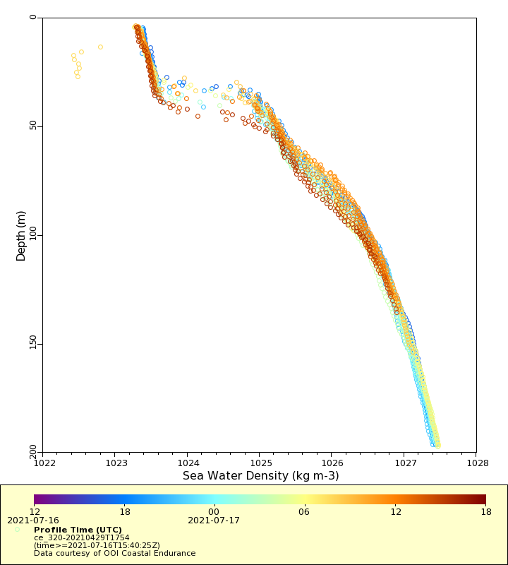
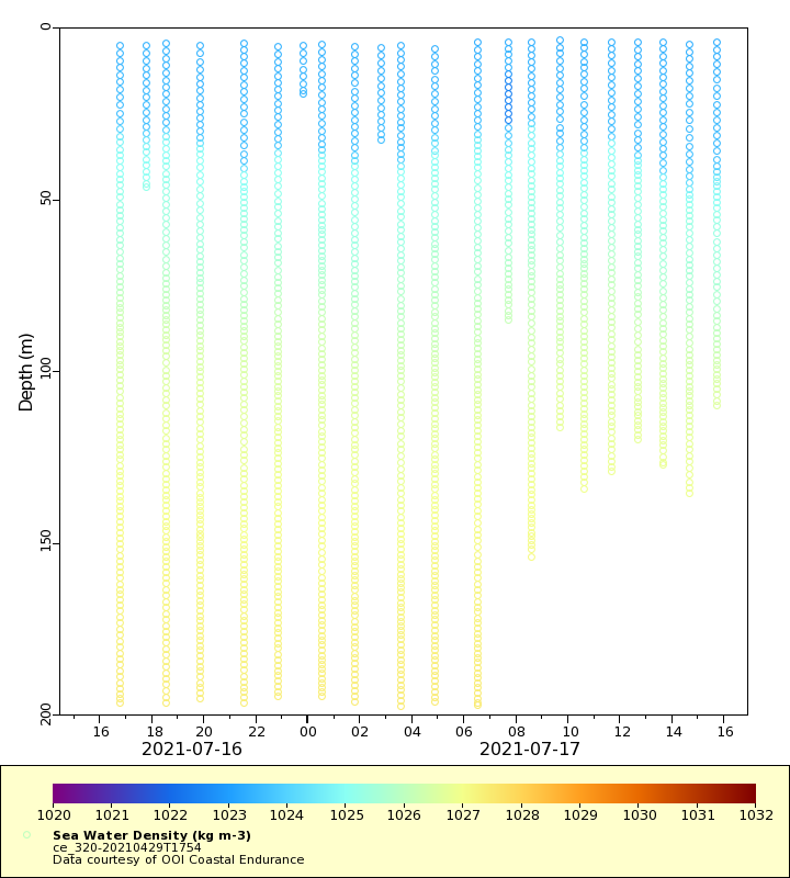
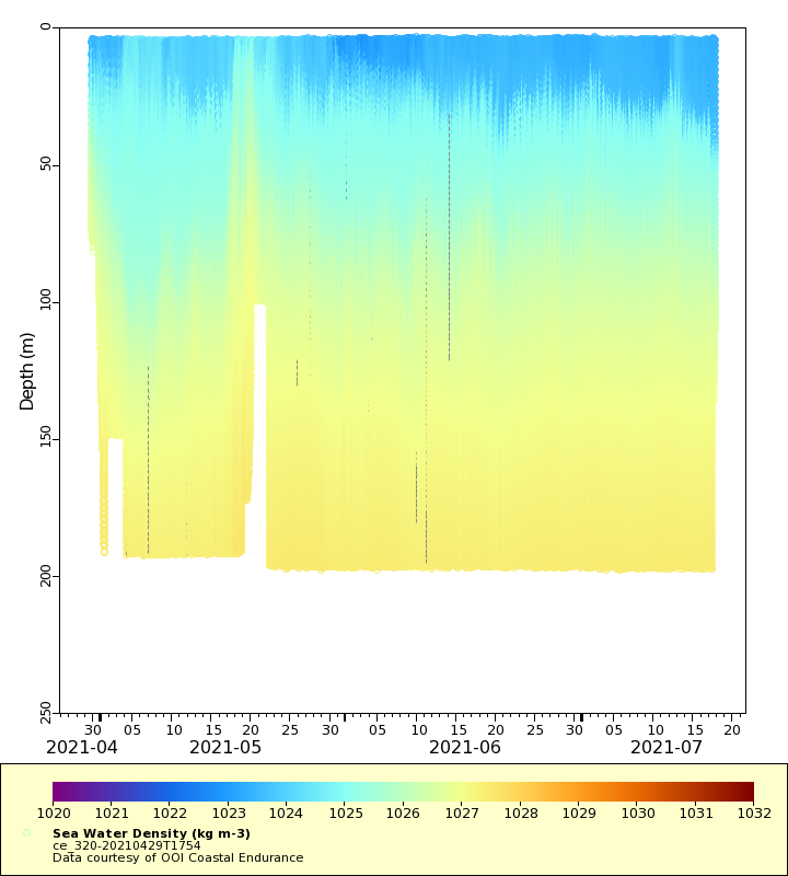
Density
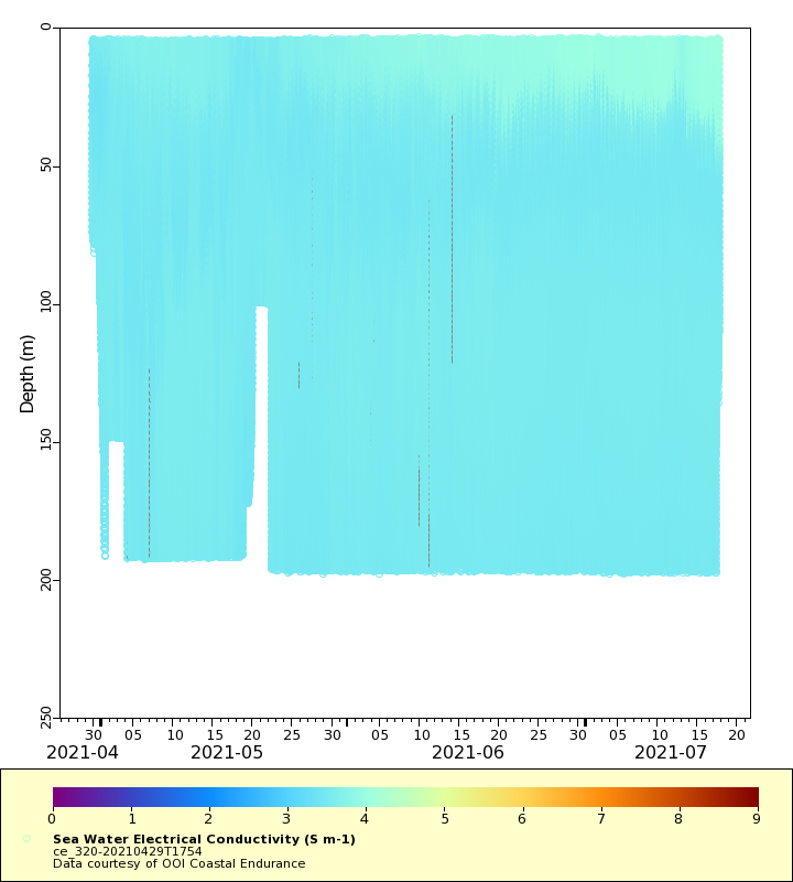
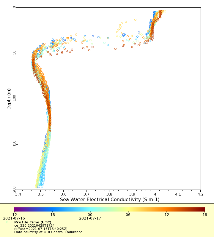
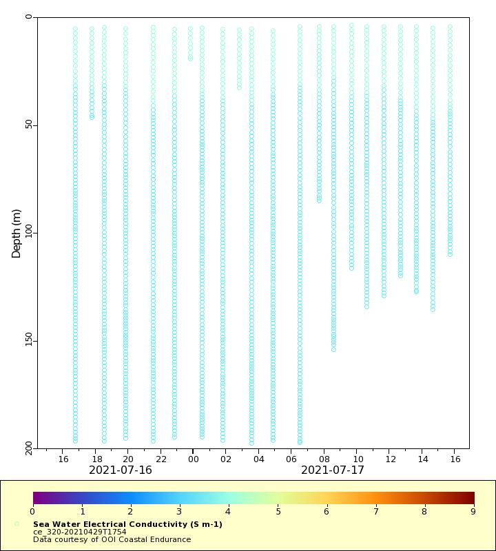
Conductivity
Latest Timeseries
Temperature
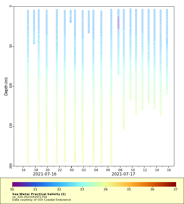
Salinity
Density
Conductivity
Synoptic Timeseries
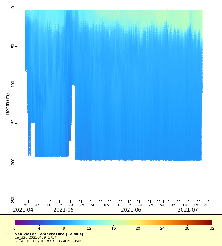
Temperature
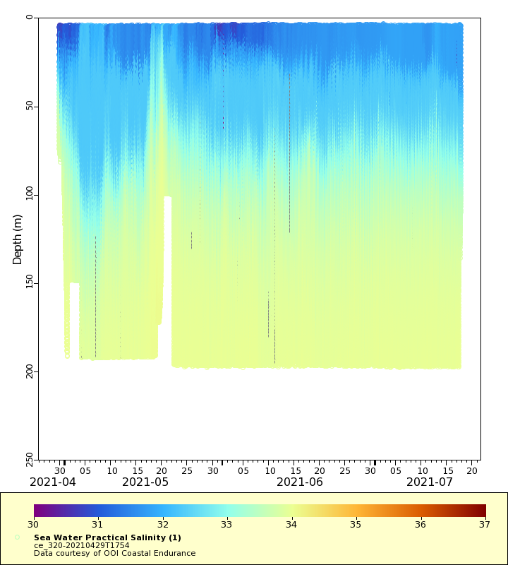
Salinity
Density
Conductivity