| Dataset | bill-20220825T1421 |
|---|---|
| Glider | bill |
| Status | Completed |
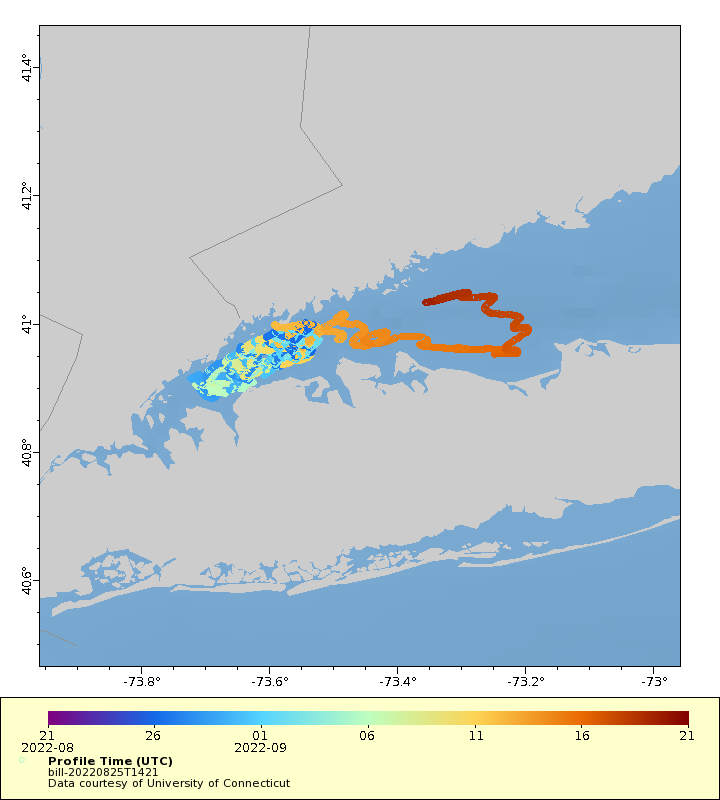
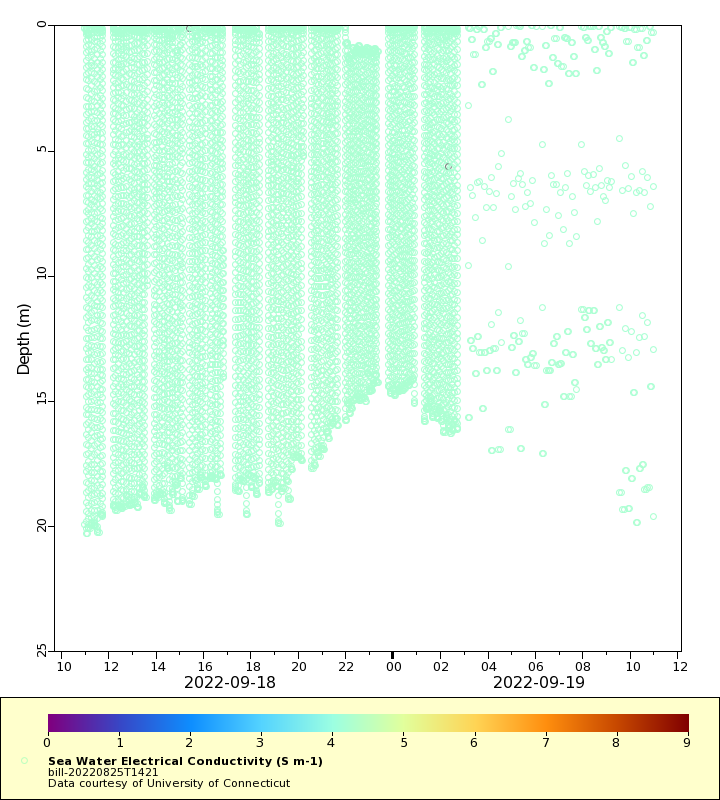
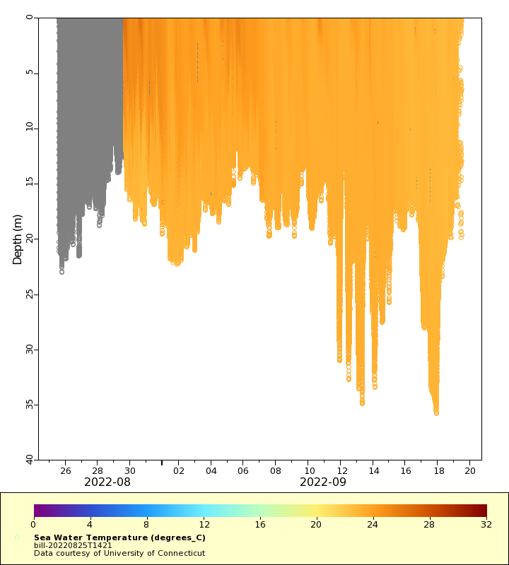
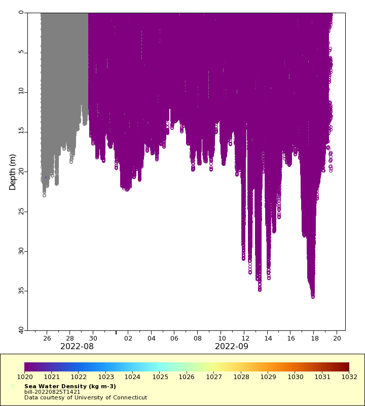
| Summary | The glider was deployed in the Western Long Island Sound with the intent of mappng areal extent of hypoxia in western Long Island Sound. This deployment and survey will compliment the University of Connecticut's network water quality monitoring buoys |
| WMO ID | 4803970 |
| Attribution | United States Environmental Protection Agency and the U.S. Integrated Ocean Observing System |
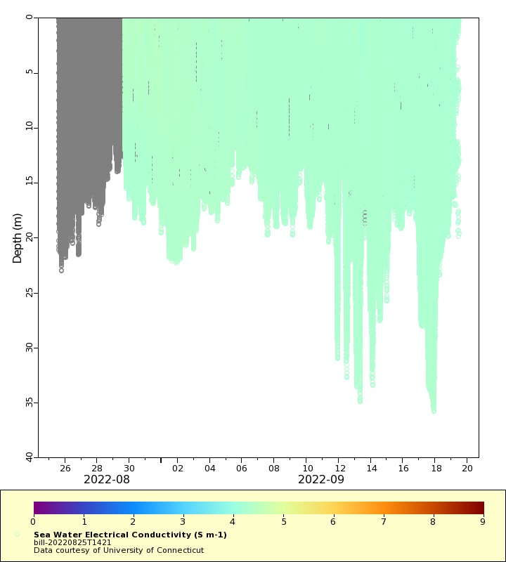
| Time Coverage Start | 2022-08-25 14:25:19 UTC |
| Time Coverage End | 2022-09-19 10:54:56 UTC |
| Registered | 2022-09-07 |
| Deployed | 2022-08-25 |
| Operator | University of Connecticut |
| Institution | University of Connecticut |
| Data Provider | rutgers |
| # Profiles | 12408 |
| Days Deployed | 25 |
| BBox North | 41.049 |
| BBox South | 40.882 |
| BBox East | -73.723 |
| BBox West | -73.194 |
Maps
Track
Latest Profiles
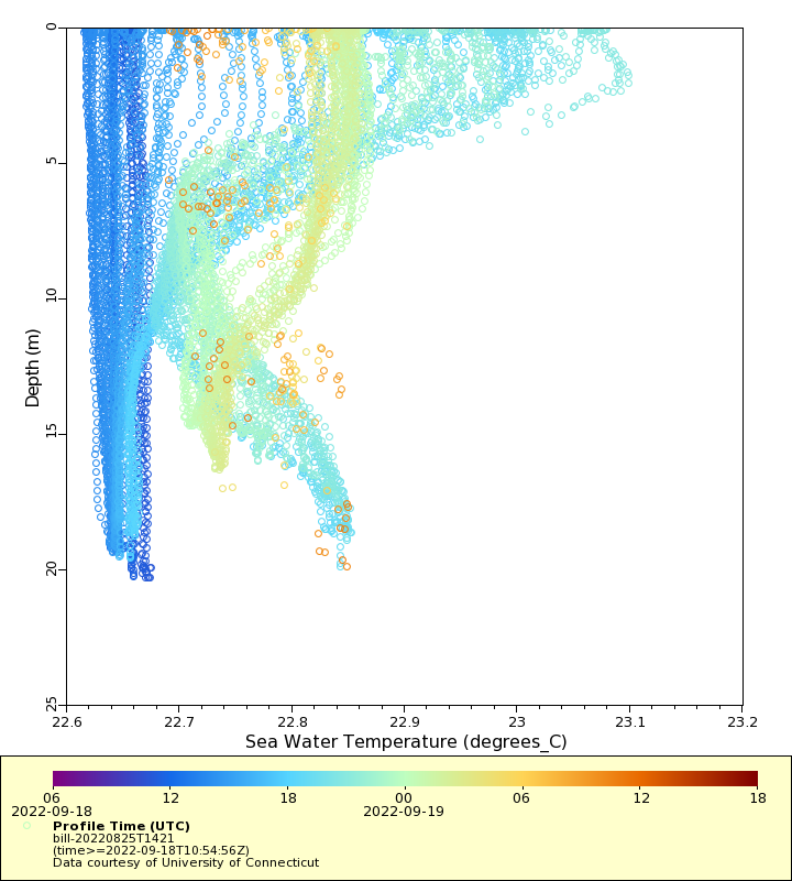
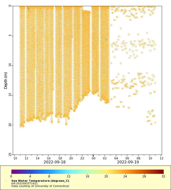
Temperature
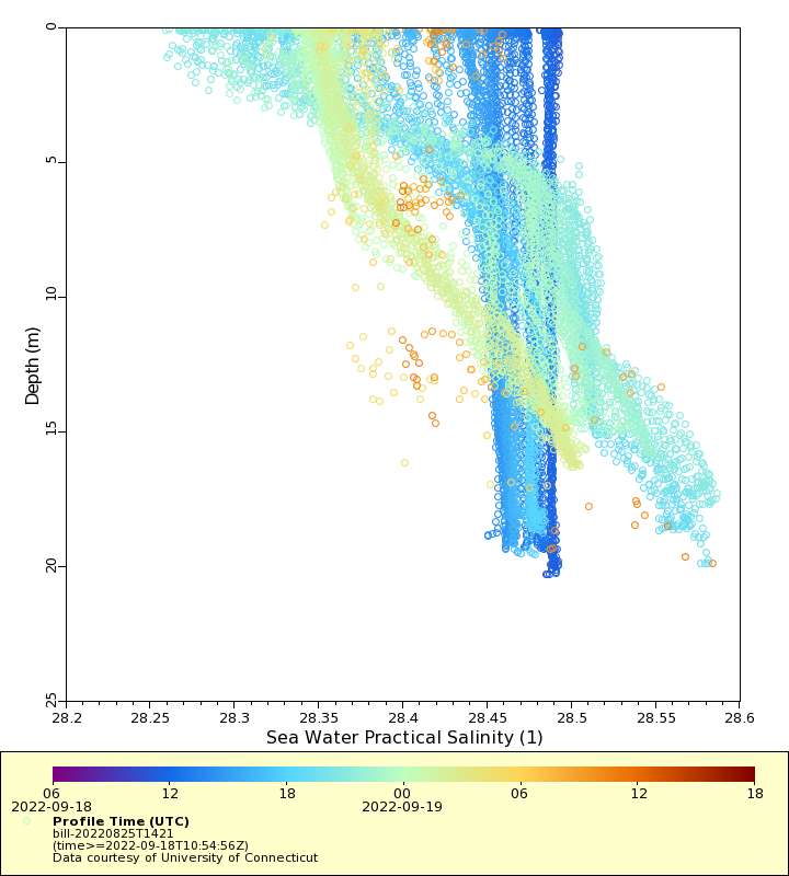
Salinity
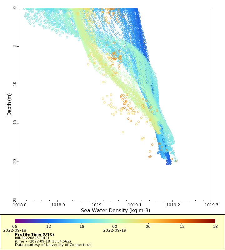
Density
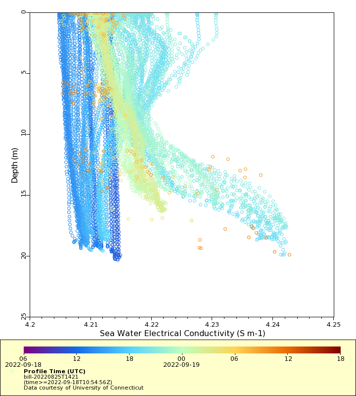
Conductivity
Latest Timeseries
Temperature
Salinity

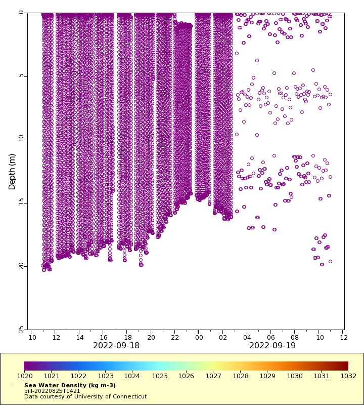
Density
Conductivity
Synoptic Timeseries
Temperature
Salinity

Density
Conductivity