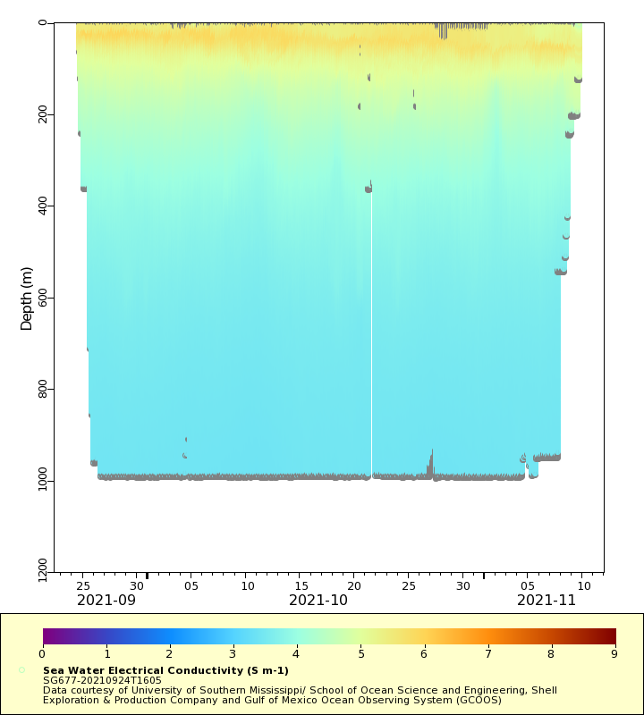
| Dataset | SG677-20210924T1605 |
|---|
| Glider | SG677 |
|---|
| Status | Completed |
|---|
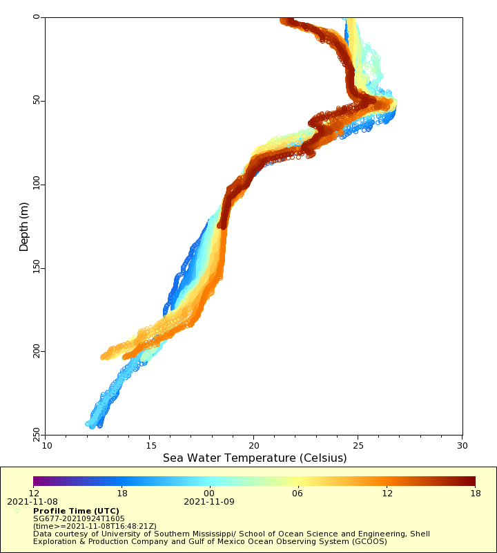
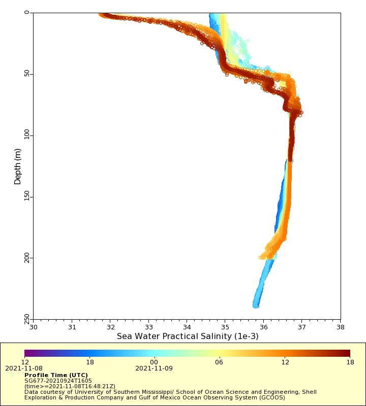
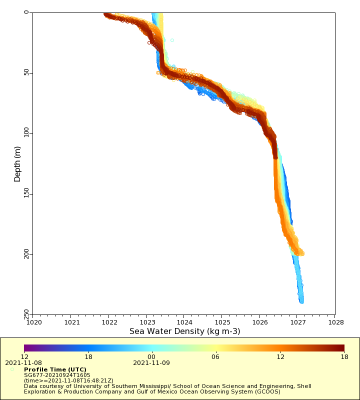
| Summary | Underwater glider data gathered by the National Oceanic and Atmospheric Administration (NOAA |
|---|
| WMO ID | 4802999 |
|---|
| Attribution | Shell Exploration & Production Company |
|---|
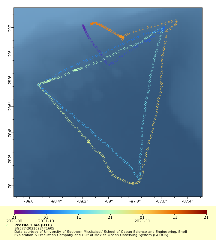
| Time Coverage Start | 2021-09-24 16:09:20 UTC |
|---|
| Time Coverage End | 2021-11-09 16:48:21 UTC |
|---|
| Registered | 2021-09-25 |
|---|
| Deployed | 2021-09-24 |
|---|
| Operator | University of Southern Mississippi |
|---|
| Institution | University of Southern Mississippi/ School of Ocean Science and Engineering, Shell Exploration & Production Company and Gulf of Mexico Ocean Observing System (GCOOS) |
|---|
| Data Provider | martink |
|---|
| # Profiles | 532 |
|---|
| Days Deployed | 47 |
|---|
| BBox North | 29.25 |
|---|
| BBox South | 28.013 |
|---|
| BBox East | -88.533 |
|---|
| BBox West | -87.476 |
|---|