| Dataset | SG610-20220621T1130 |
|---|---|
| Glider | SG610 |
| Status | Completed |
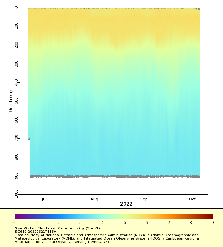
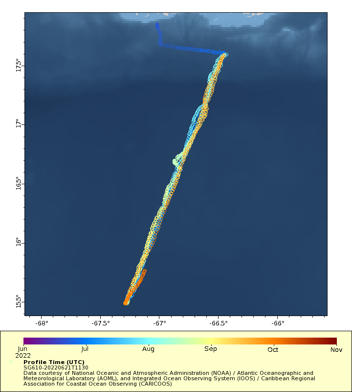
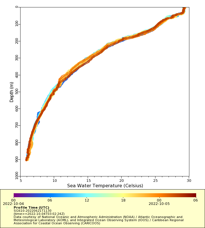
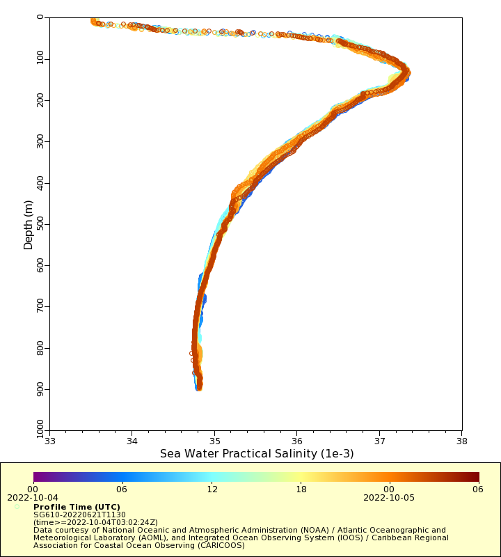
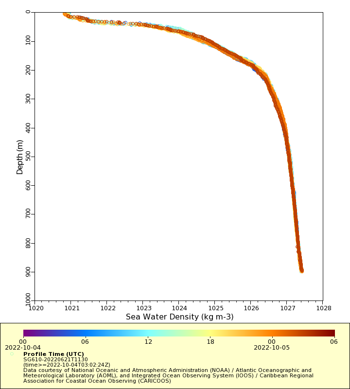
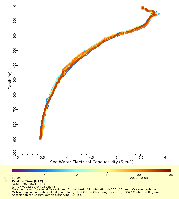
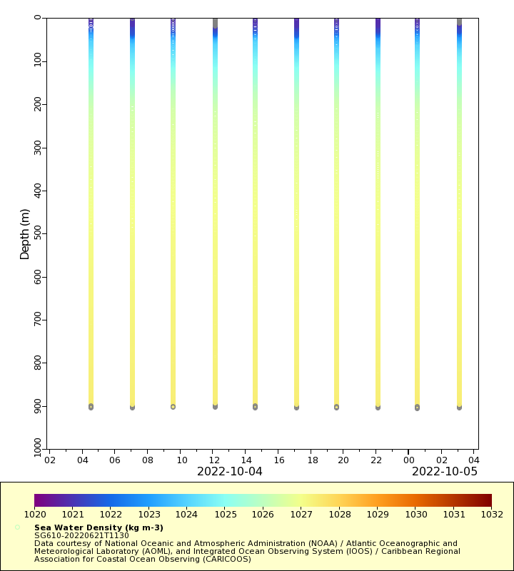
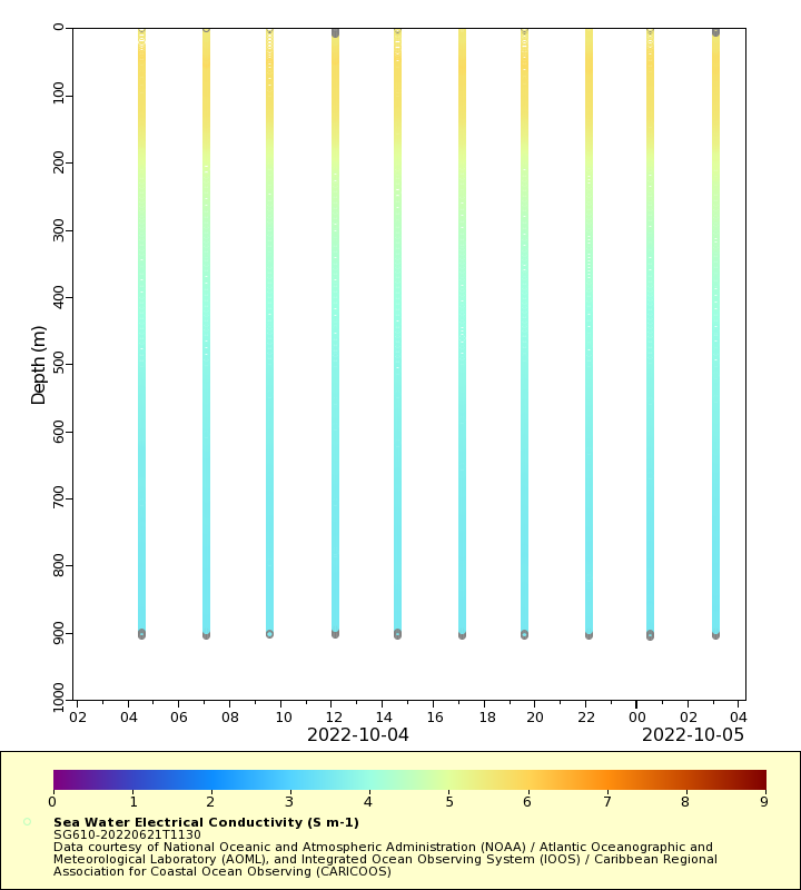
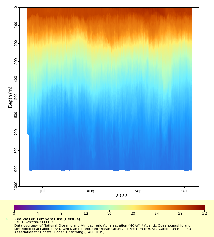
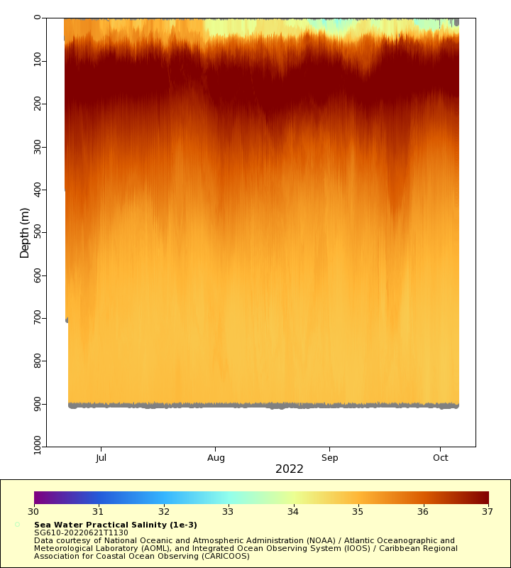
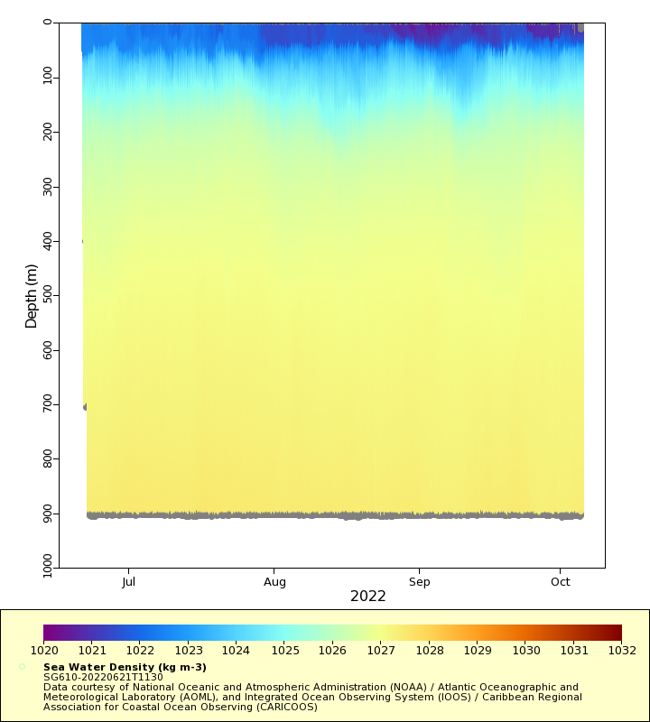
| Summary | Underwater glider data gathered by the National Oceanic and Atmospheric Administration (NOAA) in partnership with several national and international institutions. This dataset includes temperature and salinity profiles up to 1000 m depth with mean vertical resolution of 1.5 m and mean spatial resolution of 2 km per profile, and is part of a network of underwater gliders operating in the Caribbean Sea and the southwest Tropical North Atlantic since 2014. This glider network is aimed at providing upper ocean data to improve our knowledge on the ocean response to Tropical Cyclone (TC) force winds and for TC intensification studies and forecasts. All the data collected are transmitted in full resolution and in near real-time (maximum delay of 30 min) to the Integrated Ocean Observing System (IOOS) Glider Data Assembly Center for archival and distribution and to the Global Telecommunication System (GTS) for assimilation into weather and climate forecast models. The data are also archived at NOAA / National Centers for Environmental Information (NCEI) |
| WMO ID | 4800917 |
| Attribution | This project is funded by the National Oceanic and Atmospheric Administration (NOAA) |
| Time Coverage Start | 2022-06-21 11:58:20 UTC |
| Time Coverage End | 2022-11-15 10:11:21 UTC |
| Registered | 2022-06-23 |
| Deployed | 2022-06-21 |
| Operator | Atlantic Oceanographic and Meteorological Laboratory (AOML) |
| Institution | National Oceanic and Atmospheric Administration (NOAA) / Atlantic Oceanographic and Meteorological Laboratory (AOML), and Integrated Ocean Observing System (IOOS) / Caribbean Regional Association for Coastal Ocean Observing (CARICOOS) |
| Data Provider | aoml |
| # Profiles | 1492 |
| Days Deployed | 147 |
| BBox North | 17.866 |
| BBox South | 15.484 |
| BBox East | -67.289 |
| BBox West | -66.428 |
Maps
Track
Latest Profiles
Temperature
Salinity
Density
Conductivity
Latest Timeseries
Temperature
Salinity
Density
Conductivity
Synoptic Timeseries
Temperature
Salinity
Density
Conductivity