| Dataset | SG601-20200906T1631 |
|---|---|
| Glider | SG601 |
| Status | Completed |
| Summary | Underwater glider data gathered by the National Oceanic and Atmospheric Administration (NOAA |
| WMO ID | 4802962 |
| Attribution | NDBC/USM |
| Time Coverage Start | 2020-09-06 17:21:47 UTC |
| Time Coverage End | 2020-12-01 18:35:19 UTC |
| Registered | 2020-09-08 |
| Deployed | 2020-09-06 |
| Operator | Kevin Martin |
| Institution | National Oceanic and Atmospheric Administration (NOAA) / National Data Buoy Center (NDBC), University of Southern Mississippi/ School of Ocean Science and Engineering, Shell Exploration & Production Company and Gulf of Mexico Ocean Observing System (GCOOS) |
| Data Provider | martink |
| # Profiles | 888 |
| Days Deployed | 87 |
| BBox North | 29.036 |
| BBox South | 27.929 |
| BBox East | -89.738 |
| BBox West | -87.652 |
Maps
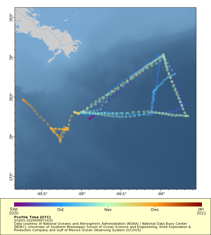
Track
Latest Profiles
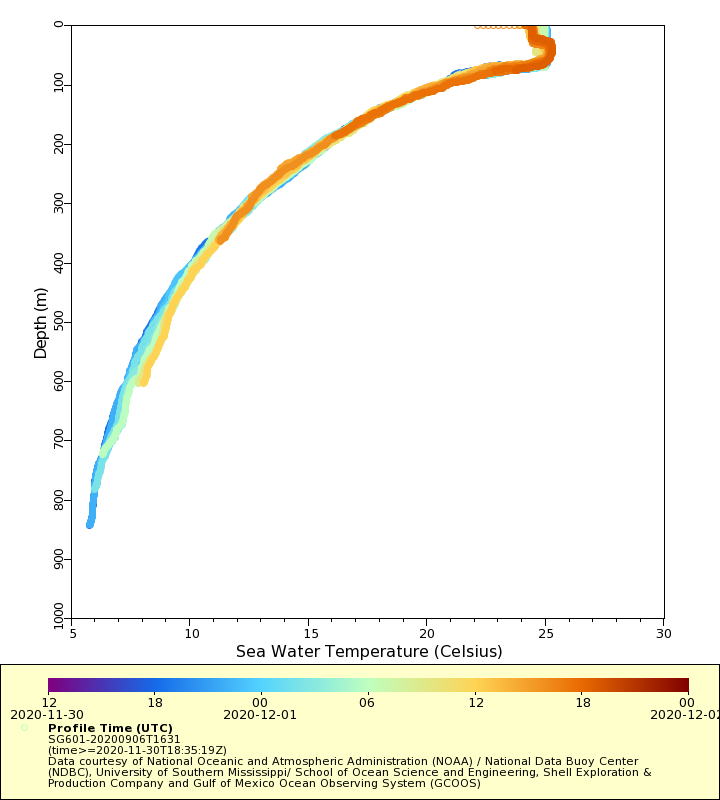
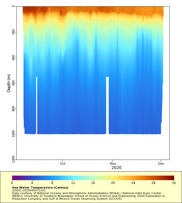
Temperature
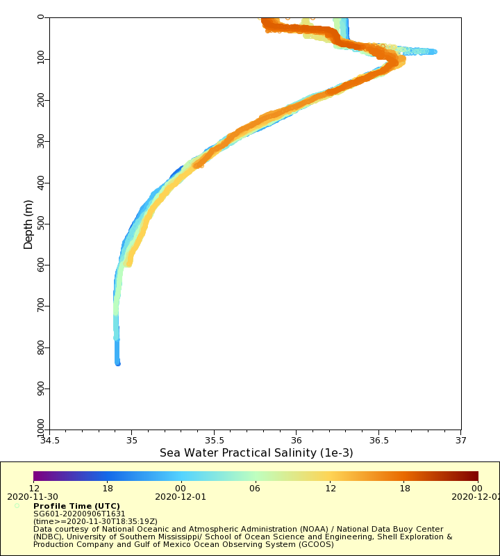
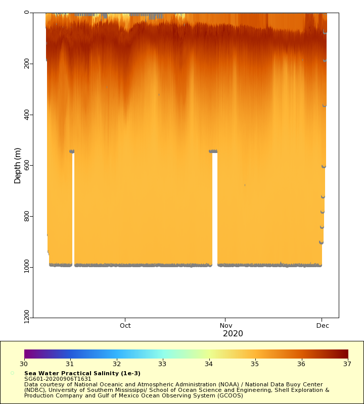
Salinity
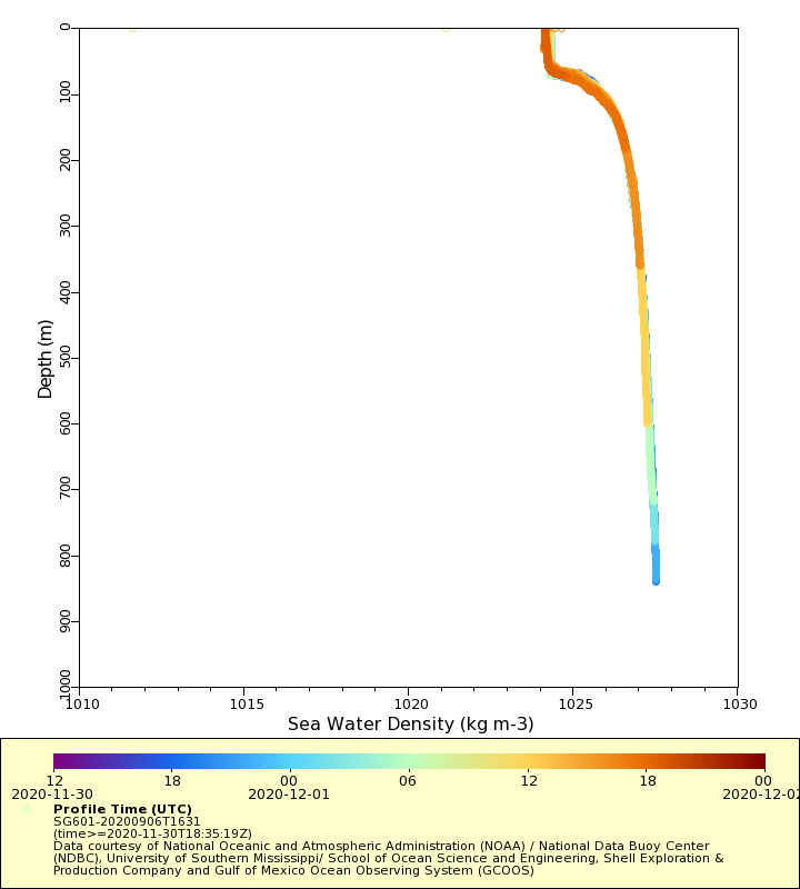
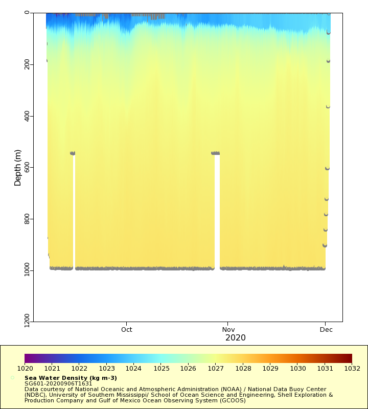
Density
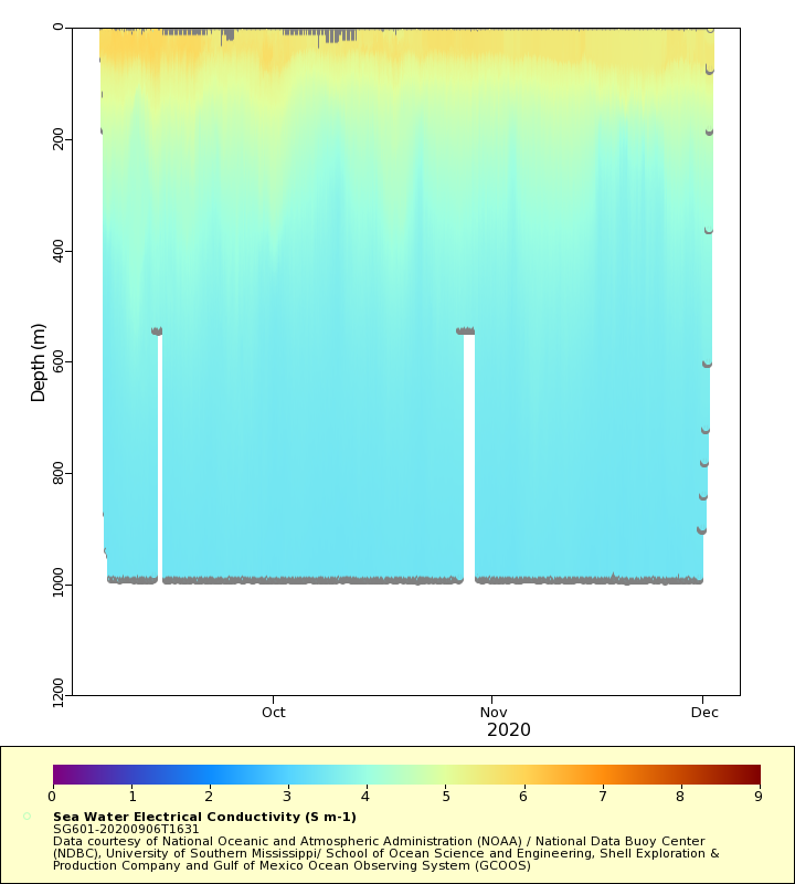
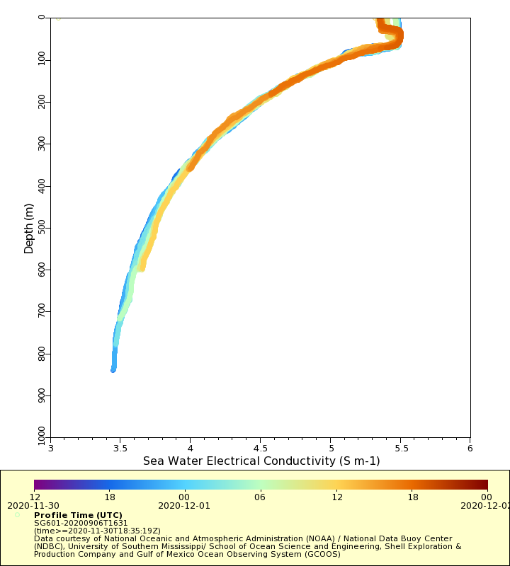
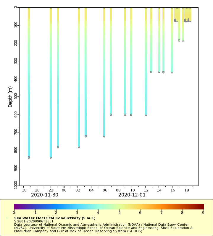
Conductivity
Latest Timeseries
Temperature

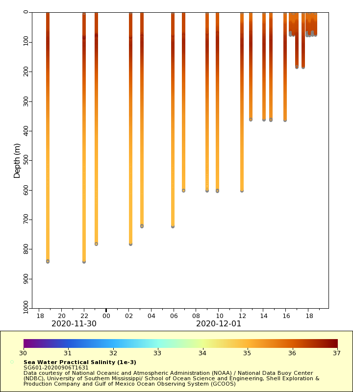
Salinity
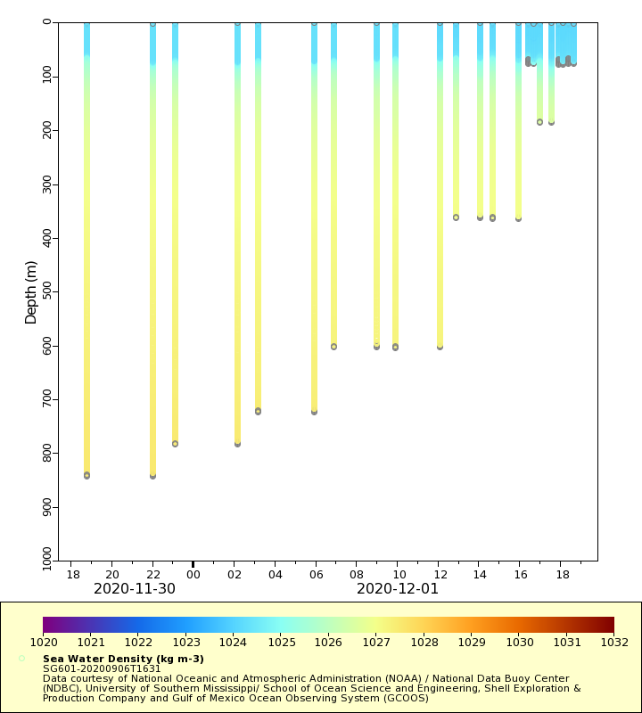
Density
Conductivity
Synoptic Timeseries
Temperature
Salinity
Density
Conductivity