The Use of CODAR High Frequency
Radar to Attain Wave Height Measurements

How do the Measurements Compare to Other Platforms?
The Use of CODAR High Frequency
Radar to Attain Wave Height Measurements
How do the Measurements Compare to Other Platforms?
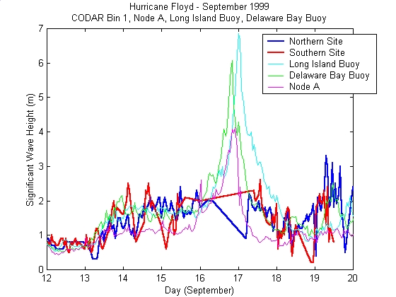
Figure 1 - Significant
wave height estimates from the Long Island buoy, Delaware Bay buoy, Node
A at LEO-15 and the Northern and Southern CODAR sites. Comparing
the two buoys and the node, the Long Island buoy encounters the highest
waves, Delaware Bay Buoy the next highest, and Node A encounters the lowest
of the three. This is as expected, since the Long Island buoy is
in the deepest water, and Node A is in the shallowest. Measurements
from the two CODAR sites follow the other three measurements until the
point where waves begin to increase beyond two meters due to Hurricane
Floyd. This is a result of the system limitation described earlier,
indicating that the Rutgers CODAR frequency setting of 25 MHz will result
in reliable wave measurements only up to about two meters.
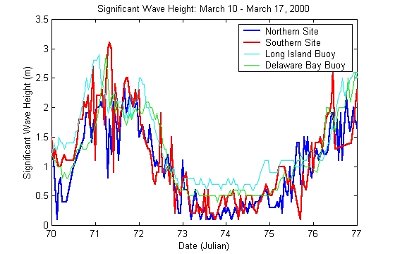
Figure 2 - Significant
wave height estimates for this period in time shows that the two CODAR
sites produce measurements that are close to measurements from the two
buoys.
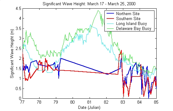
Figure 3 - Significant
wave height measurements from this time frame once again confirms the
CODAR system limitation that waves cannot be measured beyond two meters.
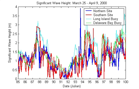
Figure 4 - As in Figure
2, significant wave height estimates for this period in time shows that
the two CODAR sites produce measurements that are close to measurements
from the two buoys.
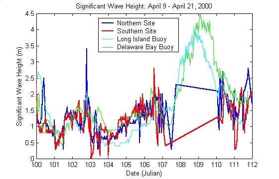
Figure 5 - Once again, CODAR measurements are close to those obtained by the buoys, with the limitation that using the current Rutgers transmission signal of 25 MHz, wave heights above two meters cannot be accurately measured.